Pisté in Tinum, Yucatán, Mexico — The Southeast (Yucatan Peninsula)
The Castle or Temple of Kukulcán
El Castillo o Templo del Kukulkan
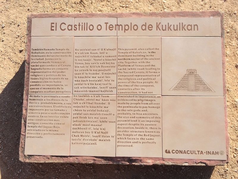
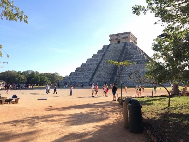
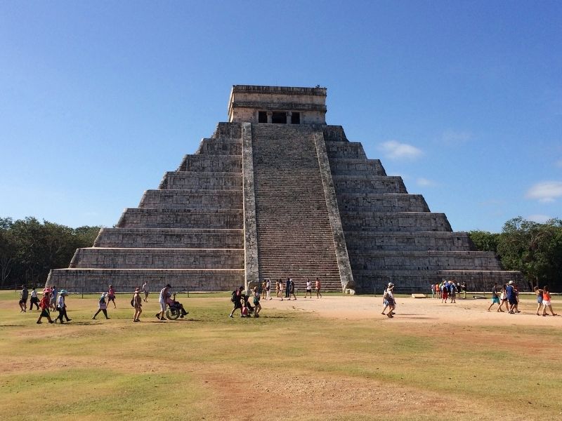
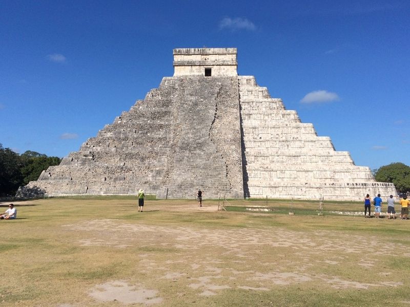
También llamado Templo de Kukulcán, es la construcción dominante del sector norte de la ciudad. Junto con la plataforma de Venus y el sacbé que conduce al Cenote Sagrado forma un conjunto representativo del poder religioso y político de los itzáes. Siglos después de su construcción no había perdido su importancia, ya que en el momento de la conquista acudían peregrinos de toda la península a rendir homenaje a los dioses de la lluvia y, probablemente, a sus ancestros itzáes. El edificio es imponente por su tamaño y simetría pese a su decoración austera. En su interior existe otra construcción más antigua, conocida como el Templo del Jaguar Rojo, orientado en la misma dirección y perfectamente preservado.
Maya-Yucateco:
Ku ya’ala’al xan ti’ U K’ulnajil K’u’uk’um Kaan, leti’ u nojochil ti’ tuláakal u xamanil le noj kaajo’. Yéetel u kúuchil Venus, bey xan le sak bej ku bin tak te’ Kili’ich Dzono’oto ku ye’esik le noj páajtalil yaan ti’ le Itzáobo’. U nojochil le kúuchila’ ma’ sa’at kex wáa úuch beeta’aki’, lela’ tu yo’olal le k’iin ka’aj taal le sak wíiniko’obo’, laayli’ yaan máaxo’ob táanxel kajilo’ob ku taalo’ol u k’ult Yuum Cháake’, yéetel ma’ káan wáa tak u ch’i’ibal Izáobe’. U nojochil le kúuchilo’ ma’ chéen tu yo’olal buka’aji’, yo’olal xan ma’alob t’ooxlil u pak’ilo’ob kex ma’ seen jadzutzkíinta’ani’. Ichile’ yaan uláak’ múul maanal úuchbenil ti’, lela’ k’aj óolta’an bey U K’ul Najil Chak Mo’ole’, laayli’ tia’an te’ tzéelo’ dzo’okole’ ma’alob kaláantpaja’anil.
English:
This pyramid, also called the Temple of Kukulcán, is the dominant building in the northern sector of the ancient city. Together with the Platform of Venus and the sacbé (white road) leading to the Sacred Cenote, it forms a compound representative of the religious and political power of the Itza people. At the time of the conquest, centuries after its construction, it had not diminished in importance, as evidenced by pilgramages made by people from all over the peninsula to pay homage to the rain gods and, probably, to Itza ancestors. The size and symmetry of this pyramid lend it an imposing aspect despite its austere decoration. Inside it, there is an older structure known as the Temple of the Red Jaguar, which faces in the same direction and is perfectly preserved.
Erected by Consejo Nacional para la Cultura y las Artes de México (CONACULTA)-INAH.
Topics and series. This historical marker is listed in these topic lists: Anthropology & Archaeology • Native Americans. In addition, it is included in the UNESCO World Heritage Sites series list.
Location. 20°
40.984′ N, 88° 34.166′ W. Marker is in Pisté, Yucatán, in Tinum. Marker can be reached from Carretera Costera de Golfo (Route 180). The marker is located to the west of the Temple of Kukulkán at Chichén Itzá Archaeological Site. Touch for map. Marker is in this post office area: Pisté YU 97751, Mexico. Touch for directions.
Other nearby markers. At least 8 other markers are within walking distance of this marker. The Platform of Eagles and Jaguars (about 120 meters away, measured in a direct line); The Great Ball Court (about 120 meters away); The Temple of the Warriors (about 210 meters away); Platform of Venus and Round Platform (about 210 meters away); Platform of the Tombs (about 210 meters away); Temple of the Large Tables (about 210 meters away); The Ossuary or Tomb of the Great Priest (about 210 meters away); The Plaza of the Thousand Columns (about 240 meters away). Touch for a list and map of all markers in Pisté.
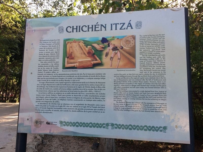
Regarding The Castle or Temple of Kukulcán. The following overview of the site is from photo 7:
La capital de los Itzáes fue el sitio más poderoso de Yucatán para
el Clásico Terminal y el Posclásico Temprano. Está situada en el
centro de la planicie norte de la Península de Yucatán y tiene acceso a escasas pero seguras fuentes de agua. Además, hacia el sur disponía de extensos suelos agrícolas necesarias para mantener a su activa población.
Esta urbe controló los puertos comerciales y las salinas, también dominó el tráfico marítimo en las costas de Yucatán, desde Tabasco hasta Ameríca Central. El poderío miilar, subrayado con insistencia en las representaciones pictóricas del sitio, fue la base para mantener este control. Así mismo, su Cenote Sagrado era considerado una de las entradas al mundo de los dioses, idea que fue aprovechada para someter a la ciudad, a sus habitantes y a cualquier enemigo beligerante a través de los rituales de sacrificio llevados a cabo en él. Su auge y florecimiento como capital regional es relativamente tardío en la historia de Mesoamérica y se logró después de la caída de Teotihuacan y del ocaso gradual de los centros mayas del sur. Sin embargo, hay evidencias de ocupaciones humanas en la región de Chichén desde el último milenio antes de nuestra era, cuando se formaron aldeas o pueblos cerca de los cenotes. Pero el sitio con las proporciones urbanas que hoy admiramos se formó entre los años 650 u 800 y 1200 d.C. Los primeros edificios se erigieron en un estilo derivado del Puuc, característico de ciudades mayas como Uxmal, Kabah y Sayil; pero pronto se desarroló un estilo arquitectónico propio que integró, sobre la base Puuc, conceptos, formas e imágenes de otras partes de México, especialmente la Costa del Golfo y el Altiplano Central, ocasionando un traslape entre ambos, logrando una integración de estilos. La decadencia de
Chichén Itzá se relaciona con el surgimiento de Mayapán como nuevo centro de poder en Yucatán en el siglo XIII. Aún así, todavía en el siglo XVI el Templo de Kukulcan y el Cenote Sagrado funcionaban como escenario de grandes procesiones que acudían a Chichén para consultar el oráculo, aún cuando los demás edificios de la gran ciudad ya se encontraban abandonados.
English:
The capital of the Itza was the seat of power in the Yucatan during the Terminal Classic period and the Early Postclassic period. It is situated in the center of the north plain of the Yucatan Peninsula and has access to scarce but reliable water sources. Furthermore, to the south the extensive agricultural land needed to maintain its active population was readily available.
The city controlled the salt works and the trading ports while also
dominating maritime traffic on the coast of Yucatan from Tabasco to
Central America. Military power, strongly emphasized in pictorial representations of the site, was the basis for maintaining this control. Likewise, the Sacred Cenote was considered one of the entrances to the world of the gods, an idea that was used to subdue the city, its inhabitants and any belligerent enemy through the sacrificial rituals performed there.
Its rise and flourish as the regional capital came relatively late in the history of Mesoamerica and was achieved after
Photographed By J. Makali Bruton, January 17, 2017
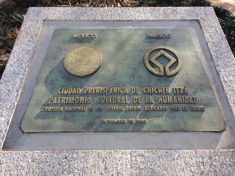
5. Chichen Itzá World Heritage Site dedication marker from December, 1988
This marker is near The Temple of Kukulkán as one enters the park. It reads:Ciudad Prehispánica de Chichen Itzá
Patrimonio Cultural de la Humanidad
Comisión Nacional de los Estados Unidos Mexicanos para la UNESCO
Diciembre de 1988
Patrimonio Cultural de la Humanidad
Comisión Nacional de los Estados Unidos Mexicanos para la UNESCO
Diciembre de 1988
The first buildings were erected in a style derived from Puuc, typical of
Mayan cities such as Uxmal, Kobah and Sayil, but soon developed their own architectural style that integrated, based on Puuc, concepts, forms and images from other parts of Mexico, especialy the Gulf Coast and the Central Plateau, causing an overlap between the two but achieving an integration of styles.
The decline of Chichen Itza is linked with the emergence of Mayapán as
the new center of power in Yucatan in the thirteenth century. Even so, in the sixteenth century, the Temple of Kukulcan and the Sacred Cenote operated as a stage for large processions that went to Chichen consult the oracle, even when the other buidings of the great city had already been abandoned.
Also see . . . The Temple of Kukulkán. (Submitted on March 6, 2017, by J. Makali Bruton of Accra, Ghana.)
Credits. This page was last revised on October 14, 2022. It was originally submitted on March 6, 2017, by J. Makali Bruton of Accra, Ghana. This page has been viewed 427 times since then and 19 times this year. Photos: 1, 2, 3, 4, 5, 6. submitted on March 6, 2017, by J. Makali Bruton of Accra, Ghana. 7. submitted on March 14, 2017, by J. Makali Bruton of Accra, Ghana.
