Darlingside in Leeds and Grenville United Counties, Ontario — Central Canada (North America)
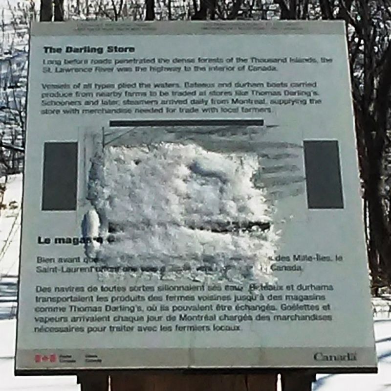
The Darling Store
⎯⎯⎯
Le magasin Darling
Canada's National Parks and National Historic Sites
Photographed by William Fischer, Jr., March 16, 2017
1. The Darling Store / Le magasin Darling Marker
 Long before roads penetrated the dense forests of the Thousand Islands, the St. Lawrence River was the highway to the interior of Canada.
Vessels of all types plied the waters. Bateaux and durham boats carried produce from nearby farms to be traded at stores like Thomas Darling's. Schooners and later, steamers arrived daily from Montreal, supplying the store with merchandise needed for trade with local farmers.
Des navires de toutes sortes sillonnaient ses eaux. Bateaux et durhams transportaient les produits des fermes voisines jusqu'à des magasins comme Thomas Darling's, où ils pouvaient être échangés. Goélettes et vapeurs arrivaient chaque jour de Montréal chargés des marchandises nécessaires pour traiter avec les farmiers locaux.
Erected by Parks Canada.
Topics. This historical marker is listed in these topic lists: Industry & Commerce • Man-Made Features • Settlements & Settlers • Waterways & Vessels.
Location. Marker has been permanently
this page online
We have been informed that this marker is no longer there and will not be replaced. This page is an archival view of what was.
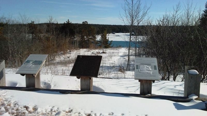
Regionally, this marker was in Eastern Ontario and specifically in Southeastern Ontario. It was also in Central Canada. Globally, it was in North America, the Western Hemisphere, the Western World, and the Anglosphere. Historically, it found itself in what was once a British colony, the Viceroyalty of New France, the Haudenosaunee (Iroquois) Confederacy, and Rupert’s Land.

Other nearby markers. At least 8 other markers are within 5 kilometers of this location, measured as the crow flies: Darlingside (here, next to this marker); The Thousand Islands (here,
Photographed by William Fischer, Jr., March 16, 2017
2. The Darling Store / Le magasin Darling Marker
Additional commentary.
1. Marker Removed
This marker was removed c2022 after the heritage designation was delisted due to extensive renovations on the property.
Leaving this full entry is of value to local history. Note To Editor only visible by Contributor and editor
— Submitted August 9, 2023, by James Saynor of Mallorytown, Ontario, Canada.
Photographed by William Fischer, Jr., March 16, 2017
3. The Darling Store / Le magasin Darling Marker
Credits. This page was last revised on August 13, 2023. It was originally submitted on March 20, 2017, by William Fischer, Jr. of Reynoldsburg, Ohio. This page has been viewed 261 times since then and 10 times this year. Photos: 1, 2, 3. submitted on March 20, 2017, by William Fischer, Jr. of Reynoldsburg, Ohio.
Editor’s want-list for this marker. Better close photo of the marker • Can you help?
