
Mérida, Yucatán, Mexico — The Southeast (Yucatan Peninsula)
Temple of St. John the Baptist
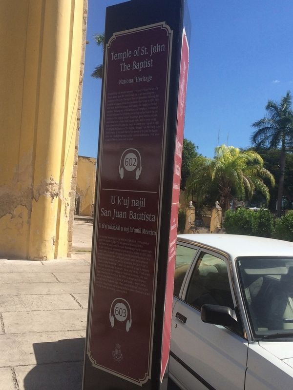
Photographed by J. Makali Bruton, January 18, 2017
1. Temple of St. John the Baptist Marker
When this photo was taken the grounds of the temple were closed, making it impossible to take a photo of the Spanish version of the marker. A translation of the English text is provided.

Spanish translation from English text:
Patrimonio Nacional
English:
National Heritage
this page online
Maya-Yucateco:
U ti’al tuláakal u noj lu’umil Meexico
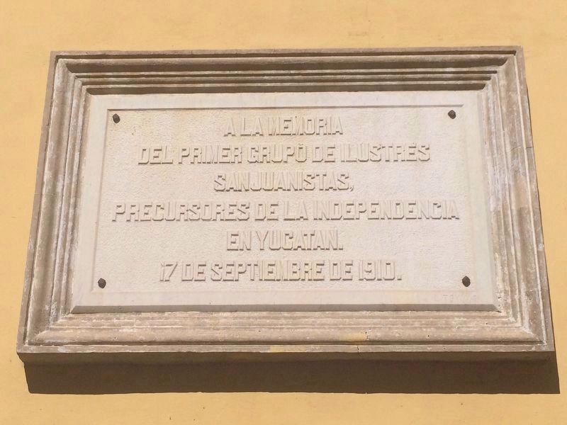
Photographed by J. Makali Bruton, January 18, 2017
2. An additonal marker on the Temple of St. John the Baptist
This additional marker is at the far southeastern corner of the church. It reads:
A la memoria
del primer grupo de ilustres
Sanjuanistas,
precursores de la Independencia
in Yucatan.
17 de septiembre de 1910.
English translation:
To the memory of the first group of illustrious Sanjuanistas, pioneers of Independence in the Yucatán.
September 17, 1910.
del primer grupo de ilustres
Sanjuanistas,
precursores de la Independencia
in Yucatan.
17 de septiembre de 1910.
To the memory of the first group of illustrious Sanjuanistas, pioneers of Independence in the Yucatán.
September 17, 1910.
Topics. This historical marker is listed in these topic lists: Architecture • Colonial Era • Man-Made Features • Religion & Religious Structures. A significant historical year for this entry is 1769.
Location. 20° 57.762′ N, 89° 37.554′ W. Marker is in Mérida, Yucatán. It can be
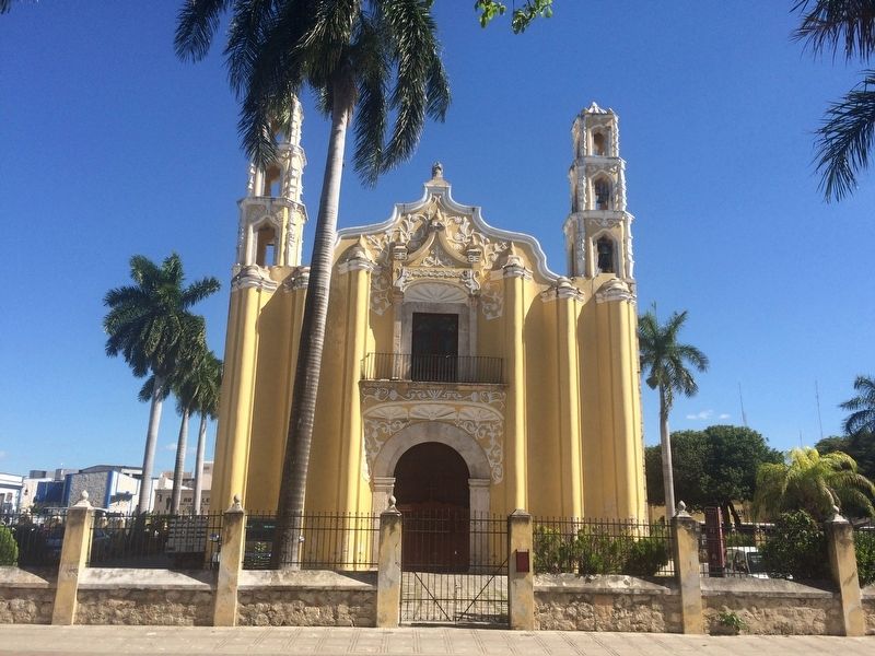
Photographed by J. Makali Bruton, January 18, 2017
3. Temple of St. John the Baptist Marker
The marker is to the right of the church in this view. The additional marker on the right column of the entry to the atrium is a Braille version of the marker.

Regionally, this marker is in the Mexican Gulf Coast, in the Maya Heartland, and on the Yucatán Peninsula. Globally, it is in North America, Mesoamerica, a Gulf of Mexico state, and the Western Hemisphere. Historically, it finds itself in what was once New Spain and also a Spanish colony.
Other nearby markers. At least 8 other markers are within walking distance of this marker: Benito Juárez (within shouting distance of this marker); Colegio Montejo Annex (within shouting distance of this marker); The San Juan Arch (about 90 meters away, measured in a direct line); Monsignor Norberto Domínguez (about 150 meters away); Corner of Calle 62 and 67 (about 150 meters away); The House of the Headless Friar (approx. 0.3 kilometers away); Calle 64 (approx. 0.3 kilometers away); "The Count" (approx. 0.3 kilometers away). Touch for a list and map of all markers in Mérida.
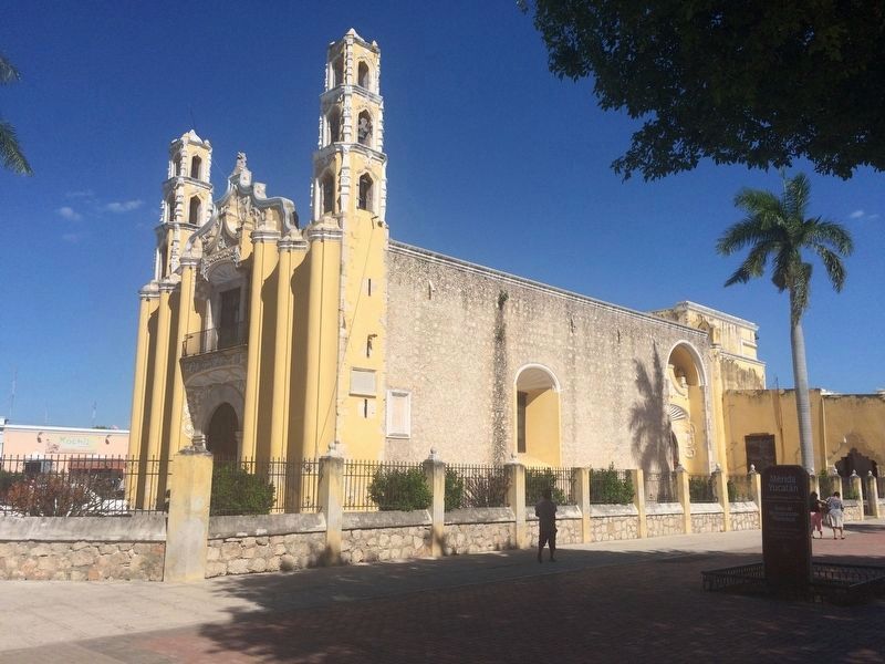
Photographed by J. Makali Bruton, January 18, 2017
4. Temple of St. John the Baptist
The marker is just to the left outside of this additional view of the temple. Also note the two additional, older markers on the south face of the church.
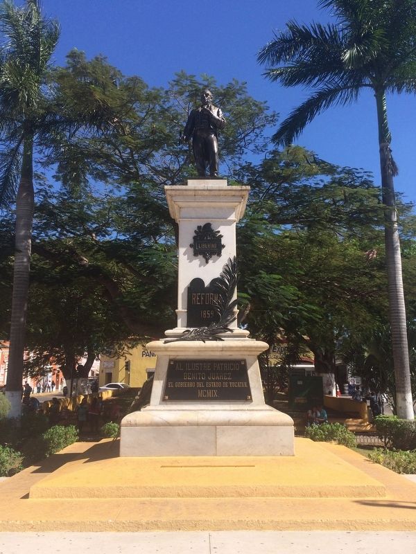
Photographed by J. Makali Bruton, January 18, 2017
5. The nearby statue of Juárez just south of the Temple of St. John the Baptist
As mentioned in the marker text, the area around this statue used to be a bullring.
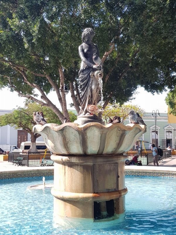
Photographed by J. Makali Bruton, February 18, 2019
6. "La Negrita" statue in front of the Temple of St. John the Baptist
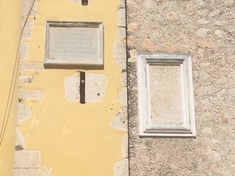
Photographed by J. Makali Bruton, January 18, 2017
7. Additional, older markers on the Temple of St. John the Baptist
The leftmost marker on the south face of the temple reads:El Chantre Dr. Saturnino Vela.
Capellan de esta ermita
de San Juan Bta, hace una
ofrenda de gratitud al Sr.
Don Manuel Zapata Bolio.
por las notables mejoras que
ha realizado en dicha Ermita
Dbre-1954
English translation:
Dr. Saturnino Vela, Chaplain of this hermitage of St. John the Baptish, offers his gratitude to Manuel Zapata Bolio for the notable improvements that he has made to this church.
December 1954
The additional marker to the right is not readable, however the date “1770” can be seen.
Capellan de esta ermita
de San Juan Bta, hace una
ofrenda de gratitud al Sr.
Don Manuel Zapata Bolio.
por las notables mejoras que
ha realizado en dicha Ermita
Dbre-1954
English translation:
Dr. Saturnino Vela, Chaplain of this hermitage of St. John the Baptish, offers his gratitude to Manuel Zapata Bolio for the notable improvements that he has made to this church.
December 1954
The additional marker to the right is not readable, however the date “1770” can be seen.
Credits. This page was last revised on March 15, 2019. It was originally submitted on March 28, 2017, by J. Makali Bruton of Washington, District of Columbia. This page has been viewed 277 times since then and 12 times this year. Photos: 1, 2, 3, 4, 5. submitted on March 28, 2017, by J. Makali Bruton of Washington, District of Columbia. 6. submitted on March 15, 2019, by J. Makali Bruton of Washington, District of Columbia. 7. submitted on March 28, 2017, by J. Makali Bruton of Washington, District of Columbia.
