Georgetown in Georgetown County, South Carolina — The American South (South Atlantic)
Life on the Rivers of Georgetown
| — | Port of Georgetown | — |
Photographed by Brian Scott, March 31, 2017
1. Life on the Rivers of Georgetown Marker
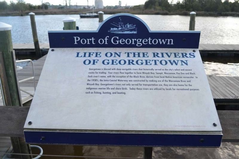
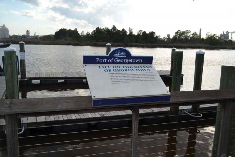
Georgetown is blessed with deep navigable rivers that historically served as the city's safest and easiest routes for trading. Four rivers flow together to form Winyah Bay: Sampit, Waccamaw, Pee Dee, and Black. Each river's name, with the exception of the Black River, derives from local Native American vernacular. In the 1930's, the Intra-Coastal Waterway was constructed by making use of the Waccamaw River and Winyah Bay. Georgetown's rivers not only served for transportation use, they are also home for the indigenous marine life and shore birds. Today these rivers are utilized by locals for recreational purposes such as fishing, hunting, and boating.
Erected by Seaport of Georgetown.
Topics. This memorial is listed in these topic lists: Indigenous Peoples and Communities • Settlements & Settlers • Waterways & Vessels.
Location. 33° 21.967′ N, 79° 17.033′ W. Memorial is in Georgetown, South Carolina, in Georgetown County. It can be reached from Harborwalk, on the left when traveling north. Touch for map. Memorial is in this post office area: Georgetown
this page online

Regionally, this memorial is in South Carolina’s Pee Dee and on Waccamaw Neck. It is also in the American South, specifically in the Deep South, and on the Eastern Seaboard. Globally, it is in the North Atlantic Region, North America, the Western Hemisphere, the Western World, and the Anglosphere. Historically, it finds itself in what was once the territory of the Mississippian Culture, one of the original Thirteen Colonies, one of the Confederate States of America, and the Antebellum South.
Other nearby markers. At least 10 other markers are within walking distance of this marker: Georgetown (a few steps from this marker); Georgetown County Veteran’s Memorial (a few steps from this marker); Dedicated to the Memory of Major C. Spencer Guerry (within shouting distance of this marker); Francis Marion (within shouting distance of this marker); a different marker also named Ship's Propeller (within shouting distance of this marker); 801 & 803 Front Street (within shouting distance of this marker); 805 Front Street (within shouting distance of this marker); 807 Front Street
Photographed by Brian Scott, March 31, 2017
2. Life on the Rivers of Georgetown Marker
Another marker is no longer nearby. Ship’s Propeller (was within shouting distance of this marker but has been replaced with another marker now near it).
Also see . . .
1. Sampit River. The Sampit River begins in a swampy area of western Georgetown County, South Carolina, USA. It flows in an easterly direction to Winyah Bay at Georgetown. Only small crafts can navigate the upper parts of the river. The lower river merges into the bay and is deepened by tidal flows, and (to Georgetown harbor) by dredging. (Submitted on April 8, 2017, by Brian Scott of Anderson, South Carolina.)
2. Waccamaw River. The Waccamaw River is a river, approximately 140 miles (225 km) long, in southeastern North Carolina and eastern South Carolina in the United States. It drains an area of approximately 1110 square miles in the coastal plain along the eastern border between the two states into the Atlantic Ocean. Along its upper course, it is a slow-moving, blackwater river surrounded by vast wetlands, passable only by shallow-draft watercraft such as canoe. Along its lower course, it is lined by sandy banks and old plantation houses, providing an important navigation channel with a unique geography, flowing roughly parallel to the coast. (Submitted on April 8, 2017, by Brian Scott of Anderson, South Carolina.)
3. Pee Dee River. The Pee Dee River, also known as the Great Pee Dee River, is a river in the U.S. states of North Carolina and South Carolina. It originates in the Appalachian Mountains in North Carolina, where its upper course, above the mouth of the Uwharrie River is known as the Yadkin River. It is extensively dammed for flood control and hydroelectric power. The lower part of the river is named Pee Dee (in colonial times written Pedee) after the Native American Pee Dee tribe. (Submitted on April 8, 2017, by Brian Scott of Anderson, South Carolina.)
4. Black River. The Black River is a 151-mile-long (243 km) blackwater river in South Carolina in the United States. (Submitted on April 8, 2017, by Brian Scott of Anderson, South Carolina.)
5. Winyah Bay. Winyah Bay is a coastal estuary that is the confluence of the Waccamaw River, the Pee Dee River, the Black River, and the Sampit River in Georgetown County, in eastern South Carolina. The historic port city of Georgetown is located on the bay, and the bay generally serves as the terminating point for the Grand Strand. (Submitted on April 8, 2017, by Brian Scott of Anderson, South Carolina.)
Credits. This page was last revised on May 28, 2026. It was originally submitted on April 8, 2017, by Brian Scott of Anderson, South Carolina. This page has been viewed 848 times since then and 59 times this year. Photos: 1, 2. submitted on April 8, 2017, by Brian Scott of Anderson, South Carolina.
