Santa Elena, Yucatán, Mexico — The Southeast (Yucatan Peninsula)
The Cemetery Group
El Grupo del Cementerio
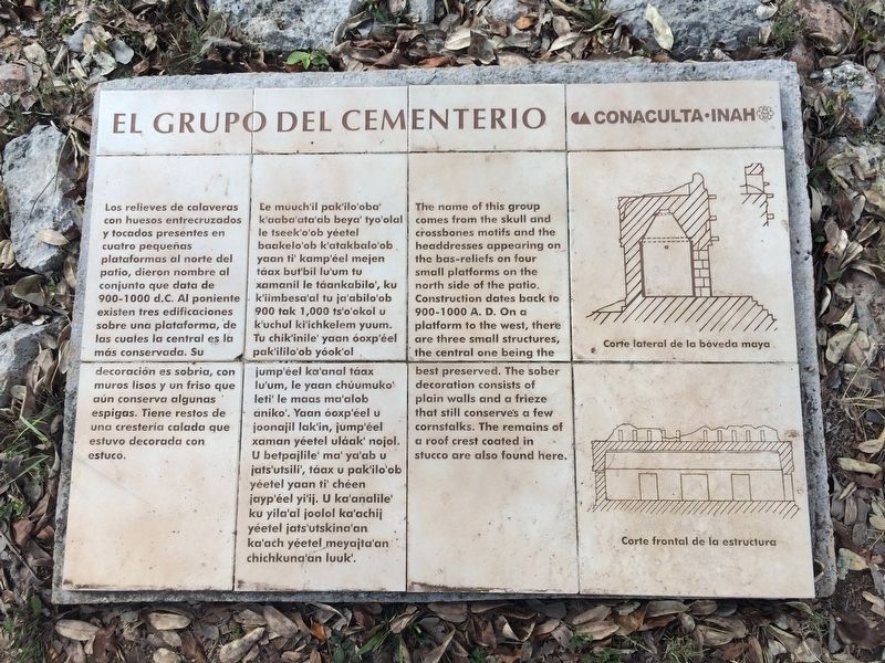
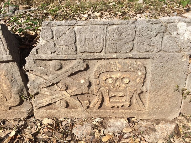
Los relieves de calaveras con huesos entrelacruzados y tocados presentes en cuatro pequeñas plataformas al norte del patio, dieron nombre al conjunto que data de 900-1000 d.C. Al poniente existen tres edificaciones sobre una plataforma, de las cuales la central es la más conservada. Su decoración es sobria, con muros lisos y un friso que aún conserva algunas espigas. Tiene restos de una crestería calada que estuvo decorada con estuco.
Pie de dibujos:
Corte lateral de la bóveda maya.
Corte frontal de la estructura
Maya-Yucateco:
Le múuchi’il pak’ilo’oba’ k’aaba’ata’ab beya’ tyo’olal le tseek’o’ob yéetel baakelo’ob k’atakbalo’ob yaan ti’ kamp’éel mejen táax but’bil lu’um tu xamanil le táankabilo’, ku k’iimbesa’al tu ja’abilo’ob 900 tak 1,000 ts’o’okol u k’uchul ki’ichkelem yuum. Tu chik’inile’ yaan óoxp’éel pak’ililo’ob yóok’ol jump’éel ka’anal táax lu’um, le yaan chúumuko’ let’ le maas ma’alob aniko’. Yaan óoxp’éel xaman yéetel uláak’ nojol. U betpajlile’ ma’ ya’ab u jats’utsili’, táax u pak’ilo’ob yéetel yaan ti’ chéen jayp’éel yi’ij. U ka’analile’ ku yila’al joolol ka’achij yéetel jats’utskina’an ka’ach yéetel meyajta’an chichkuna’an luuk’.
English:
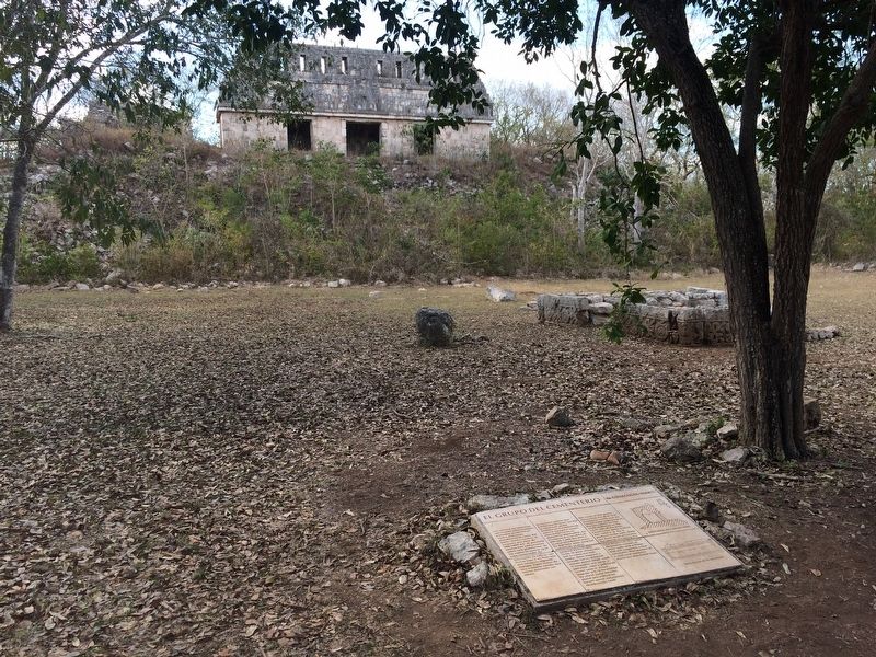
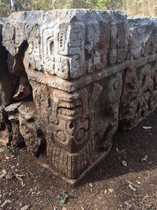
The name of this group comes from the skull and crossbones motif and the headdresses appearing on the bas-reliefs on four small platforms on the north side of the patio. Construction dates back to 900-1000 A.D. On a platform to the west, there are three small structures, the central one being the best preserved. The sober decoration consists of plain walls and a frieze that still conserves a few cornstalks. The remains of a roof crest coated in stucco are also found here.
Captions, translated:
Cross section of the maya vault.
Cross section of the front of the structure.
Erected by Consejo Nacional para la Cultura y las Artes de México (CONACULTA)-INAH.
Topics. This historical marker is listed in these topic lists: Anthropology & Archaeology • Architecture • Man-Made Features • Native Americans.
Location. 20° 21.648′ N, 89° 46.379′ W. Marker is in Santa Elena, Yucatán. Marker can be reached from Route 261. The marker is in the center of the Cemetery Group in the southern portion of the Uxmal Archaeological Site, some ten kilometers from Muna, south of Mérida. Touch for map. Marker is in this post office area: Santa Elena YU 97899, Mexico. Touch for directions.
Other nearby markers. At least 8 other markers are within walking distance of this marker. Stelae Building (about 150 meters away, measured in a direct line); The Ballgame (about 210 meters away); The Pigeon-House Cluster (approx. 0.2 kilometers away); The Great Temple / Great Pyramid (approx. 0.2 kilometers away); The Columns Building or the East Portico (approx. 0.3 kilometers away); Quadrangle of the Birds (approx. 0.3 kilometers away); Architecture (approx. 0.3 kilometers away); The Governor's Palace (approx. 0.3 kilometers away). Touch for a list and map of all markers in Santa Elena.
Photographed By J. Makali Bruton, January 20, 2017
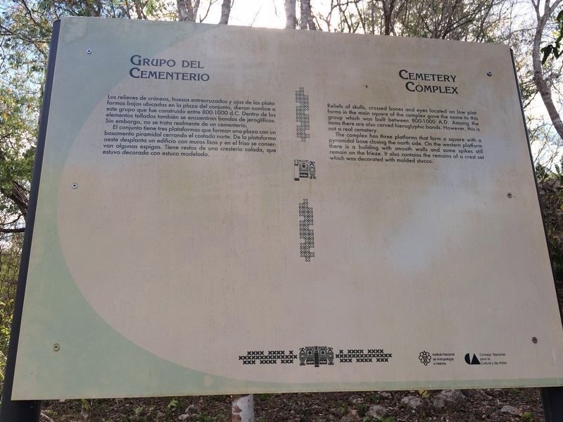
3. An additional Cemetery Complex Marker
This marker has similar text to the featured marker and is directly outside of the complex on the walking path. It notes that the complex is not actually a cemetery. The area was given that name due to the sculpted imagery of skulls found in the complex.
Credits. This page was last revised on April 22, 2017. It was originally submitted on April 20, 2017, by J. Makali Bruton of Accra, Ghana. This page has been viewed 132 times since then and 7 times this year. Photos: 1, 2, 3, 4, 5. submitted on April 20, 2017, by J. Makali Bruton of Accra, Ghana.
