
Near Swansea in Lexington County, South Carolina — The American South (South Atlantic)
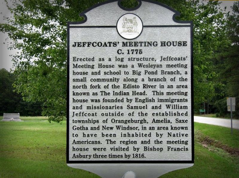
Jeffcoats' Meeting House
c.1775
June 13, 2015
1. Jeffcoats' Meeting House Marker
Erected 2015 by Big Pond Branch Historical Research Society, Ebenezer United Methodist Church Marker Committee.
Topics. This historical marker is listed in these topic lists: Colonial Era • Indigenous Peoples and Communities. A significant historical year for this entry is 1775.
Location. 33° 39.562′ N, 81° 10.828′ W. Marker is near Swansea, South Carolina, in Lexington County. It is at the intersection of Main Street (State Highway 178) and Whetstone Road (Highway 3), on the left when traveling east on Main Street. Marker is located south of Ebenezer United Methodist
this page online

Regionally, this marker is in the Midlands and in the Greater Columbia Area. It is also in the American South and specifically in the Deep South. Globally, it is in North America, the Western Hemisphere, the Western World, and the Anglosphere. Historically, it finds itself in what was once the territory of the Mississippian Culture, one of the original Thirteen Colonies, one of the Confederate States of America, and the Antebellum South.
Other nearby markers. At least 8 other markers are within 10 miles of this marker, measured as the crow flies: The Town Of North (approx. 5.4 miles away); Old Indian Trail (approx. 6.4 miles away); Moorefield Memorial Highway (approx. 6.6 miles away); Mount Olive A.M.E. Church (approx. 6.9 miles away); Indian Head / The Middle Road (approx. 7.1 miles away); Commemorative Memorial (approx. 7.9 miles away); Neeses (approx. 9.4 miles away); The Salley Family (approx. 9½ miles away).
More about this marker. HMdb.org Editor’s note: This marker page has received a number of inquiries questioning the validity of certain facts that it presents. The Historical Marker Database publishes the text found on the face of any marker which qualifies for inclusion into their online catalog without making any judgement on its validity. We will publish at our discretion civilly written and well cited rebuttals of the information provided by this or any other marker on this database. Apply by email to the editor or use the Add Commentary link if you wish to do so.
Credits. This page was last revised on May 26, 2017. It was originally submitted on April 7, 2017. This page has been viewed 2,348 times since then and 185 times this year. Last updated on April 22, 2017. Photo 1. submitted on April 7, 2017. • Kevin W. was the editor who published this page.
