Zona Centro in San Francisco de Campeche in Campeche, Mexico — The Southeast (Yucatan Peninsula)
Bastion of San Pedro
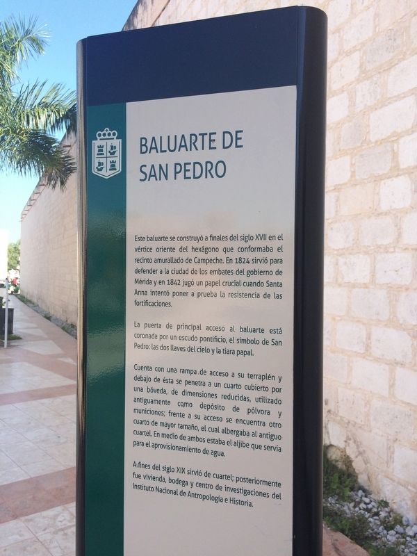
Baluarte de San Pedro
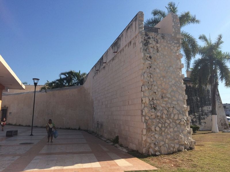
Este baluarte se construyó a finales del siglo XVII en el vértice oriente del hexágono que conformaba el recinto amurallado de Campeche. En 1824 sirvió para defender a la ciudad de los embates del gobierno de Mérida y en 1842 jugó un papel crucial cuando Santa Anna intentó poner a prueba la resistencia de las fortificaciones.
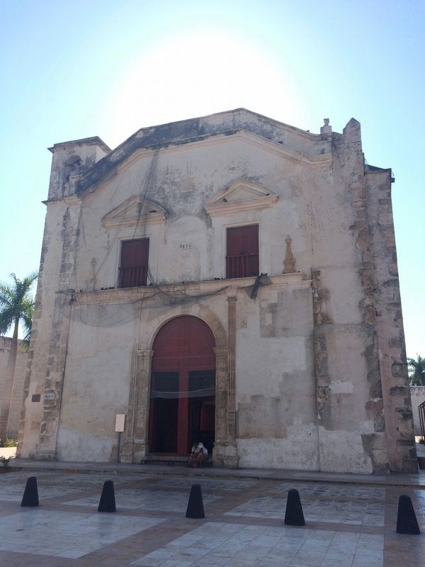
La puerta de principal acceso al baluarte está coronada por un escudo pontificio, el símbolo de San Pedro: las dos llaves del cielo y la tiara papal.
Cuenta con una rampa de acceso a su terraplén y debajo de ésta se penetra a un cuarto cubierto por una bóveda, de dimensiones reducidas, utilizado antiguamente como depósito de pólvora y municiones; frente a su acceso se encuentra otro cuarto de mayor tamaño, el cual albergaba al antiguo cuartel. En medio de ambos estaba el aljibe que servía para el aprovisionamiento de agua.
Al fines del siglo XIX sirvió de cuartel; posteriormente fue vivienda, bodega y centro Nacional de Antropología e Historia.
English:
Bastion of San Pedro
This bastion was built at the end of the 17th century in the eastern vertex of the hexagon that made up the walled enclosure of Campeche. In 1824 it was used to defend the city from the attacks of the government of Merida and in 1842 it played a crucial part when Santa Anna tried to put the resistance of the fortifications to test.
The main entrance to the bastion is crowned by a pontifical shield, the symbol of San Pedro: the two keys to heaven and the papal tiara.
It has a ramp for access to its embankment and underneath it goes into a vault-covered room of tight dimensions, used in former times as a depot for gunpowder and munitions; facing this access is another larger room, which housed the former barracks. Between the two was the cistern that served to provide water.
At the end of the 19th century it was a barracks; later it was used as housing, as a warehouse and as a research center for the National Institute of Anthropology and History.
Topics. This historical marker is listed in these topic lists: Forts and Castles • Man-Made Features • Wars, Non-US. A significant historical year for this entry is 1824.
Location. 19° 50.605′ N, 90° 31.968′ W. Marker is in San Francisco de Campeche, Campeche. It is in Zona Centro. Marker can be reached from Calle 16 close to Calle 51. The marker is to the southeast of the Church of San Juan de Dios, along a pedestrian walkway that passes near the entryway to the Bastion of San Pedro. Touch for map. Marker is in this post office area: San Francisco de Campeche CAMP 24000, Mexico. Touch for directions.
Other nearby markers. At least 8 other markers are within walking distance of this marker. Independence of Campeche (about 150 meters away, measured in a direct line); Francisco de Paulo Toro Theater (approx. 0.3 kilometers away); The House of the King’s Lieutenant (approx. 0.3 kilometers away); Temple of the Sweet Name of Jesus (approx. 0.4 kilometers away); Professor Septimio Perez Palacios (approx. 0.4 kilometers away); Campeche's Land Gate (approx. 0.4 kilometers away); The Guadalupe Gate (approx. 0.4 kilometers away); Park of the 4th Centenary San Martín (approx. 0.4 kilometers away). Touch for a list and map of all markers in San Francisco de Campeche.
Photographed By J. Makali Bruton, January 21, 2017
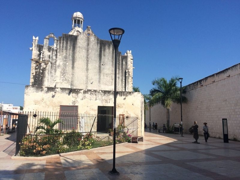
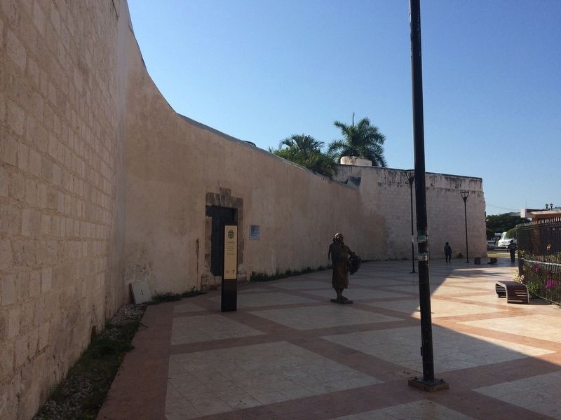
3. Bastion of San Pedro Marker
In this view to the south, the three-sided marker can be seen. Just behind the marker is the bastion and its main entrance. One side of the marker only announces that one is in the area of historic monuments of Campeche.

Photographed By J. Makali Bruton, January 21, 2017
5. Detail of the entryway to the Bastion of San Pedro
This part of the former bastion is now used as the "Gallery and Museum of Popular Art". Of note is: "...The main entrance to the bastion...crowned by a pontifical shield, the symbol of San Pedro: the two keys to heaven and the papal tiara" as mentioned in the marker text.
Credits. This page was last revised on April 23, 2017. It was originally submitted on April 23, 2017, by J. Makali Bruton of Accra, Ghana. This page has been viewed 178 times since then and 13 times this year. Photos: 1, 2, 3, 4, 5, 6, 7, 8. submitted on April 23, 2017, by J. Makali Bruton of Accra, Ghana.
