Near Perkins in Jenkins County, Georgia — The American South (South Atlantic)
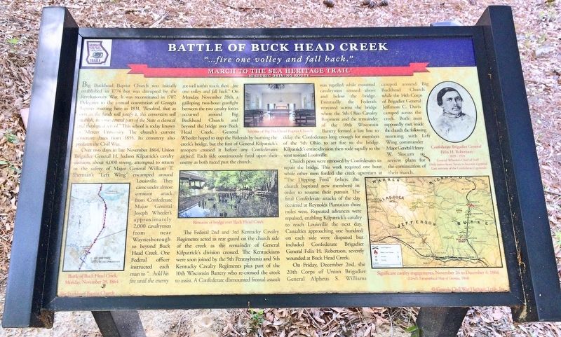
Battle of Buck Head Creek
"...fire one volley and fall back."
— March to the Sea Heritage Trail —
Over two days in late November 1864, Union Brigadier General H. Judson Kilpatrick's cavalry division, about 4,000 strong, attempted to return to the safety of Major General William T. Sherman's "Left Wing" encamped around Louisville. They came under almost constant attack from Confederate Major General Joseph Wheeler's approximately 2,000 cavalrymen from Waynesborough to beyond Buck Head Creek. One Federal officer instructed each man to "...hold his fire until the enemy got well within reach, then.. fine one volley and fall back." On Monday, November 28th, a galloping two-hour gunfight between the two cavalry forces occurred around Big Buckhead Church and beyond the bridge over Buck Head Creek. General Wheeler hoped to trap the Federals by burning the creek's bridge, but the first of General Kilpatrick's troopers crossed it before any Confederates arrived. Each side continuously fired upon their enemy as both raced past the church.
The Federal 2nd and 3rd Kentucky Cavalry Regiments acted as rear guard on the church side of the creek as the remainder of General Kilpatrick's division crossed. The Kentuckians were soon joined by the 9th Pennsylvania and 5th Kentucky Cavalry Regiments plus part of the 10th Wisconsin Battery who re-crossed the creek to assist. A Confederate dismounted frontal assault was repelled while mounted cavalrymen crossed above and below the bridge. Eventually the Federals retreated across the bridge where the 5th Ohio Cavalry Regiment and the remainder of the 10th Wisconsin Battery formed a last line to delay the Confederates long enough for members of the 5th Ohio to set fire to the bridge. Kilpatrick's entire division then rode rapidly to the west toward Louisville.
Church pews were removed by Confederates to repair the bridge. This work required one hour while other men forded the creek upstream at the "Dipping Ford" (where the church baptized new members) in order to resume their pursuit. The final Confederate attacks of the day occurred at Reynolds Plantation three miles west. Repeated advances were repulsed, enabling Kilpatrick's cavalry to reach Louisville the next day. Casualties approaching one hundred on each side were disputed but included
Confederate Brigadier General Felix H. Robertson, severely wounded at Buck Head Creek.
On. Friday, December 2nd, the 20th Corps of Union Brigadier General Alpheus S. Williams camped around Big Buckhead Church while the 14th Corps of Brigadier General Jefferson C. Davis camped across the creek. Both men supposedly met inside the church the following morning with Left Wing commander Major General Henry W. Slocum to review plans for the continuation of their march.
[Photo captions]
Bottom left: Battle of Buck Head Creek, Monday, November 28,1864
Middle top: Interior of Big Buckhead Baptist Church
Middle bottom: Remains of bridge over Buck Head Creek
Top right: Confederate Brigadier General Felix H. Robertson 1839 - 1928
General Wheeler's Chief of Staff
Only native-born Texan to become a general, Last survivor of the Confederacy's generals
Bottom right map: Significant cavalry engagements, November 26 to December 4, 1864
Lloyd's Topographical Map of Georgia, 1864)
Background watermark: Big Buckhead Baptist Church
Erected by Georgia Civil War Heritage Trails, Inc. (Marker Number L26.)
Topics and series. This historical marker is listed in these topic lists: Churches & Religion • War, US Civil • Waterways & Vessels. In addition, it is included in the Georgia Civil War Trails, and the Sherman’s March to the Sea series lists. A significant historical month for this entry is November 1864.
Location. 32° 54.059′ N, 82° 1.45′ W. Marker is near Perkins, Georgia, in Jenkins County. Marker is on Big Buckhead Church Road, 3˝ miles west of U.S. 25, on the right when traveling west. Touch for map. Marker is at or near this postal address: Big Buckhead Church Road, Perkins GA 30822, United States of America. Touch for directions.
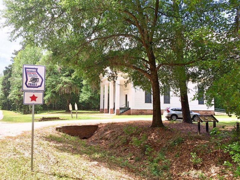
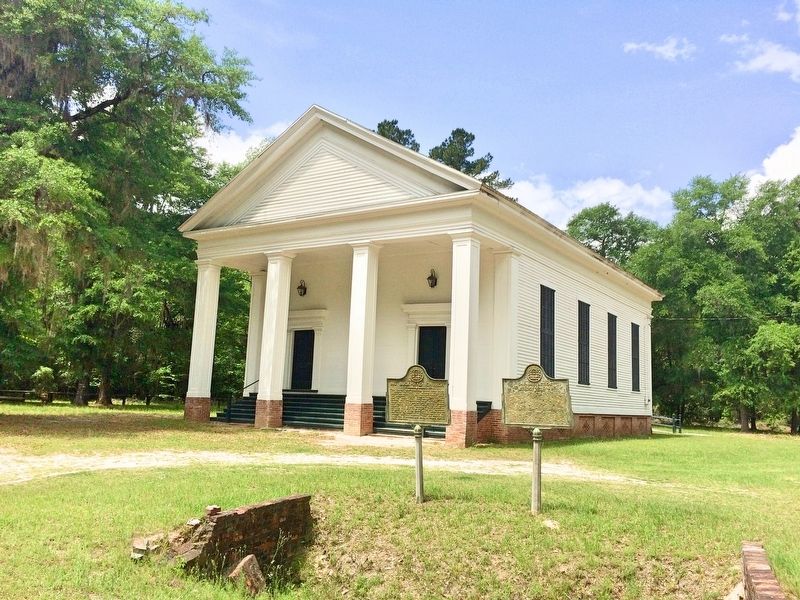
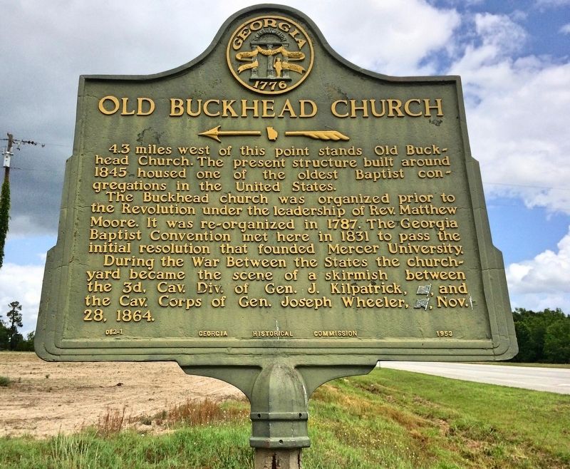
Other nearby markers. At least 8 other markers are within 5 miles of this marker, measured as the crow flies. Cavalry Action at Buckhead Church (here, next to this marker); Big Buckhead Church (here, next to this marker); Carswell Grove Baptist Church (about 400 feet away, measured in a direct line); Bellevue Plantation (approx. 2 miles away); Site of Planters Electric Membership Corporation Organizational Meeting (approx. 2 miles away); Old Buckhead Church (approx. 3.4 miles away); Camp Lawton (approx. 4.2 miles away); Welcome to Magnolia Springs – The Civil War’s Camp Lawton (approx. 4.2 miles away). Touch for a list and map of all markers in Perkins.
Also see . . . Wikipedia article on the Battle of Buck Head Creek. (Submitted on May 8, 2017, by Mark Hilton of Montgomery, Alabama.)
Credits. This page was last revised on May 8, 2017. It was originally submitted on May 8, 2017, by Mark Hilton of Montgomery, Alabama. This page has been viewed 1,081 times since then and 67 times this year. Photos: 1, 2, 3, 4. submitted on May 8, 2017, by Mark Hilton of Montgomery, Alabama.


