Fort Monroe in Hampton, Virginia — The American South (Mid-Atlantic)
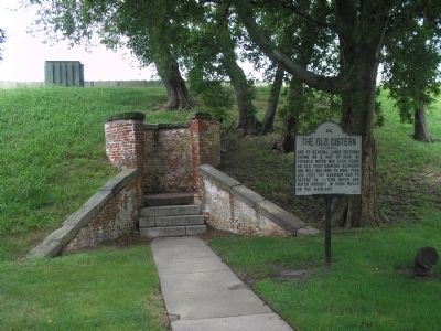
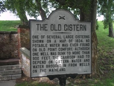
The Old Cistern
Erected 1969.
Topics. This historical marker is listed in these topic lists: Colonial Era • Forts and Castles • Military. A significant historical year for this entry is 1834.
Location. 37° 0.159′ N, 76° 18.601′ W. Marker is in Hampton, Virginia. It is in Fort Monroe. Marker is on Bernard Road, on the right when traveling south. Marker is located inside Fortress Monroe, near the entrance to the Casemate Museum. Touch for map. Marker is in this post office area: Fort Monroe VA 23651, United States of America. Touch for directions.
Other nearby markers. At least 8 other markers are within walking distance of this marker. Fort Monroe (a few steps from this marker); Eprouvette Mortar (a few steps from this marker); a different marker also named Fort Monroe (a few steps from this marker); 12-Pounder Howitzer (a few steps from this marker); Lantaka (within shouting distance of this marker); Austrian 6-Pounder Gun (within shouting distance of this marker); a different marker also named Austrian 6-Pounder Gun (within shouting distance of this marker); John Mitchel (within shouting distance of this marker). Touch for a list and map of all markers in Hampton.
Also see . . .
1. Fort Monroe (Stone Fort) National Register of Historic Places Registration Form (pdf file). (Submitted on August 19, 2019.)
2. Fort Monroe National Monument, National Park Service. (Submitted on August 19, 2019.)

Photographed By Bill Coughlin, August 11, 2008
2. Marker in Fort Monroe
Fort Monroe was originally called Point Comfort. It is beleived to have been named in 1607 by the original settlers of Jamestown. Captain Christopher Newport anchored the Susan Constant near here on April 28, 1607, and members of his crew rowed to this place "which put them in good comfort."
Credits. This page was last revised on February 1, 2023. It was originally submitted on August 16, 2008, by Bill Coughlin of Woodland Park, New Jersey. This page has been viewed 1,514 times since then and 39 times this year. Photos: 1, 2. submitted on August 16, 2008, by Bill Coughlin of Woodland Park, New Jersey.
