
Near Williamsburg in York County, Virginia — The American South (Mid-Atlantic)
Redoubt 12
Hancock the Superb
| — | 1862 Peninsula Campaign | — |
Photographed by Bill Coughlin, August 10./2008
1. Redoubt 12 Marker
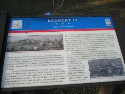
You are near the northern end of the Confederate defensive line built in 1861 to protect the eastern approach to Richmond. The “Williamsburg Line” stretched between the James and York rivers and consisted of fourteen forts, commonly called redoubts. This was the third Confederate line encountered by Federal troops under Maj. Gen. George B. McClellan during the Peninsula Campaign.
The road entering the park is part of the original Queen’s Creek Road. Four redoubts were built along this road. To the east, across the Colonial Parkway, the old road trace is still visible, as is Redoubt 11. During the Battle of Williamsburg on May 5, 1862, Redoubt 11 was the site of a fierce engagement between forces under Union Brig. Gen. Winfield Scott Hancock and Confederate generals Daniel Harvey Hill and Jubal Early. Hancock’s force consisted of troops from New York, Wisconsin, Pennsylvania, and Maine. On the afternoon of the battle, Hancock “the Superb,” so named for his actions on this day, found Redoubt 11 unmanned and took “quiet possession.” Confederate troops from Virginia and the Carolinas made a heroic but disjointed charge to
this page online
As the road proceeds west through the park, the old road trace forks to the north, following its original track toward Queen’s Creek and passing directly in front of Redoubt 12. A chevron-shaped fort, Redoubt 13, is a half mile north of Redoubt 12. It faces along Cub Dam Creek and anchored the extreme northern end of the Confederate line. These two redoubts were also unmanned during the Battle of Williamsburg. Their silent presence affords a forgotten vestige of America’s Civil War.
Erected by Virginia Civil War Trails.
Topics and series. This historical marker is listed in this topic list: War, US Civil. In addition, it is included in the Virginia Civil War Trails series list. A significant historical month for this entry is May 1862.
Location. 37° 16.978′ N, 76° 39.04′ W. Marker is near Williamsburg, Virginia, in York County. It
Photographed by Bill Coughlin, August 10, 2008
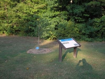
2. Marker in Newquarter Park

Regionally, this marker is on Virginia’s Peninsula, in Coastal Virginia, and in the Hampton Roads Metropolitan Area. It is also in the American South, specifically in the Upper South, in the Tidewater, and on the Eastern Seaboard. Globally, it is in the North Atlantic Region, North America, the Western Hemisphere, the Western World, and the Anglosphere. Historically, it finds itself in what was once the territory of the Mississippian Culture, one of the original Thirteen Colonies, one of the Confederate States of America, and the Antebellum South.
Other nearby markers. At least 8 other markers are within 2 miles of this marker, measured as the crow flies: A Union Advance (approx. half a mile away); Redoubts 12 & 13: The End of the Williamsburg Line (approx. 0.8 miles away); a different marker also named Vineyard Tract (approx. 1½ miles away); Fort Magruder (approx. 1.6 miles away); Confederate Soldiers and Sailors Monument
Photographed by Bill Coughlin, August 10, 2008
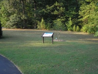
3. Redoubt 12 Marker
Other markers no longer nearby. Vineyard Tract (was approx. 1½ miles away but has been replaced with another marker now near it); Magruder’s Defenses (was approx. 2 miles away but has been confirmed missing).
More about this marker. The top left of the marker contains a watercolor by Lt. Robert Sneden of “The Battle of Williamsburg” – Copyright Virginia Historical Society, 1997. The bottom right of the marker features an engraving of “The Battle of Williamsburg” from Harper’s Weekly.
Also see . . .
1. Battle of Williamsburg, 5 May 1862. (Submitted on August 17, 2008, by Bill Coughlin of Woodland Park, New Jersey.)
2. The Peninsula Campaign. (Submitted on August 17, 2008, by Bill Coughlin of Woodland Park, New Jersey.)
3. Tidewater Virginia, The 1862 Peninsula Campaign. Civil War Traveler. (Submitted on August 17, 2008, by Bill Coughlin of Woodland Park, New Jersey.)
Photographed by Bill Coughlin, August 10, 2008
4. Newquarter Park
Marker is located near the entrance to Newquarter Park in Williamsburg.
Credits. This page was last revised on October 9, 2022. It was originally submitted on August 17, 2008, by Bill Coughlin of Woodland Park, New Jersey. This page has been viewed 3,101 times since then and 37 times this year. Photos: 1, 2, 3, 4. submitted on August 17, 2008, by Bill Coughlin of Woodland Park, New Jersey.
