Ferriday in Concordia Parish, Louisiana — The American South (West South Central)
Lamarque Landing Mound
Ancient Mounds Trail
Photographed by Cajun Scrambler, May 27, 2017
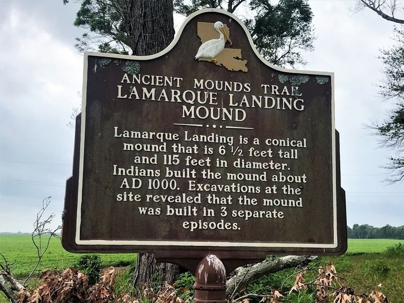
1. Lamarque Landing Mound Marker
Lamarque Landing is a conical mound that is 6½ feet tall and 115 feet in diameter. Indians built the mound about AD 1000. Excavations at the site revealed that the mound was built in 3 separate episodes.
Lower Plaque
This archaeological site is on private property. Please view the site from the highway right-of-way.
NO TRESPASSING
Topics and series. This historical marker is listed in these topic lists: Anthropology & Archaeology • Indigenous Peoples and Communities. In addition, it is included in the Louisiana Ancient Mounds Trail series list. A significant historical year for this entry is 1000 CE.
Location. 31° 43.554′ N, 91° 38.831′ W. Marker is in Ferriday, Louisiana, in Concordia Parish. It is on Dunbarton Drive (State Highway 566) south of Lamarque Road, on the left when traveling south. Touch for map. Marker is in this post office area: Ferriday LA 71334, United States of America. Touch for directions.

Regionally, this marker is in Central Louisiana. It is also in the American South, specifically in the Deep South, and in the Mississippi Delta. Globally, it is in North America, a Gulf of Mexico state,
this page online
Other nearby markers. At least 8 other markers are within 9 miles of this marker, measured as the crow flies: Cypress Grove Mound (approx. 3½ miles away); Churupa Plantation Mound (approx. 6.3 miles away); Peck Village (approx. 6.9 miles away); Peck Mounds (approx. 6.9 miles away); Elkhorn Plantation Mound (approx. 7.2 miles away); DePrato Mounds (approx. 8 miles away); Frogmore Mound (approx. 8½ miles away); The Blues Trail: Mississippi to Louisiana (approx. 8.6 miles away). Touch for a list and map of all markers in Ferriday.
Also see . . . Indian Mounds of Northeast Louisiana - Lamarque Landing Mound. (Submitted on May 29, 2017, by Mark Hilton of Montgomery, Alabama.)
Photographed by Cajun Scrambler, May 27, 2017
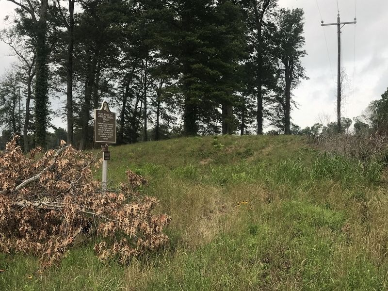
2. Lamarque Landing Mound and Marker
Credits. This page was last revised on March 18, 2022. It was originally submitted on May 28, 2017, by Cajun Scrambler of Assumption, Louisiana. This page has been viewed 1,019 times since then and 73 times this year. Photos: 1, 2. submitted on May 28, 2017, by Cajun Scrambler of Assumption, Louisiana.
