Thomasville Heights near Atlanta in Fulton County, Georgia — The American South (South Atlantic)
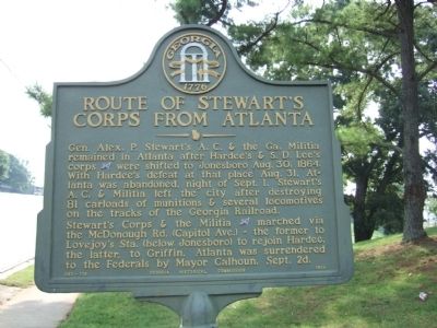
Route of Stewart's Corps from Atlanta
Photographed by Felch Dumas, August 14, 2008
1. Route of Stewart's Corps from Atlanta Marker
Stewart’s Corps & the Militia (CS) marched via the McDonough Rd. (Capitol Ave.) – the former to Lovejoy’s Sta. (below Jonesboro) to rejoin Hardee, the latter to Griffin. Atlanta was surrendered to the Federals by Mayor Calhoun, Sept. 2d.
Erected 1956 by Georgia Historical Commission. (Marker Number 060-106.)
Topics and series. This historical marker is listed in this topic list: War, US Civil. In addition, it is included in the Georgia Historical Society series list. A significant historical date for this entry is September 1, 1864.
Location. 33° 42.265′ N, 84° 21.16′ W. Marker is near Atlanta, Georgia, in Fulton County. It is in Thomasville Heights. It is on McDonough Boulevard 0.3 miles west of Henry Thomas Drive, on the left when traveling west. Touch for map.
this page online

Regionally, this marker is in Georgia’s Piedmont. It is also in the American South and specifically in the Deep South. Globally, it is in North America, the Western Hemisphere, the Western World, and the Anglosphere. Historically, it finds itself in what was once the territory of the Mississippian Culture, one of the original Thirteen Colonies, one of the Confederate States of America, and the Antebellum South.
Other nearby markers. At least 8 other markers are within 2 miles of this marker, measured as the crow flies: Hardee's Night March (about 500 feet away, measured in a direct line); Hardee at Wm. Cobb’s House (approx. 1.2 miles away); Site: Cobb’s Mill (approx. 1.2 miles away); South-View Cemetery (approx. 1.3 miles away); To Robert Burns (approx. 1.6 miles away); Hardee at Road Fork (approx. 1.7 miles away); Fort Walker (approx. 2 miles away); This Line of Breastworks (approx. 2.1 miles away). Touch for a list and map of all markers in Atlanta.
Another marker is no longer nearby. Hardee’s March Turned N.E. on Fayetteville Road
Photographed by Felch Dumas, August 14, 2008
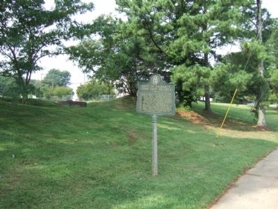
2. Route of Stewart's Corps from Atlanta Marker
Credits. This page was last revised on February 8, 2023. It was originally submitted on August 18, 2008, by Felch Dumas of Decatur, Georgia. This page has been viewed 1,234 times since then and 26 times this year. Photos: 1, 2. submitted on August 18, 2008, by Felch Dumas of Decatur, Georgia. • Craig Swain was the editor who published this page.
