Near Laguna Verde in Actopan, Veracruz, Mexico — The Gulf Coast (North America)
Quiahuiztlán
Photographed by J. Makali Bruton, March 24, 2017
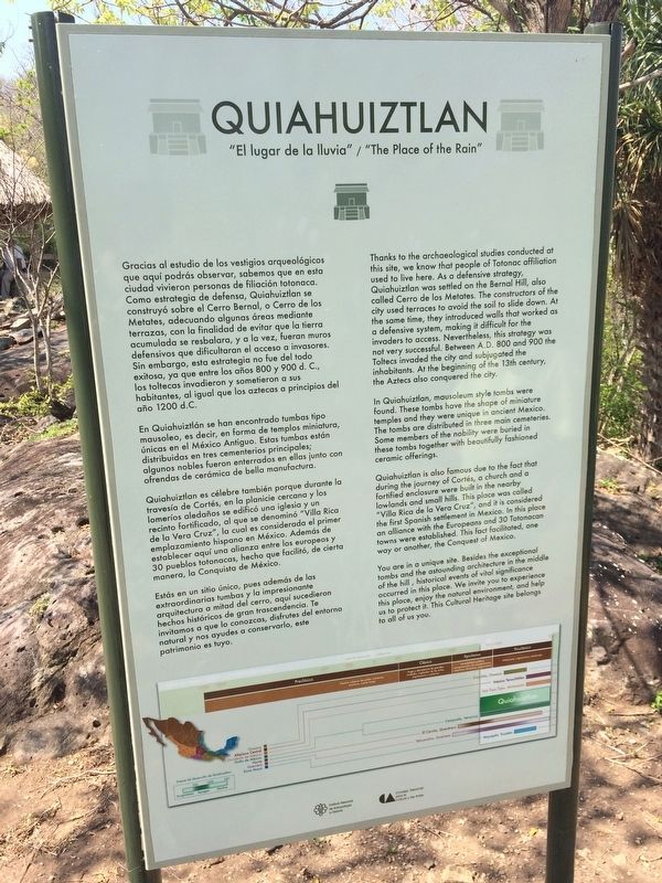
1. Quiahuiztlán Marker

"El lugar de la lluvia."
En Quiahuiztlán se han encontrado tumbas tipo mausoleo, es decir, en forma de templos miniatura, únicos en el México Antiguo. Estas tumbas están distribuidas en tres cementerios principales; algunos nobles fueron enterradas en ellas junto con ofrendas de cerámica de bella manufactura.
Quiahuiztlan es célebre también porque durante la travesía de Cortés, en la planicie cercana y los lomeríos aledaños se edificó una iglesia y un recinto fortificado, al que se denominó
this page online
Estás en un sitio único, pues además de las extraordinarias tumbas y la impresionante arquitectura a mitad del cerro, aquí sucedieron hechos históricos de gran trascendencia. Te invitamos a que lo conozcas, disfrutes del entorno natural y nos ayudes a conservarlos, este patrimonio es tuyo.
English:
"The Place of the Rain."
Photographed by J. Makali Bruton, March 24, 2017
2. Quiahuiztlán Marker
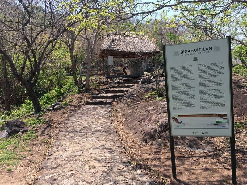
The marker is near where payment is made to enter the park, seen in the distance.
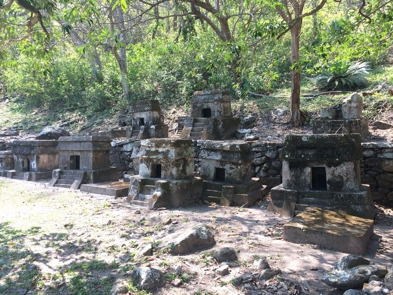
In Quiahuiztlan, mausoleum style tombs were found. These tombs have the shape of miniature temples and they were unique in ancient Mexico. The tombs are distributed in three main cemeteries. Some members of the nobility were buried in these tombs together with beautifully fashioned ceramic offerings.
Quiahuiztlan is also famous due to the fact that during the journey of Cortés, a church and a fortified enclosure were built in the nearby lowlands and small hills. This place was called "Villa Rica de la Vera Cruz", and it is considered the first Spanish settlement in Mexico. In this place an alliance with the Europeans and 30 Totonacan towns were established. This fact facilitated, one way or another, the Conquest of Mexico.
You are in a unique site. Besides the exceptional tombs and the astounding architecture in the middle of the hill, historical events of vital significance occurred in this place. We invite you to experience this place, enjoy the natural environment, and help us to protect it. This Cultural Heritage site belongs to all of us.
Erected by Consejo Nacional
Photographed by J. Makali Bruton, March 24, 2017
3. Small mausoleums shaped like temples at Quiahuiztlán
These small tombs are mentioned in the marker text. They are only found at this particular site and nowhere else in Mexico.
Topics. This historical marker is listed in these topic lists: Anthropology & Archaeology • Architecture • Indigenous Peoples and Communities. A significant historical year for this entry is 1200.
Location. 19° 40.197′ N, 96° 24.927′ W. Marker is near Laguna Verde, Veracruz, in Actopan. It can be reached from Route 180. The marker is at the archaeological site of Quiahuiztlán, turning off Highway 180 (Veracruz-Poza Rica) near the small village of Play Villa Rica. The next largest town is Laguna Verde to the north. Touch for map. Marker is in this post office area: Laguna Verde VER 91480, Mexico. Touch for directions.

Regionally, this marker is in the Gulf Coast and in the Sierra Madre. Globally, it is in North America, specifically in Mesoamerica, in a Gulf of Mexico state, on the Ring of Fire, and in the Western Hemisphere. Historically, it finds itself in what was once New Spain, a Spanish colony, and the Aztec Empire.
Photographed by J. Makali Bruton, March 24, 2017
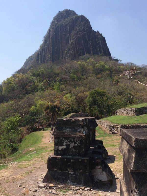
4. Bernal Hill at Quiahuiztlán
The Bernal Hill is mentioned in the marker text. Note the small tomb shaped like a temple in the foreground.
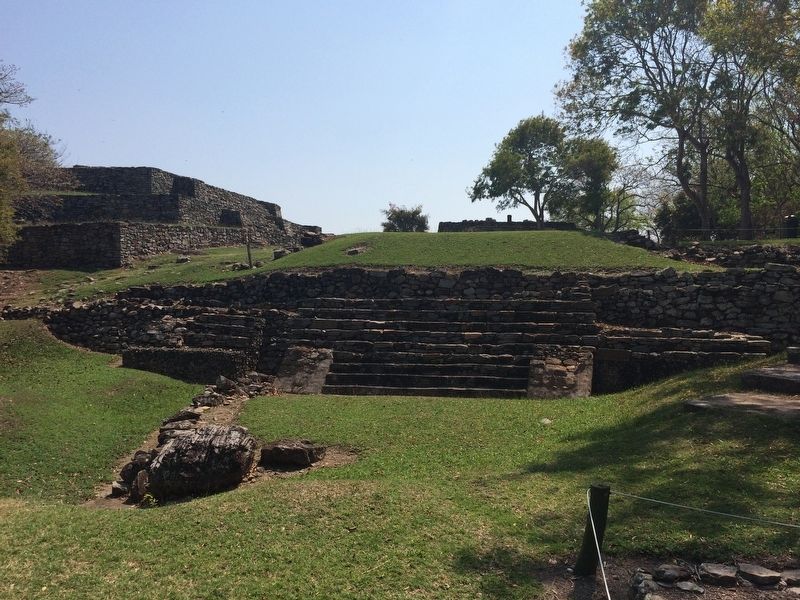
Photographed by J. Makali Bruton, March 24, 2017
5. Indigenous ruins at Quiahuiztlán
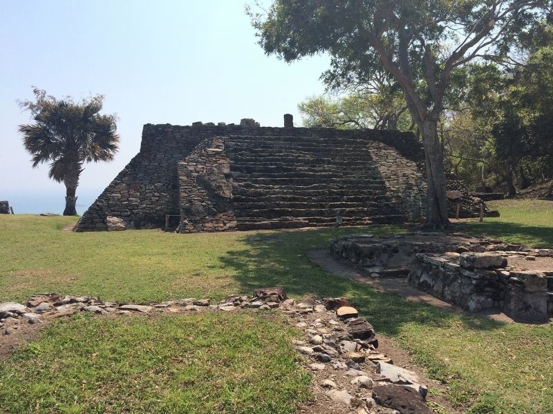
Photographed by J. Makali Bruton, March 24, 2017
6. A pyramid at Quiahuiztlán
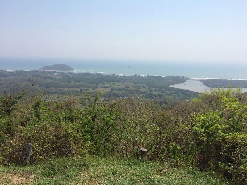
Photographed by J. Makali Bruton, March 24, 2017
7. A view of Playa Villa Rica from Quiahuiztlán
The beach in the distance, today a small village known as Playa Villa Rica, was probably where Cortés landed as he moved north from what is now Veracruz. The people of Quiahuiztlán would have seen the Spanish land from this vantage point. It is also possible that this was where Cortés decided to burn his ships in order to eliminate the possibility of return to his soldiers.
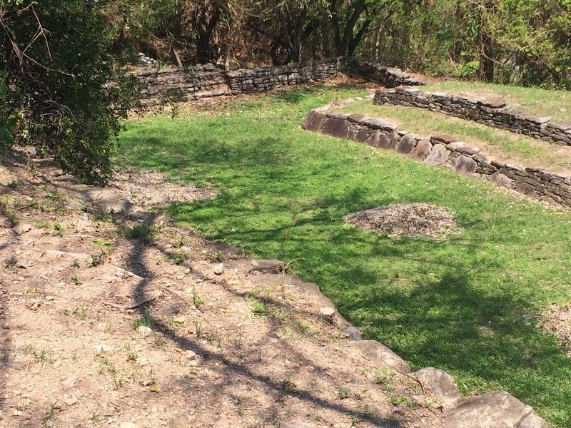
Photographed by J. Makali Bruton, March 24, 2017
8. A relatively rare T-shaped ball court at Quiahuiztlán
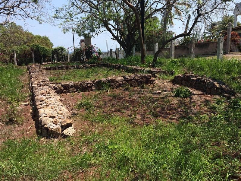
Photographed by J. Makali Bruton, March 24, 2017
9. Spanish settlement of "Villa Rica de la Veracruz"
As the marker mentions, the Spanish built a nearby settlement, closer to the beach. The location is in the small village of Playa Villa Rica at the coordinates 19.675925, -96.398807. The site can be visited but it is not marked or well known. The foundations of the Spanish buildings have been protected by placing stones over their bases, which serves to show their outline.
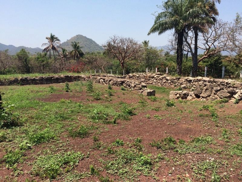
Photographed by J. Makali Bruton, March 24, 2017
10. Spanish settlement of "Villa Rica de la Veracruz"
This area was discovered in 1943, proving that the Spanish had landed near here.
Credits. This page was last revised on January 4, 2023. It was originally submitted on June 12, 2017, by J. Makali Bruton of Washington, District of Columbia. This page has been viewed 751 times since then and 97 times this year. Photos: 1, 2, 3, 4, 5, 6, 7, 8, 9, 10. submitted on June 12, 2017, by J. Makali Bruton of Washington, District of Columbia.
