Scotland in St. Mary's County, Maryland — The American Northeast (Mid-Atlantic)
"Contraband" Camp
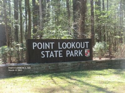
Point Lookout State Park
| — | Maryland Park Service | — |
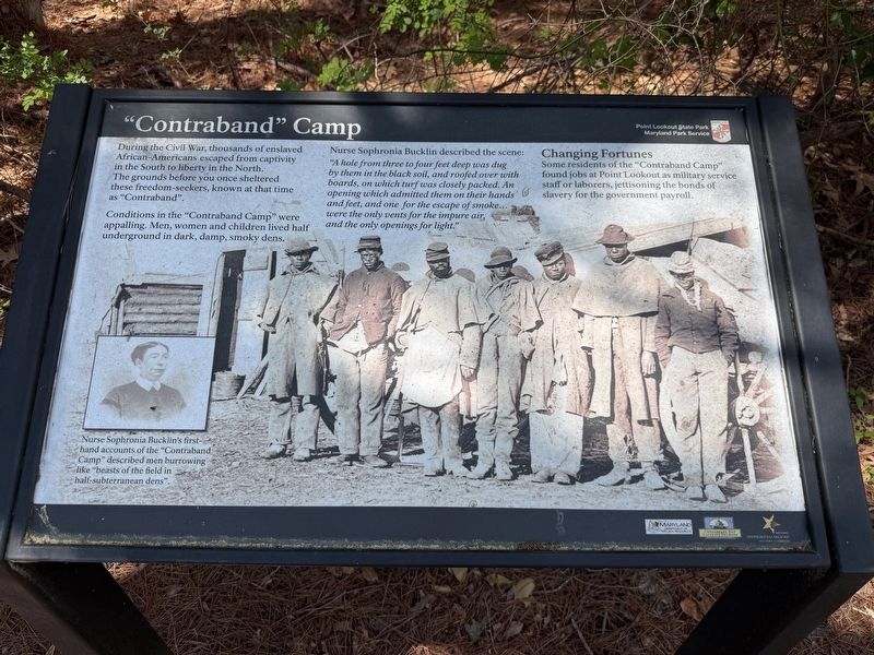
During the Civil War, thousands of enslaved African-Americans escaped from captivity in the South to liberty in the North. The grounds before you once sheltered these freedom-seekers, know at that time as “Contraband”.
Conditions in the “Contraband Camp” were appalling. Men, women and children lived half underground in dark, damp, smoky dens.
Nurse Sophronia Bucklin described the scene:
“A hole from three to four feet deep was dug by them in the black soil, and roofed over with boards, on which turf was closely packed. An opening which admitted them on their hands and feet, and one for the escape of smoke…were the only vents for the impure air, and the only openings for light.”
Changing Fortunes
Some residents of the “Contraband Camp” found jobs at Point Lookout as military service staff or laborers, jettisoning the bonds of slavery for the government payroll.
[Caption:]
Nurse Sophronia Bucklin’s first-hand accounts of the “Contraband Camp” described men burrowing like “beasts of the field in half-subterranean dens.”
Erected by Maryland Park Service; Maryland Department of Natural Resources; Chesapeake
this page online
Topics and series. This historical marker is listed in these topic lists: Abolition & Underground RR • War, US Civil. In addition, it is included in the Network to Freedom series list.
Location. 38° 2.885′ N, 76° 19.385′ W. Marker is in Scotland, Maryland, in St. Mary's County. It is on Point Lookout Road (Maryland Route 5) 1.6 miles south of 3rd Way, on the right when traveling south. Touch for map. Marker is at or near this postal address: 10380 Point Lookout Rd, Scotland MD 20687, United States of America. Touch for directions.

Regionally, this marker is in Southern Maryland. It is also in the American South, specifically in the Upper South, in the Mid-Atlantic, in the Tidewater, in the Chesapeake Bay Region, and on the Eastern Seaboard. Globally, it is in the North Atlantic Region, North America, the Western Hemisphere, the Western World, and the Anglosphere. Historically, it finds itself in what was once one of the original Thirteen Colonies and also the Antebellum South.
Other nearby markers. At
Photographed by Don Morfe, March 11, 2012
2. "Contraband" Camp Marker
Another marker is no longer nearby. Prison Pen (was about 500 feet away but has been replaced with another marker now near it).

Photographed by Pete Payette, June 19, 2017
3. "Contraband" Camp Marker
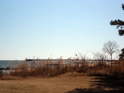
This marker is now located further south, opposite the entrance to the state park fishing pier, near the Prison Pen site.

Photographed by Don Morfe, March 11, 2012
4. "Contraband" Camp Marker in a prior location
Photographed by Don Morfe, March 11, 2012
5. "Contraband" Camp Marker
Photographed by Don Morfe, March 11, 2012
6. "Contraband" Camp Marker
Credits. This page was last revised on April 13, 2026. It was originally submitted on October 15, 2012, by Don Morfe of Baltimore, Maryland. This page has been viewed 1,068 times since then and 41 times this year. Last updated on June 26, 2017, by Pete Payette of Orange, Virginia. Photos: 1. submitted on April 13, 2026, by Devry Becker Jones of Washington, District of Columbia. 2. submitted on October 15, 2012, by Don Morfe of Baltimore, Maryland. 3. submitted on June 26, 2017, by Pete Payette of Orange, Virginia. 4, 5, 6. submitted on October 15, 2012, by Don Morfe of Baltimore, Maryland. • Bernard Fisher was the editor who published this page.
