Near Cobden in Renfrew County, Ontario — Central Canada (North America)
Champlain's Astrolabe
Photographed by Kevin Craft, July 4, 2017
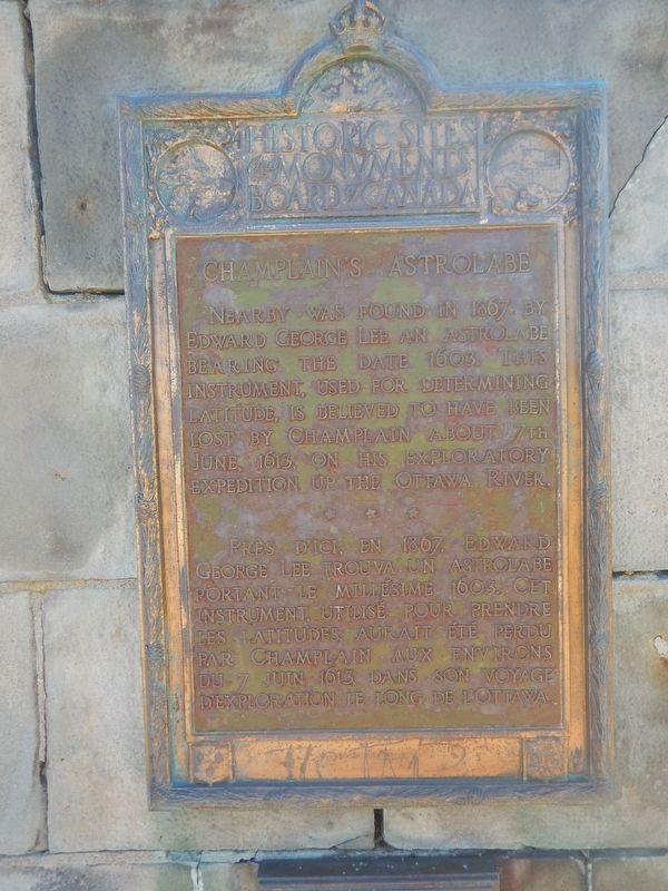
1. Champlain's Astrolabe Marker
Nearby was found in 1867 by Edward George Lee an Astrolabe bearing the date 1603. This instrument, used for determining latitude, is believed to have been lost by Champlain about 7th June, 1613, on his exploratory expedition up the Ottawa River.
Erected by Historic Sites and Monuments Board of Canada.
Topics and series. This historical marker is listed in these topic lists: Colonial Era • Exploration • Science & Medicine. In addition, it is included in the Canada, Historic Sites and Monuments Board series list. A significant historical date for this entry is June 7, 1613.
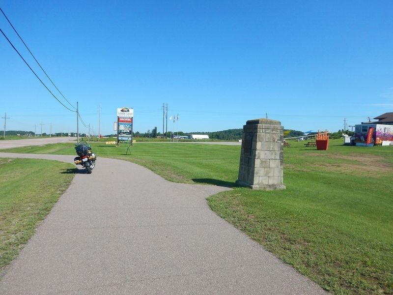
Location. 45° 35.925′ N, 76° 50.665′ W. Marker is near Cobden, Ontario, in Renfrew County. It is on Trans-Canada Highway (Provincial Highway 17) 0.1 kilometers east of Logos Land Road, on the right when traveling west. Marker is located in a small paved turnout just in front of Logos Land Resort. Touch for map. Marker is at or near this postal address: 15906 Highway 17, Cobden ON K0J 1K0, Canada. Touch for directions.

Regionally, this marker is in the Haliburton Highlands to Ottawa Valley and in Eastern Ontario. It is also in Central Canada.
this page online
Other nearby markers. At least 8 other markers are within 19 kilometers of this marker, measured as the crow flies: Champlain's Journey of 1613 (approx. 4.3 kilometers away); War Memorial (approx. 18.7 kilometers away); The Founding of Renfrew (approx. 18.7 kilometers away); First Municipal Council Meeting (approx. 18.8 kilometers away); Renfrew Public Library (approx. 18.8 kilometers away); The Book Tree (approx. 18.8 kilometers away); Renfrew Fire Station (approx. 18.8 kilometers away); Renfrew Fire Bell (approx. 18.8 kilometers away).
Also see . . . Wikipedia - Samuel de Champlain. (Submitted on July 15, 2017, by Kevin Craft of Bedford, Quebec.)
Photographed by Kevin Craft, July 4, 2017
2. Wideview of Champlain's Astrolabe Marker
Credits. This page was last revised on March 27, 2025. It was originally submitted on July 15, 2017, by Kevin Craft of Bedford, Quebec. This page has been viewed 731 times since then and 89 times this year. Photos: 1, 2. submitted on July 15, 2017, by Kevin Craft of Bedford, Quebec.
