Near Cullman in Cullman County, Alabama — The American South (East South Central)
What happens to my wastewater?
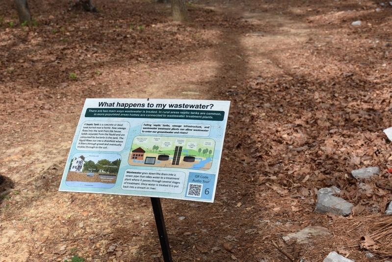
Photographed by Sandra Hughes, April 18, 2017
1. What happens to my wastewater? Marker
A Septic Tank is a concrete or steel tank buried near a home. Raw sewage flows into the tank from the house.
Solids separate from the liquid and are consumed by bacteria in the tank. The liquid flows out into a drainfield where it filters through gravel and eventually trickles through the soil.
Failing septic tanks, sewage infrastructure, and wastewater treatment plants can allow wastewater to enter our groundwater and rivers!
Wastewater goes down the drain into a sewer pipe that takes water to a treatment plant where it passes through several stages of treatment. Once water is treated it is put back into a stream or river.
Topics. This historical marker is listed in these topic lists: Environment • Waterways & Vessels.
Location. 34° 12.447′ N, 86° 59.452′ W. Marker is near Cullman, Alabama, in Cullman County. It is on County Road 1043. Located at Clarkson Covered Bridge Park. Touch for map. Marker
this page online

Regionally, this marker is in North Alabama. It is also in the American South and specifically in the Deep South. Globally, it is in North America, a Gulf of Mexico state, the Western Hemisphere, the Western World, and the Anglosphere. Historically, it finds itself in what was once the original Cherokee Nation, the territory of the Mississippian Culture, one of the Confederate States of America, and the Antebellum South.
Other nearby markers. At least 8 other markers are within 2 miles of this marker, measured as the crow flies: Alabama's Aquatic Biodiversity (here, next to this marker); Birds of Alabama (here, next to this marker); Where does your drinking water come from? (here, next to this marker); Alabama's Physical Diversity (within shouting distance of this marker); Clarkson Covered Bridge (within shouting distance of this marker); Land-Use and Water Quality (within shouting distance of this marker); Streight’s Raid (approx. 1.9 miles away); a different marker also named Streight’s Raid (approx. 1.9 miles away). Touch for a list and map of all markers in Cullman.
Credits. This page was last revised on December 24, 2021. It was originally submitted on July 25, 2017, by Sandra Hughes Tidwell of Killen, Alabama, USA. This page has been viewed 458 times since then and 30 times this year. Photo 1. submitted on July 25, 2017, by Sandra Hughes Tidwell of Killen, Alabama, USA. • Bill Pfingsten was the editor who published this page.
