Yorktown in York County, Virginia — The American South (Mid-Atlantic)
Capture of Redoubt No. 10
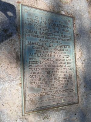
Photographed by Bill Coughlin, August 12, 2008
1. Capture of Redoubt No. 10 Marker
Siege of Yorktown
on October 14, 1781, at night
the Battalions of
Gimat, Hamilton and Laurens
of the Light Infantry Division of
Major-General Marquis de Lafayette,
under the command of
Lieutenant-Colonel Alexander Hamilton
with unloaded muskets and fixed bayonets, scaled the parapets and gallantly captured Redoubt No 10 which formed the extreme left outlying defense of the British and so hastened the surrender of Yorktown in
the last fighting of
the troops of
Gen. George Washington.
----------
Erected 1925 by Sons of the Revolution in the State of New York.
Topics and series. This historical marker is listed in these topic lists: Notable Events • Notable Places • War, US Revolutionary. In addition, it is included in the Sons of the American Revolution (SAR) series list. A significant historical month for this entry is October 1777.
Location. 37° 13.75′ N, 76° 29.853′ W. Marker is in Yorktown, Virginia, in York County. It can be reached from Ballard Street (Virginia Route 238), on the left when traveling south. Marker is located on the Yorktown Battlefield in Colonial National Historical Park, at stop D on the
this page online

Regionally, this marker is on Virginia’s Peninsula, in Coastal Virginia, and in the Hampton Roads Metropolitan Area. It is also in the American South, specifically in the Upper South, in the Tidewater, and on the Eastern Seaboard. Globally, it is in the North Atlantic Region, North America, the Western Hemisphere, the Western World, and the Anglosphere. Historically, it finds itself in what was once the territory of the Mississippian Culture, one of the original Thirteen Colonies, one of the Confederate States of America, and the Antebellum South.
Other nearby markers. At least 8 other markers are within walking distance of this marker: Redoubt 10 (here, next to this marker); Redoubts 9 and 10 (about 400 feet away, measured in a direct line); The Second Siege Line (about 400 feet away); Time, Tide and Erosion (about 400 feet away); Grand American Battery (about 500 feet away); Redoubt 9 (about 600 feet away); French Soldiers and Sailors (about 600 feet away); Communicating Trench (approx.
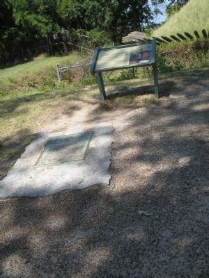
Photographed by Bill Coughlin, August 12, 2008
2. Markers on Yorktown Battlefield
Also see . . .
1. Yorktown Battlefield. National Park Service. (Submitted on August 22, 2008, by Bill Coughlin of Woodland Park, New Jersey.)
2. The Battle of Yorktown. The Patriot Resource website. (Submitted on August 22, 2008, by Bill Coughlin of Woodland Park, New Jersey.)
3. The Battle of Yorktown 1781. A British perspective of the Battle of Yorktown from BritishBattles.com (Submitted on August 22, 2008, by Bill Coughlin of Woodland Park, New Jersey.)
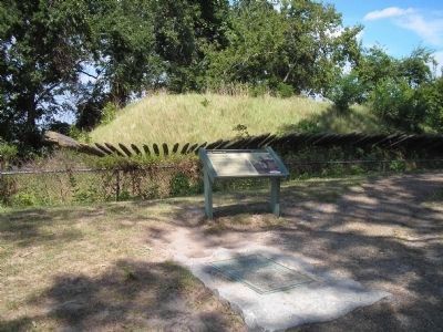
Photographed by Bill Coughlin, August 12, 2008
3. Markers at Redoubt No. 10
This redoubt and nearby Reboubt No 9 were captured on the night of October 14, 1781 after less than 30 minutes of fighting.
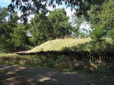
Photographed by Bill Coughlin, August 12, 2008
4. Redoubt No. 10
After its capture, this redoubt and Redoubt 9 were incorporated into the Allies second siege line. A Grand American Battery for siege artillery was then constructed between the redoubts.
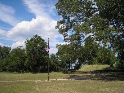
Photographed by Bill Coughlin, August 12, 2008
5. Redoubt No. 10
Cornwallis requested a cease fire three days after the fall of Redoubt No. 10. Washington signed the surrender documents within this redoubt.
Credits. This page was last revised on June 16, 2016. It was originally submitted on August 22, 2008, by Bill Coughlin of Woodland Park, New Jersey. This page has been viewed 1,851 times since then and 65 times this year. Photos: 1, 2, 3, 4, 5. submitted on August 22, 2008, by Bill Coughlin of Woodland Park, New Jersey.
