Big Cypress National Preserve
Rain-the Swamp's Lifeblood
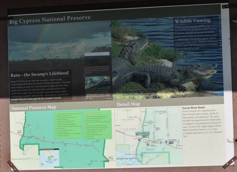
Nearly 55 inches of rain falls here annually-drenching Big Cypress National Preserve during the summer wet season.
The fresh water flowing through the national preserve replenishes the local aquifer and sustains the abundant plant and animal life of the region.
Fresh water flows to mix with coastal salt waters within neighboring Everglades National Park, renewing the nutrient-rich estuaries that are nursery grounds for a myriad of sea life.
Deep water often means taller cypress trees, commonly forming domes or strands. Where water leaves are shallow, prairies and dwarf cypress grow.
In South Florida's subtropical environment, the seasons are reflected through changing water levels. During the winter dry season wildlife activity concentrates in the shrinking water holes.
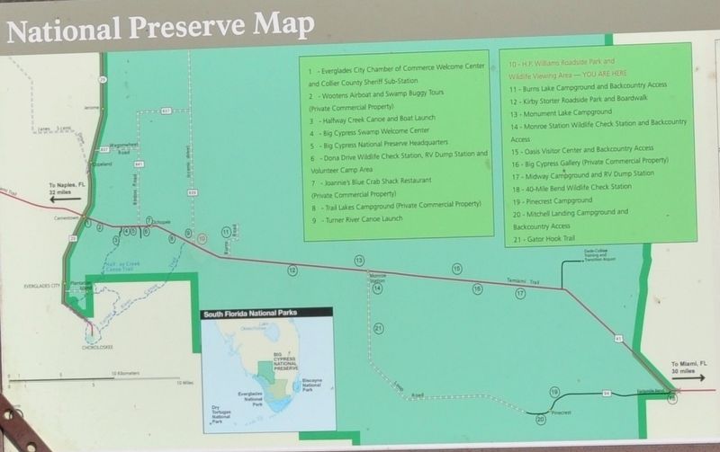
National Preserve Map
1. Everglades City Chamber of Commerce Welcome Center and Collier County Sheriff Sub-Station
2. Wootens Airboat and Swamp buggy Tours (Private Commercial Property)
3. Halfway Creek Canoe and Boat Launch
4. Big Cypress Swamp Welcome Center
5. Big Cypress National Preservation Headquarters
6. Dona Drive Wildlife Check Station, RV Dump Station and Volunteer Camping Area
7. Joannie's Blue Crab Shack Restaurant (Private Commercial Property)
8.
9. turner River Canoe Launch
10. H. P. Williams Roadside Park and Wildlife Viewing Area - You are here
11. Burns Lake Campground and Backcountry Access
12. Kirby Storter Roadside Park and Boardwalk
13. Monument Lake Campground
14. Monroe Station Wildlife Check Station and Backcountry Access
15. Oasis Visitor Center and Backcountry Access
16. Big Cypress Gallery (Private Commercial Property)
17. Midway Campground and RV Dump Station
18. 40-Mile Bend Wildlife Check Station
19. Pinecrest Campground
20. Mitchell Landing Campground and Backcountry Access
21. Gator Hook Trail
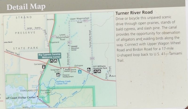
Turn River Road
Drive or bicycle this unpaved scenic drive through open prairies, stands of bald cypress, and slash pine. The canal provides the opportunity for observation of alligators and wading birds along the way. Connect with Upper Wagon Wheel Road and Birdon Road for a 17-mile U-shaped loop back to U. S. 41-Tamiami Trail.
Erected by Big Cypress National Preserve/Everglade Park Service U. S. Department of the Interior.
Topics. This historical marker is listed in these topic lists: Animals • Environment • Waterways & Vessels.
Location. 25° 51.468′ N, 81° 1.998′ W. Marker is in Ochopee, Florida, in Collier County. Marker is on Florida Trail. Marker is inside Big Cypress Park. Touch for map. Marker is at or near this postal address: 33100 Tamiami Trail East, Ochopee FL 34141, United States of America. Touch for directions.
Other nearby markers. At least 7 other markers are within 5 miles of this marker, measured as the crow flies. Fighting an Invasion (a few steps from this marker); H. P. Williams Roadside Park (a few steps from this marker); Wildlife & You (within shouting distance of this marker); Birds of Big Cypress (within shouting distance of this marker); Stephen Tyng Mather (within shouting distance of this marker); Big Cypress (about 400 feet away, measured in a direct line); 1936 Seminole Conference (approx. 5 miles away).
Credits. This page was last revised on August 2, 2017. It was originally submitted on July 28, 2017, by Sandra Hughes Tidwell of Killen, Alabama, USA. This page has been viewed 291 times since then and 8 times this year. Photos: 1, 2, 3. submitted on July 28, 2017, by Sandra Hughes Tidwell of Killen, Alabama, USA. • Bill Pfingsten was the editor who published this page.


