Everglades City in Collier County, Florida — The American South (South Atlantic)
Everglades
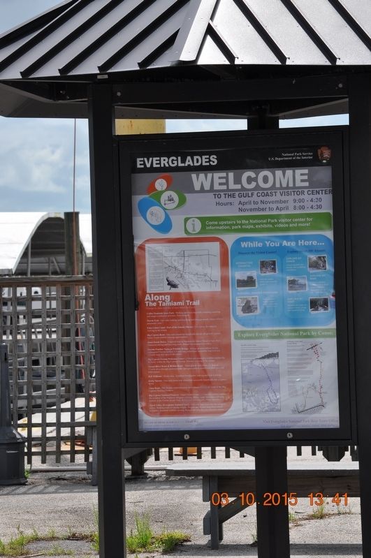
Welcome To the Gulf Coast Visitor Center
Photographed by Sandra Hughes, October 3, 2015
1. Welcome To the Gulf Coast Visitor Center Marker
Hours: April to November 9:00-4:4:30
November to April 8:00 -4:30
Come upstairs to the National Park visitor center for information, park maps, exhibits, videos and more!
Along The Tamiami Trail
Things to see and do (From West to East)
Collier Seminole State Park
-Walking and bicycling trails, camping, canoeing and ranger-conducted actives. Fee charged.
Marsh Trial
- One mile walking and bicycling trail through marsh. Tower offers a panoramic view.
Faka Union Canal/Port of the Island Marina
- Good place for manatee viewing in the winter.
Big Cypress Bend
- One mile round-trip boardwalk into an old growth cypress forest. Good wildlife viewing opportunities.
Janes Scenic Drive
- Unpaved road in Fakahatchee Stands Preserve State Park. Numerous hiking and bicycling trails. Ranger-led programs in winter.
Florida Panther National Wildlife Refuge
- Refuge protects habitat for the endangered Florida panther. 1/3-mile long wheelchair accessible loop trail and 1.3-mile long trail open to the public.
Big Cypress Swamp Welcome Center
- A film and interactive exhibits explain the diversity within the Big Cypress Swamp. Manatee viewing in the winter.
Turner River Road & Birdon Road
- These gravel roads form a U-shaped, 17-mike drive through predominantly open grass prairie dotted with slash pine and bald cypress.
H.P. Williams - Picnic Area
- Excellent for alligator viewing and bird watching.
Kirby Storter
- One mile round-trip wheelchair accessible boardwalk into a cypress dome:
Loop Road
- The 26-mile unpaved scenic drive passes through the heart of Big Cypress National Preserve.
Big Cypress National Preserve
- Oasis Visitor Center - A fill and exhibits explain the wonders of the Preserve. Alligator viewing, Hiking trails including a 35-mile portion of the Florida Scenic Trail.
this page online
Shark Valley (Everglades National Park)
Narrated tram tours into the sawgrass prairie. Walking trails of varying lengths.Bicycle the 15-mile loop (big rentals viable). Excellent wildlife viewing. Ranger-led actives are offered in winter.
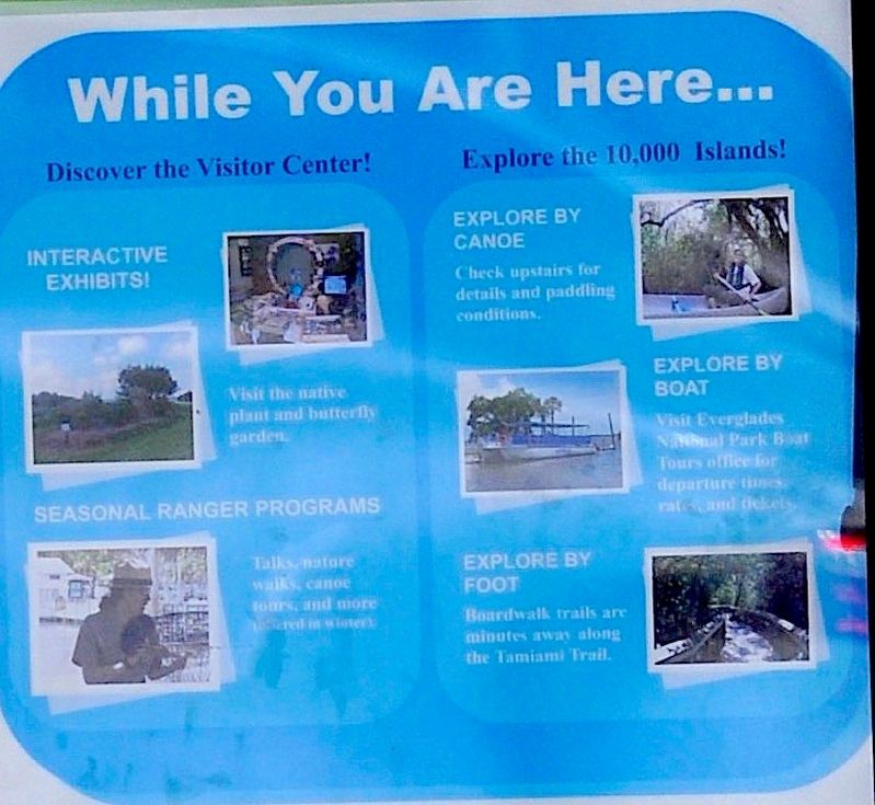
While you are Here …
Discover the Visitor Center!
Interactive Exhibits!
Visit the native plant and butterfly garden.
Seasonal Ranger Programs
Talks, nature walks, canoe, tours, and more offered in winter.
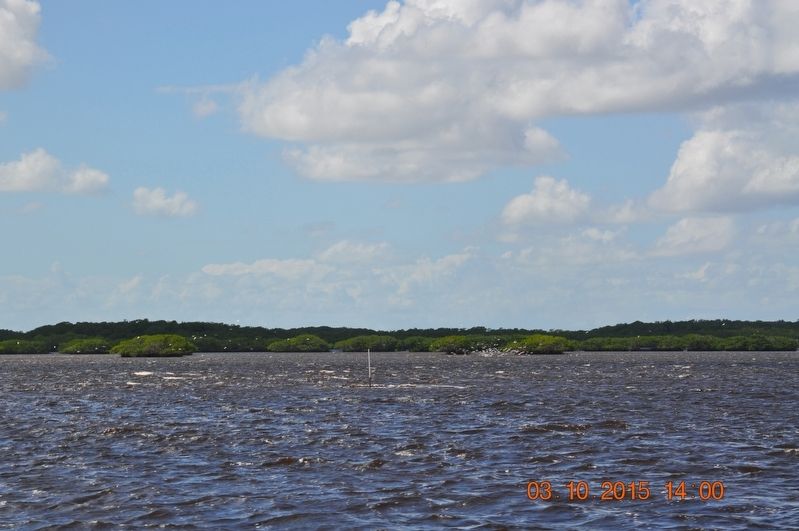
Explore the 10,000 Islands!
Explore by Canoe Check upstairs for details and paddling conditions.
Explore by boat
Visit the Everglades National Park Boat Tours office for departure times, rates and tickets.
Explore by foot
Boardwalk trails are minutes away along the Tamiami Trail.
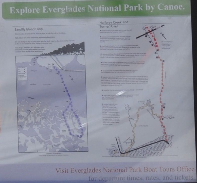
Explore Everglades National Park by Canoe.
Sandfly Island Loop
Halfway creek and Turner River
Erected by National Park Service U.S.Department of the Interior.
Topics. This historical marker is listed in these topic lists: Animals • Entertainment • Environment • Waterways & Vessels. A significant day of the year for for this entry is November 9.
Location. 25° 50.71′ N,
Photographed by Sandra Hughes, October 3, 2015
2. Everglade National Park by Canoe

Regionally, this marker is on the Gulf Coast and in the Everglades. It is also in the American South and on the Gulf Coast. Globally, it is in the North Atlantic Region, North America, a Gulf of Mexico state, the Western Hemisphere, the Western World, and the Anglosphere. Historically, it finds itself in what was once New Spain, the territory of the Mississippian Culture, one of the Confederate States of America, and the Antebellum South.
Other nearby markers. At least 8 other markers are within walking distance of this marker: Everglades National Park (here, next to this marker); Collier County First Jail Site (approx. 0.8 miles away); Everglades Community Church (approx. 0.8 miles away); Old Laundry Building - Everglades Women's Club (approx. 0.8 miles away); Broadway (approx. 0.9 miles away); Barron G. Collier (approx. 0.9 miles away); A Gateway to America’s Everglades
Photographed by Sandra Hughes, October 3, 2015
3. While you are here
Also see . . . Everglades National Park. National Park Service website homepage (Submitted on November 9, 2024, by Larry Gertner of New York, New York.)
Photographed by Sandra Hughes, October 3, 2015
4. Ten Thousand Islands
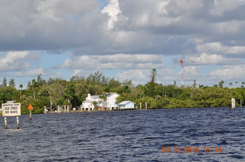
Photographed by Sandra Hughes, October 3, 2015
5. Visitor Center
Credits. This page was last revised on November 9, 2024. It was originally submitted on July 28, 2017, by Sandra Hughes Tidwell of Killen, Alabama, USA. This page has been viewed 382 times since then and 31 times this year. Photos: 1, 2, 3, 4, 5. submitted on July 28, 2017, by Sandra Hughes Tidwell of Killen, Alabama, USA. • Bill Pfingsten was the editor who published this page.
