Yorktown in York County, Virginia — The American South (Mid-Atlantic)
British Inner Defense Line
1781 Siege of Yorktown
— Colonial National Historical Park —
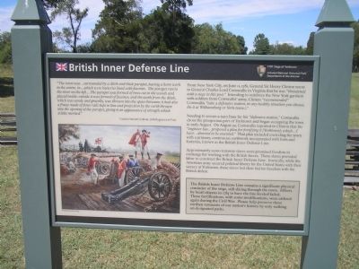
“The town was … surrounded by a ditch and thick parapet, having a horn work in the centre, in … which were batteries lined with facines. The parapet ran to the river on the left … The parapet was formed of trees cut in the woods and placed inside; outside it was formed of fascines; and the earth from the ditch, which was sandy and gravelly, was thrown into the space between; it had also a fraize made of fence rails kept in line and projection by the earth thrown into the opening of the parapet, giving it an appearance of strength which it little merited.”
Captain Samuel Graham, 76th Regiment of Foot
From New York City, on June 11, 1781, General Sir Henry Clinton wrote to General Charles Lord Cornwallis in Virginia that he was “threatened with a siege in this post.” Intending to reinforce the New York garrison with soldiers from Cornwallis’ army, Clinton “recommended” Cornwallis “take a defensive station, in any healthy situation you choose, be it at Williamsburg or York-town.).”
Needing to secure a navy base for his “defensive station,” Cornwallis chose the prosperous port of Yorktown and began occupying the town in early August. On August 22, Cornwallis reported to Clinton that his “engineer has … proposed a plan for fortifying it [Yorktown]; which … I have … directed to be executed.” That plan included encircling the town with a primary, continuous earthwork incorporated with forts and batteries, known as the British Inner Defense Line.
Sidebar:
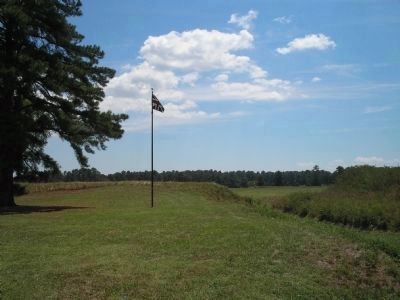
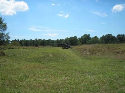
The British Inner Defense Line remains a significant physical reminder of the siege, still slicing through the town. Efforts by local citizens in 1783 to have the line leveled failed. These fortifications, with some modifications, were utilized again during the Civil War. Please help preserve these earthen remnants of our nation’s history by only walking on designated paths.
Erected by Colonial National Historical Park, National Park Service.
Topics. This historical marker is listed in these topic lists: Notable Events • Notable Places • War, US Revolutionary. A significant historical month for this entry is June 1852.
Location. 37° 13.813′ N, 76° 30.35′ W. Marker is in Yorktown, Virginia, in York County. Marker is on Colonial Pkwy, on the left when traveling east. Marker is located on the Yorktown Battlefield in Colonial National Historical Park, at stop A on the Battlefield Tour. Touch for map. Marker is in this post office area: Yorktown VA 23690, United States of America. Touch for directions.
Other nearby markers. At least 8 other markers are within walking distance of this marker. The Hornwork (a few steps from this marker); Cornwallis Headquarters (about 400 feet away, measured in a direct line); Yorktown (about 500 feet away); Home of Thomas Nelson (about 600 feet away); a different marker also named Yorktown (approx. 0.2 miles away); Yorktown Bicentennial Pine Trees (approx. 0.2 miles away); a different marker also named Yorktown (approx. 0.2 miles away); Don't Tread on Me! (approx. 0.2 miles away). Touch for a list and map of all markers in Yorktown.
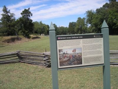
More about this marker. The bottom left of the marker contains a painting by Sidney King of the British Army manning artillery pieces behind the Inner Line fortifications.
Also see . . .
1. Yorktown Battlefield. National Park Service. (Submitted on August 23, 2008, by Bill Coughlin of Woodland Park, New Jersey.)
2. The Battle of Yorktown. The Patriot Resource website. (Submitted on August 23, 2008, by Bill Coughlin of Woodland Park, New Jersey.)
3. The Battle of Yorktown 1781. A British perspective of the Battle of Yorktown from BritishBattles.com. (Submitted on August 23, 2008, by Bill Coughlin of Woodland Park, New Jersey.)
Credits. This page was last revised on June 16, 2016. It was originally submitted on August 23, 2008, by Bill Coughlin of Woodland Park, New Jersey. This page has been viewed 1,098 times since then and 26 times this year. Photos: 1, 2, 3, 4, 5. submitted on August 23, 2008, by Bill Coughlin of Woodland Park, New Jersey.


