Fredericksburg, Virginia — The American South (Mid-Atlantic)
The Canal Ditch
Battlefield Obstacle
Photographed by Dawn Bowen, June 2, 2007
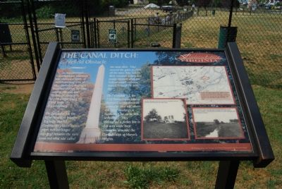
1. The Canal Ditch: Battlefield Obstacle Marker
On December 12 , the 82nd New York Infantry Regiment cleared Confederate pickets from a paper mill (no longer standing) between the main canal and what was called the canal ditch. They secured the gates to close off the water flow, but the ditch remained a deep and muddy obstacle when the Federal assault columns moved forward the next day.
On December 13, the 71st infantry deployed on the elevated ground to your left, where the Mary Washington monument lay on its side, unfinished. They maintained a picket line in this area while their comrades attacked the Confederates at Marye’s Heights.
Erected by City of Fredericksburg.
Topics. This historical marker is listed in these topic lists: War, US Civil • Waterways & Vessels. A significant historical month for this entry is December 1862.
Location. This marker has been replaced by another marker nearby. It was located near 38° 18.431′ N, 77° 28.233′ W.
this page online

Regionally, this marker was in the Washington Metropolitan Area and in Northern Virginia. It was also in the American South and specifically in the Upper South. Globally, it was in North America, the Western Hemisphere, the Western World, and the Anglosphere. Historically, it found itself in what was once the territory of the Mississippian Culture, one of the original Thirteen Colonies, one of the Confederate States of America, and the Antebellum South.
Other nearby markers. At least 10 other markers are within walking distance of this location: The Canal Ditch: Battlefield Obstacle (a few steps from this marker); Fredericksburg Granite (about 300 feet away, measured in a direct line); Col. George Eskridge Memorial Tree (about 600 feet away); Meditation Rock (about 600
Photographed by Dawn Bowen, June 4, 2007
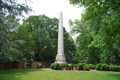
2. The Mary Washington Monument
The unfinished Mary Washingon Monument mentioned on the marker was never completed. It was removed in 1893 and replaced with this monument in 1894.
Related marker. Click here for another marker that is related to this marker. New Marker At This Location titled "The Canal Ditch: Battlefield Obstacle ".
Credits. This page was last revised on February 2, 2023. It was originally submitted on June 2, 2007, by Dawn Bowen of Fredericksburg, Virginia. This page has been viewed 2,298 times since then and 48 times this year. Last updated on June 2, 2007, by Dawn Bowen of Fredericksburg, Virginia. Photos: 1. submitted on June 2, 2007, by Dawn Bowen of Fredericksburg, Virginia. 2. submitted on June 4, 2007, by Dawn Bowen of Fredericksburg, Virginia. • J. J. Prats was the editor who published this page.
