Near Cullman in Cullman County, Alabama — The American South (East South Central)
Land-Use and Water Quality
Photographed by Sandra Hughes, April 18, 2017
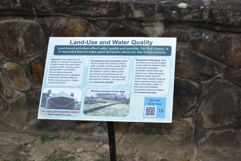
1. Land-Use and Water Quality Marker
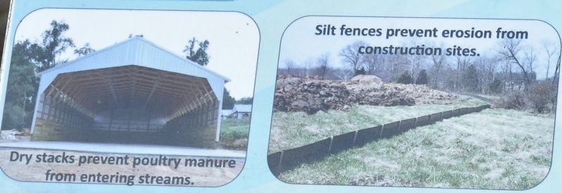
Dry stacks prevent poultry manure from entering streams. Silt fences prevent erosion from construction sites.
Agriculture
Over-application of fertilizer or improper management of animal waste can cause water quality to suffer. Visit your local Soil and Water Conservation District, Natural Resource Conservation Service, or Alabama Cooperative Extension office to find out how you can be a better steward of the land.
Development and Construction
When land is covered with pasture or forest, water can filter into the ground. When the ground is covered with concrete and asphalt, it cannot. Water rushes into streams and pollutants are not filtered out. Consider using low impact development practices. For more info visit www.aces.edu/lid.
Residential Landscaping
What and where you choose to plant in your yard can influence how much water, pesticides, herbicides, and fertilizer you need to use. Follow the guide, Alabama's Smart Yards, to protect water quality, conserve
this page online
Topics. This historical marker is listed in these topic lists: Agriculture • Environment.
Location. 34° 12.435′ N, 86° 59.417′ W. Marker is near Cullman, Alabama, in Cullman County. It is on County Road 1043. Located in Clarkson Covered Bridge Park. Touch for map. Marker is at or near this postal address: 1240 Co Rd 1043, Cullman AL 35057, United States of America. Touch for directions.

Regionally, this marker is in North Alabama. It is also in the American South and specifically in the Deep South. Globally, it is in North America, a Gulf of Mexico state, the Western Hemisphere, the Western World, and the Anglosphere. Historically, it finds itself in what was once the original Cherokee Nation, the territory of the Mississippian Culture, one of the Confederate States of America, and the Antebellum South.
Other nearby markers. At least 8 other markers are within 2 miles of this marker, measured as the crow flies: Clarkson Covered Bridge
Photographed by Sandra Hughes, April 18, 2017
2. Dry Stacks prevent poultry manure from entering streams.
Silt fences prevent erosion from Construction sites.
Also see . . . Clarkson Covered Bridge. On June 25, 1974, Clarkson Covered Bridge was named to the National Register of Historic Places. Shortly thereafter, in 1975, the Cullman County Commission restored the site with the help of concerned citizens as part of the American Bicentennial Project, embellishing the grounds with hiking trails, a picnic area, and two period structures built to accent the historical nature of the bridge: a Dogtrot log cabin and a working grist mill. Located just off U.S. Highway 278 in Bethel, Clarkson Bridge is the site of numerous weddings, car shows and various other activities. Rent the Cabin, today! (Submitted on July 25, 2017, by Sandra Hughes Tidwell of Killen, Alabama, USA.)
Credits. This page was last revised on December 24, 2021. It was originally submitted on July 25, 2017, by Sandra Hughes Tidwell of Killen, Alabama, USA. This page has been viewed 465 times since then and 31 times this year. Last updated on September 4, 2017, by Byron Hooks of Sandy Springs, Georgia. Photos: 1, 2. submitted on July 25, 2017, by Sandra Hughes Tidwell of Killen, Alabama, USA. • Bill Pfingsten was the editor who published this page.
