Near Portland in Meigs County, Ohio — The American Midwest (Great Lakes)
North End Valley
Last Stand
— John Hunt Morgan Heritage Trail —
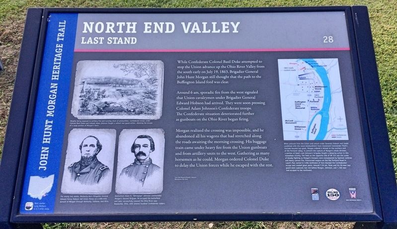
Around 6 am, sporadic fire from the west signaled that Union cavalrymen under Brigadier General Edward Hobson had arrived. They were soon pressing Colonel Adam Johnson's Confederate troops. The Confederate situation deteriorated further as gunboats on the Ohio River began firing.
Morgan realized the crossing was impossible, and he abandoned all his wagons that had stretched along the roads awaiting the morning crossing. His baggage train came under heavy fire from the Union gunboats and from artillery units to the west. Gathering as many horsemen as he could, Morgan ordered Colonel Duke to delay the Union forces while he escaped with the rest.
[Photo captions]:
Top left: Despite being exposed to artillery fire and running short of ammunition, Confederate troops under Colonel Basil Duke and Colonel Adam Johnson fought a valiant rear guard action, allowing the escape of a large portion of Morgan's force.
Bottom left portrait: For nearly two weeks, Kentucky-born Brigadier General Edward Henry Hobson led Union forces on a 600-mile pursuit of Morgan through Kentucky, Indiana, and Ohio.
Bottom second portrait: Kentuckian Adam R. "Stovepipe" Johnson commanded Morgan's Second Brigade. He escaped the battlefield and later successfully crossed the Ohio River near Reedsville, Ohio, with several hundred Confederate raiders.
Top right map: When pressure from the Union land attack under Generals Hobson and Judah combined with the naval bombardment from Lieutenant Commander Fitch's tinclads became too great, Morgan ordered a retreat to the northern end of the Portland valley. To prevent the capture of Morgan's whole division, a portion of Duke's and Johnson's brigades fought a delaying action in this immediate vicinity. The field on the opposite side of SR 124 was the scene of bloody fighting as Morgan's troopers were overpowered by Spencer carbines and heavy cannon fire. Overturned wagons on the Old Portland Road in Lauck's Run ravine 0.3 mile northwest of here blocked the Confederates' escape and created great panic. Around 7:30 am, Duke and his 50-man rear guard were captured, but not before Morgan, Johnson, and 1,100 men had escaped to the northwest.
Text: Edd Sharp & David L. Mowery
Illustrations: Bev Kirk
Erected 2013 by the Ohio Department of Transportation, the Ohio History
Connection, and the Ohio Civil War Trail Commission. (Marker Number 28.)
Topics and series. This historical marker is listed in these topic lists: War, US Civil • Waterways & Vessels. In addition, it is included in the John Hunt Morgan Heritage Trail in Ohio series list. A significant historical date for this entry is July 19, 1863.
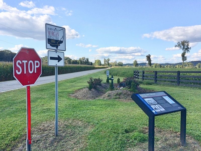
Location. 39° 1.315′ N, 81° 46.515′ W. Marker is near Portland, Ohio, in Meigs County. Marker is at the intersection of Ohio River Scenic Byway (Ohio Route 124) and County Road 69, on the right when traveling north on Ohio River Scenic Byway. Touch for map. Marker is at or near this postal address: 58132 OH-124, Portland OH 45770, United States of America. Touch for directions.
Other nearby markers. At least 8 other markers are within 2 miles of this marker, measured as the crow flies. Portland (approx. 0.6 miles away); In Grateful Remembrance (approx. 1.3 miles away); Escape from the Ohio Penitentiary (approx. 1.4 miles away); Capture in Columbiana County (approx. 1.4 miles away); Battle of Buffington Island (approx. 1.4 miles away); Path of Destruction and Damage (approx. 1.4 miles away); Attack from the West (approx. 1.4 miles away); Confusion and Panic (approx. 1.4 miles away). Touch for a list and map of all markers in Portland.
Credits. This page was last revised on September 14, 2017. It was originally submitted on September 14, 2017, by Mark Hilton of Montgomery, Alabama. This page has been viewed 300 times since then and 6 times this year. Photos: 1, 2, 3. submitted on September 14, 2017, by Mark Hilton of Montgomery, Alabama.


