Corvallis in Benton County, Oregon — The American West (Northwest)
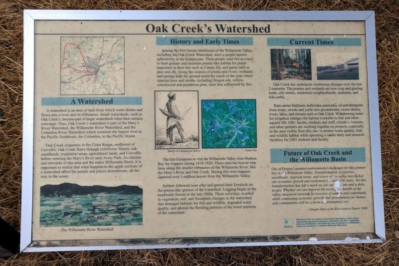
Oak Creek’s Watershed
A Watershed
A watershed is an area of land from which water drains and flows into a river and its tributaries. Small watersheds, such as Oak Creek’s, become part of larger watersheds when their streams converge. Thus, Oak Creek‘s watershed is part of the Mary’s River Watershed, the Willamette River Watershed, and the Columbia River Watershed which connects the largest river in the Pacific Northwest, the Columbia, to the Pacific Ocean.
Oak Creek originates in the Coast Range, northwest of Corvallis. Oak Creek flows through coniferous forests, oak woodlands, residential areas, agricultural lands, and Corvallis before entering the Mary's River near Avery Park. As citizens and stewards of this area and the entire Willamette Basin, it is important to realize that what happens in the upper sections of a watershed affect the people and places downstream, all the way to the ocean.
History and Early Times
Among the first human inhabitants of the Willamette Valley, including the Oak Creek Watershed, were a people known collectively as the Kalapuyans. These people used fire as a tool to bum grasses and maintain prairie-like habitat for plants important to their diet such as Camas lily, and game such as deer and elk. Along the courses of creeks and rivers, wetlands and springs kept the ground moist for much of the year where riparian trees and shrubs, including Oregon ash, willow, cottonwood and ponderosa pine, were less influenced by fire.
The first Europeans to visit the Willamette Valley were Hudson Bay fur trappers during 1810-1820. These men ran beaver trap lines along the smaller tributaries of the Willamette River, like the Mary's River and Oak Creek. During this time trappers captured over 1-million beaver from the Willamette Valley.
Settlers followed soon after and grazed their livestock on the prairie-like grasses of the watershed. Logging began in the headwater forests in the late 1800s. These activities, resulted in vegetation, soil, and floodplain changes in the watershed that damaged habitats for fish and wildlife, degraded water quality, and altered the flooding patterns of the lower portions of the watershed.
Current Times
Oak Creek has undergone continuous changes over the last 2 centuries. The prairies and wetlands are now crop and grazing lands, city streets, residential neighborhoods, stadiums, and bike paths.
Rain carries fertilizers, herbicides, pesticides, oil and detergents from crops, streets and yards into groundwater, storm drains, rivers, lakes, and streams such as Oak Creek. Withdrawing water for irrigation changes the habitat available to fish and other aquatic life. OSU faculty, students and staff, citizen volunteers, and other partners are working together on projects, especially in the area visible from this site, to protect water quality, fish, and wildlife habitat while operating a viable dairy and research facilities for OSU students and faculty.
Future of Oak Creek and the Willamette Basin
One of Oregon’s greatest environmental challenges for this century lies in the Willamette Valley. Transformation of prairies, woodlands, riparian areas, and rivers of the valley has fueled our economic growth and settlement for over 150 years. Yet this transformation has left a mark on our environment and a debt to pay. Whether we can improve the ecological health of the valley, measured currently by recovery of salmon and watersheds, while continuing economic growth and development for homes and communities will be a stern environmental test.
---Oregon State of the Environment Report 2000
”Watershed Tour” is an alliance of non-profit organizations, state, county and municipal governments agencies, corporations, and other organizations which are establishing a self guided tour map of projects in the Willamette Valley that contribute to a healthier Willamette Watershed.
Erected by Oregon State University.
Topics. This historical marker is listed in these topic lists: Education • Environment • Native Americans • Settlements & Settlers.
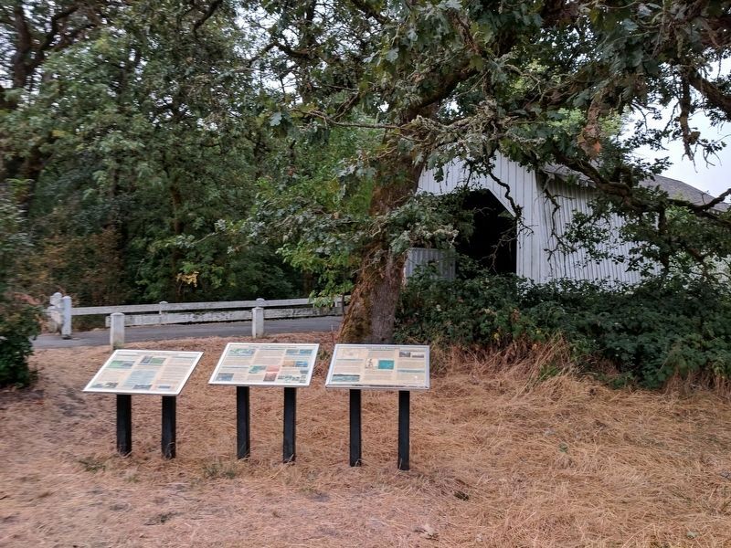
Location. 44° 34.005′ N, 123° 18.045′ W. Marker is in Corvallis, Oregon, in Benton County. Marker is on SW Campus Way, half a mile west of SW 35th Street, on the left when traveling west. Located at the Irish Bend Covered Bridge and Midge Cramer Path. Touch for map. Marker is in this post office area: Corvallis OR 97330, United States of America. Touch for directions.
Other nearby markers. At least 8 other markers are within 2 miles of this marker, measured as the crow flies. Ecology of the Agricultural Reach (here, next to this marker); Sustainable Farm Management (here, next to this marker); Peavy Hall War Memorial (approx. ¾ mile away); Alice E. Biddle (approx. 1.1 miles away); Oregon State University (approx. 1.3 miles away); Kearney Hall (approx. 1.4 miles away); Kings Valley Millstone (approx. 1½ miles away); Avery Park Applegate Trail Kiosk (approx. 1.6 miles away). Touch for a list and map of all markers in Corvallis.
Also see . . . Oregon State University. (Submitted on September 17, 2017.)
Credits. This page was last revised on September 17, 2017. It was originally submitted on September 17, 2017, by Bernard Fisher of Richmond, Virginia. This page has been viewed 235 times since then and 15 times this year. Photos: 1, 2. submitted on September 17, 2017, by Bernard Fisher of Richmond, Virginia.

