Yorktown in York County, Virginia — The American South (Mid-Atlantic)
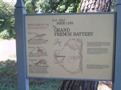
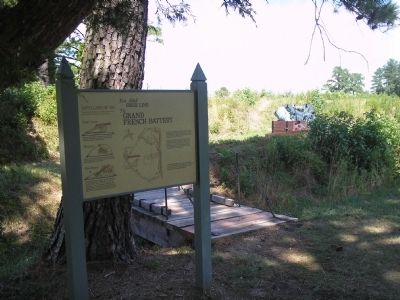
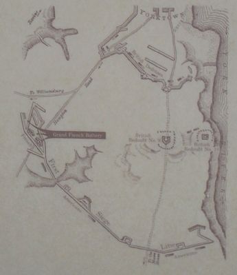
The Grand French Battery
First Allied Siege Line
Largest gun emplacement built during the siege, the Grand French Battery opened fire on October 10 and inflicted great damage on the British. A French officer noted that “ … the superiority of the fire of these different batteries over those of the enemy, silenced the firing from the town.” This superiority in artillery contributed greatly to Allied victory.
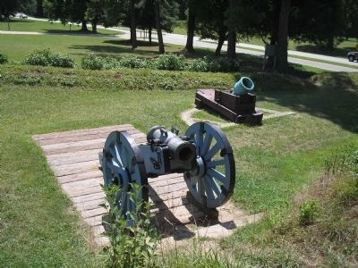
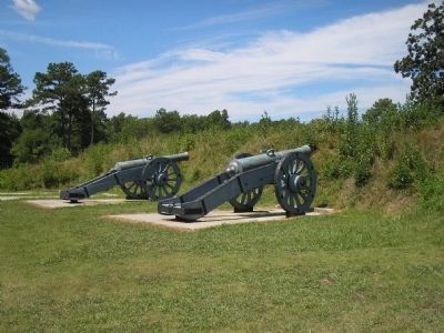
The National Park Service has reconstructed most of the Grand French Battery on its original site and equipped it with original and replica Revolutionary War period artillery.
Erected by Colonial National Historical Park, National Park Service.
Topics. This historical marker is listed in these topic lists: Notable Events • Notable Places • War, US Revolutionary. A significant historical date for this entry is October 6, 1781.
Location. 37° 13.404′ N, 76° 30.386′ W. Marker is in Yorktown, Virginia, in York County. Marker is on Cook Road (Virginia Route 704), on the left when traveling south. Marker is located on the Yorktown Battlefield in Colonial National Historical Park, at stop B on the Battlefield Tour. Touch for map. Marker is in this post office area: Yorktown VA 23690, United States of America. Touch for directions.
Other nearby markers. At least 8 other markers are within walking distance of this marker. A different marker also named Grand French Battery (within shouting distance of this marker); First Allied Siege Line (within shouting distance of this marker); Shiloh Baptist Church (about 700 feet away, measured in a direct line); Yorktown National Cemetery (approx. 0.2 miles away); a different marker also named Shiloh Baptist Church (approx. 0.2 miles away); Slabtown (approx. 0.2 miles away); Surrender at Yorktown (approx. 0.2 miles away); Second Allied Siege Line (approx. 0.2 miles away). Touch for a list and map of all markers in Yorktown.
More about this marker. The left side of the marker features pictures of various artillery used during the 1781 Siege of Yorktown. It has a caption of:
Artillery of 1781
French and American artillerymen used three types of cannon in the siege.
Field Guns
Effective range, 900 to 1340 yards. Fired mainly solid shot to batter down enemy earthworks, but could fire grapeshot against troops.
Mortars
Effective range, 670 to 1670 yards. Fired explosive shells, called bombs, at high angle so they would drop behind enemy earthworks.
Howitzers
Effective range 900 to 1120 yards. Fired bombs at low velocity, medium to high angle. An American artillery officer wrote that in this siege the howitzers “ … are of the greatest importance, in firing ricochet, as the shell hops along the ground and drops just over the enemy’s parapet, destroying them where they thought themselves most secure.”
The middle of the marker contains a map of the fortifications at Yorktown, including the Grand French Battery.
Also see . . .
1. Yorktown Battlefield. National Park Service. (Submitted on August 29, 2008, by Bill Coughlin of Woodland Park, New Jersey.)
2. The Battle of Yorktown. The Patriot Resource website. (Submitted on August 29, 2008, by Bill Coughlin of Woodland Park, New Jersey.)
3. The Battle of Yorktown 1781. A British perspective of the Battle of Yorktown from BritishBattles.com. (Submitted on August 29, 2008, by Bill Coughlin of Woodland Park, New Jersey.)
Credits. This page was last revised on June 16, 2016. It was originally submitted on August 29, 2008, by Bill Coughlin of Woodland Park, New Jersey. This page has been viewed 1,522 times since then and 72 times this year. Photos: 1, 2, 3, 4, 5. submitted on August 29, 2008, by Bill Coughlin of Woodland Park, New Jersey.
