Arkansas Post National Memorial in Arkansas County, Arkansas — The American South (West South Central)
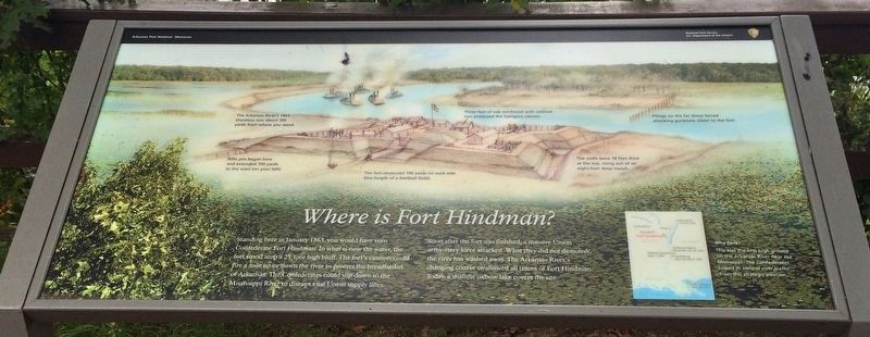
Where is Fort Hindman?
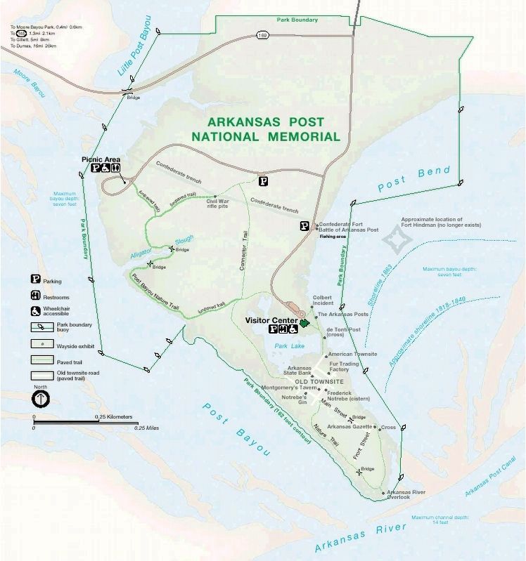
Soon after the fort was finished, a massive Union army-navy force attacked What they did not demolish, the river has washed away. The Arkansas River's changing course swallowed all traces of Fort Hindman. Today, a shallow oxbow lake covers the site.
Why here?
This was the first high ground on the Arkansas River near the Mississippi. The Confederates hoped to control river traffic from this strategic position.
[Photo captions]
Left:The Arkansas River's 1863 shoreline was about 300 yards from where you stand.
Rifle pits began here and extended 700 yards to the west (on your left).
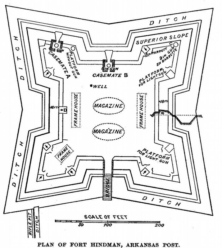
Middle: The fort measured 100 yards on each side (the length of a football field).
Three feet of oak reinforced with railroad iron protected the Dahlgren cannon.
Right: The walls were 18 feet thick at the top, rising out of an eight-foot deep trench.
Pilings on the far shore forced attacking gunboats closer to the fort.
Erected by Department of the Interior, National Park Service.
Topics. This historical marker is listed in these topic lists: Forts and Castles • War, US Civil • Waterways & Vessels. A significant historical month for this entry is January 1863.
Location. 34° 1.188′ N, 91° 20.683′ W. Marker is in Arkansas Post National Memorial, Arkansas, in Arkansas County. Marker can be reached from Old Post Road, half a mile south of State Route 169. Touch for map. Marker is at or near this postal address: 1741 Old Post Road, Gillett AR 72055, United States of America. Touch for directions.
Other nearby markers. At least 8 other markers are within walking distance of this marker. On they come like an irresistible thunder bolt (a few steps from this marker); Our ironclads and gunboats knocked the fort to pieces (within shouting distance of this marker); The Post of Arkansas (approx. 0.2 miles away); The Colbert Raid (approx. 0.2 miles away); Edge of Empires (approx. 0.2 miles away); The European Settlement (approx. 0.2 miles away); The Arkansas Posts (approx. 0.2 miles away); Stone from Ruins of Old Bank (approx. ¼ mile away). Touch for a list and map of all markers in Arkansas Post National Memorial.
Also see . . . National Park Service website on the Battle of Arkansas Post. (pdf). (Submitted on September 19, 2017, by Mark Hilton of Montgomery, Alabama.)
Credits. This page was last revised on September 29, 2020. It was originally submitted on September 19, 2017, by Mark Hilton of Montgomery, Alabama. This page has been viewed 609 times since then and 68 times this year. Photos: 1, 2. submitted on September 19, 2017, by Mark Hilton of Montgomery, Alabama. 3. submitted on September 29, 2020, by Allen C. Browne of Silver Spring, Maryland. 4. submitted on September 19, 2017, by Mark Hilton of Montgomery, Alabama.


