Near Fort Hall in Bingham County, Idaho — The American West (Mountains)
Newe'm Bo'ai -- "Indian Road"
Photographed by Barry Swackhamer, June 22, 2017
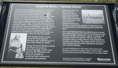
1. Newe'm Bo'ai -- "Indian Road" Marker
The Oregon Trail, a major route for white settlers moving west, followed part of the Great Medicine Road.
Along the Great Medicine Road are many hot pools, or thermal springs, which were used by the Shoshone and Bannock people for medicinal and ceremonial purposes; the practice continues to this day. Many different resources, such as plants and minerals (especially red and white rocks and soils), were collected in this area for use in medicinal
this page online
The Great Medicine Road provided access to many life-sustaining resources used by the Shoshone and Bannock people, including a variety of plants and animals, chalks and paints, willows and other material used in craft and art, and materials for hunting and fishing. The waters of the area are of central importance to both subsistence practices and cultural identity.
For more information on the history and culture of the Shoshone and Bannock people, please visit the Tribes' website or the Shoshone-Bannock Tribal Museum in Fort Hall, Idaho
Erected by PacifiCorp.
Topics. This historical marker is listed in these topic lists: Indigenous Peoples and Communities • Roads & Vehicles.
Location. 43° 1.294′ N, 112° 24.657′ W. Marker is near Fort Hall, Idaho, in Bingham County. It can be reached from Ross Fort (Simplot) Road near Interstate 15, on the left when traveling west. Touch for map. Marker is in this post office area: Fort Hall ID 83203, United States of America.
Photographed by Barry Swackhamer, June 22, 2017
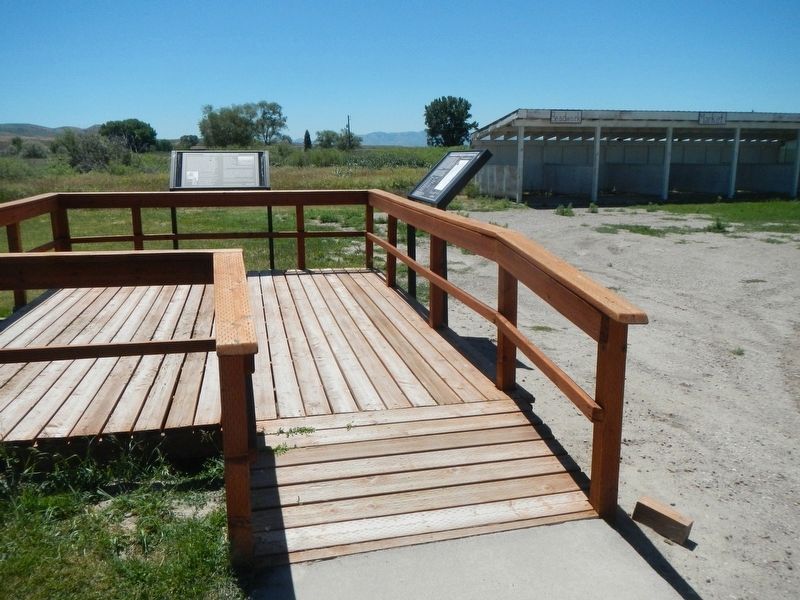
2. Newe'm Bo'ai -- "Indian Road" Marker
This marker is on the left at the end of the platform.

Regionally, this marker is in Eastern Idaho and the Yellowstone Fringe and on the Shoshone-Bannock Fort Hall Reservation. It is also in the American Mountain West. Globally, it is in North America, the Western Hemisphere, the Western World, and the Anglosphere.
Other nearby markers. At least 8 other markers are within 11 miles of this marker, measured as the crow flies: Shoshone-Bannock Tribes: Beyond the Reservation (here, next to this marker); Shoshone and Bannock Tribes (within shouting distance of this marker); Fort Hall (approx. 1.4 miles away); Shoshone-Bannock Tribes Memorial Honor Roll (approx. 1.4 miles away); Greek Orthodox Church (approx. 10.7 miles away); Vocational Building & Hangar (approx. 10.9 miles away); Veterans Memorial (approx. 11 miles away); Standrod House (approx. 11.1 miles away). Touch for a list and map of all markers in Fort Hall.
More about this marker. This marker is located at the Shoshone-Bannock Information Center near the Ross Fork (Simplot) Road exit (Exit 80) of Interstate 15.
Credits. This page was last revised on September 20, 2017. It was originally submitted on September 20, 2017, by Barry Swackhamer of Brentwood, California. This page has been viewed 446 times since then and 21 times this year. Photos: 1, 2. submitted on September 20, 2017, by Barry Swackhamer of Brentwood, California.
