Paces in Atlanta in Fulton County, Georgia — The American South (South Atlantic)
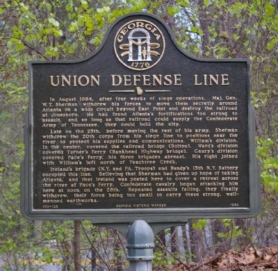
Union Defense Line
Late on the 25th, before moving the rest of his army, Sherman withdrew the 20th Corps from his siege line to positions near the river to protect his supplies and communication. William’s division, in the center, covered the railroad bridge (Bolton). Ward’s division covered Turner's Ferry, (Bankhead Highway Bridge). Geary's division covered Pace's Ferry, his three brigades abreast, his right joined with William's left north of Peachtree Creek.
Ireland's brigade (N.Y. and PA. Troops) and Bundy's 13th N.Y. Battery occupied this line. Believing that Sherman had given up hope of Atlanta, and that Ireland was posted here to cover a retreat across the river at Pace's Ferry, Confederate cavalry began attacking here at noon on the 26th. Repeated assaults failing, they withdrew, their force being too small to carry these strong, manned earthworks.
Erected 1984 by Georgia Department of Natural Resources. (Marker Number 060-128.)
Topics and series. This historical marker is listed in this topic list: War, US Civil. In addition, it is included in the Georgia Historical Society series list. A significant historical year for this entry is 1864.
Location. 33° 51.51′ N, 84° 27.019′ W. Marker is in Atlanta, Georgia, in Fulton County. It is in Paces. Marker is on Lovett Schools Entrance, 0.2 miles east of Northgate Drive, on the right when traveling east. Marker is on the campus of the Lovett Schools. Touch for map. Marker is in this post office area: Atlanta GA 30327, United States of America. Touch for directions.
Other nearby markers. At least 8 other markers are within walking distance of this marker. Palmer’s & Hooker’s A.C. Cross the Chattahoochee (about 500 feet away, measured in a direct line); Old Pace’s Ferry Road (approx. 0.2 miles away); The Errant Pontoon Bridge: Paces Ferry (approx. 0.3 miles away); The 14th & 20th A.C. Cross at Pace's Ferry (approx. 0.3 miles away); a different marker also named The 14th & 20th A.C. Cross at Pace’s Ferry (approx. 0.4 miles away); Federal Right Wing (approx. 0.8 miles away); Paces Ferry United Methodist Church (approx. 0.8 miles away); The 4th Corps Posted Along the River (approx. 0.9 miles away). Touch for a list and map of all markers in Atlanta.
Credits. This page was last revised on February 8, 2023. It was originally submitted on August 30, 2008, by David Seibert of Sandy Springs, Georgia. This page has been viewed 1,344 times since then and 22 times this year. Photo 1. submitted on August 30, 2008, by David Seibert of Sandy Springs, Georgia. • Craig Swain was the editor who published this page.
Editor’s want-list for this marker. A wide shot of the marker and its surroundings. • Can you help?
