Mineral de Pozos in San Luis de la Paz, Guanajuato, Mexico — The Central Highlands (North America)
Aqueduct
Photographed by J. Makali Bruton, September 30, 2017
1. Aqueduct Marker
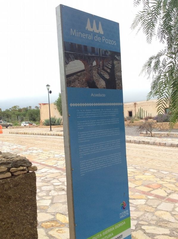
Los acueductos son, en general, obras hidráulicas con una estructura arcada sobre la que pasa un canal que conduce el agua, proveniente regularmente del cauce de un río, hasta una fuente, aljibe o cisterna para dotar a la población con el líquido.
El acueducto para las culturas prehispánicas no era algo nuevo a la llegada de los españoles; éstas también conocían perfectamente el sistema y, aunque los acueductos prehispánicos estaban hecho de barro y no contaban con arcos, funcionaban con la misma eficacia que el de los occidentales, pues mantenían el mismo principio.
Durante la Colonia, los españoles esparcieron a lo largo del territorio mexicano un buen número de acueductos para abastecer con agua a las ciudades y pueblos más importantes. En pie hay muchos ejemplos de estas estructuras arquitectónicas: el acueducto del
this page online
Es posible que el acueducto de Mineral de Pozos ya existiera durante la época colonial, sin embargo, su mayor aprovechamiento vino a finales del siglo XIX. Tenía la función, como todos los demás, de dejar el agua al alcance de los habitantes del pueblo para que estos pudieran cubrir sus necesidades básicas, pero también corría por las minas, dotándolas del líquido que formaba parte del proceso de extracción de minerales y además contribuía a la irrigación del campo.
English:
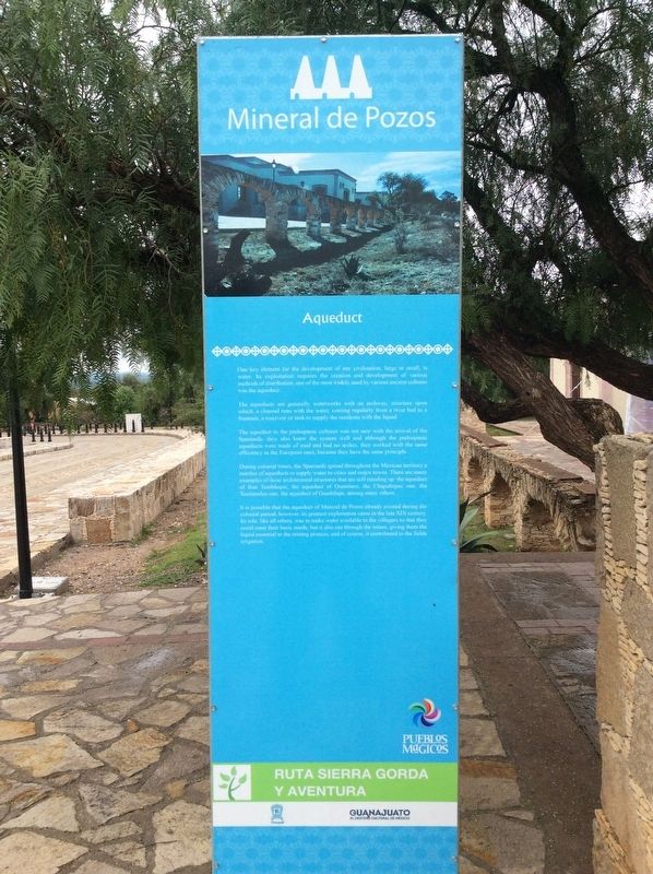
The aqueducts are generally waterworks with an archway, structure upon which, a channel runs with the water, coming regularly from a river bed to a fountain, a reservoir or tank to supply the residents with the liquid.
The aqueduct to the prehispanic cultures was not new with the arrival
Photographed by J. Makali Bruton, September 30, 2017
2. Aqueduct Marker English side
During colonial times, the Spaniards spread throughout the Mexican territory a number of aqueducts to supply water to cities and major towns. There are many examples of these architectural structures that are still standing up: the aqueduct of friar Tembleque, the aqueduct of Querétaro, the Chapultepec one, the Xochimilco one, the aqueduct of Guadalupe, among many others.
It is possible that the aqueduct of Mineral de Pozos already existed during the colonial period, however, its greatest exploitation came in the late XIX century. lts role, like all others, was to make water available to the villagers so that they could meet their basic needs; but it also ran through the mines, giving them the liquid essential to the mining process, and of course, it contributed to the fields irrigation.
Topics. This historical marker is listed in these topic lists: Colonial Era • Indigenous Peoples and Communities •
Photographed by J. Makali Bruton, September 30, 2017
3. Aqueduct Marker
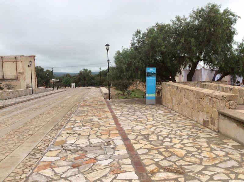
The remains of the aqueduct are to the right of the marker.
Location. 21° 13.43′ N, 100° 30.046′ W. Marker is in Mineral de Pozos, Guanajuato, in San Luis de la Paz. It is on Unnamed road just west of Calle Centenario, on the right when traveling east. Touch for map. Marker is in this post office area: Mineral de Pozos GTO 37600, Mexico. Touch for directions.

Regionally, this marker is in Central Mexico and in the Bajío. Globally, it is in North America, on the Ring of Fire, and in the Western Hemisphere. Historically, it finds itself in what was once New Spain, a Spanish colony, and the Aztec Empire.
Other nearby markers. At least 8 other markers are within 2 kilometers of this marker, measured as the crow flies: The Model School (within shouting distance of this marker); J. Encarnación Olguín and Juana Lucio (approx. half a kilometer away); Old City Hall (approx. 0.6 kilometers away); City Cemetery (approx. 1.2 kilometers away); Ex-Hacienda El Triángulo (approx. 1.2 kilometers away); Angustias Mine (approx. 1.4 kilometers away); Mine and Former Hacienda of Los Cinco Señores (approx. 1.7 kilometers
Photographed by J. Makali Bruton, September 30, 2017
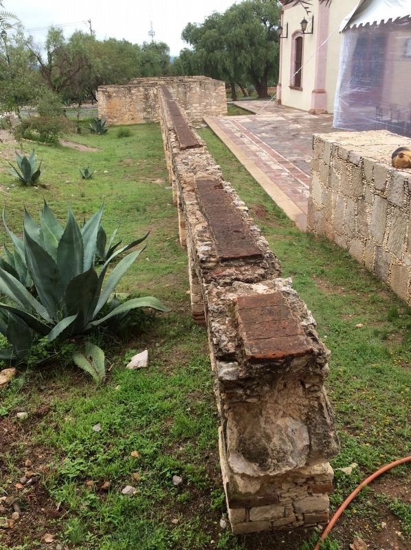
4. The remains of the 19th century aqueduct near the marker.
Credits. This page was last revised on October 19, 2017. It was originally submitted on October 19, 2017, by J. Makali Bruton of Washington, District of Columbia. This page has been viewed 262 times since then and 18 times this year. Photos: 1, 2, 3, 4. submitted on October 19, 2017, by J. Makali Bruton of Washington, District of Columbia.
