The 1929 Lake Champlain Bridge
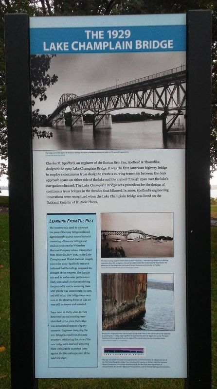
Charles M. Spofford, an engineer of the Boston firm Fay, Spofford & Thorndike, designed the 1929 Lake Champlain Bridge. It was the first American highway bridge to employ a continuous truss design to create a curving transition between the deck approach spans on either side of the lake and the arched through span over the lake's navigation channel. The Lake Champlain Bridge set a precedent for the design of continuous truss bridges in the decades that followed. In 2009, Spofford's engineering innovations were recognized when the Lake Champlain Bridge was listed on the National Register of Historic Places.
Learning From The Past
The concrete mix used to construct the piers of the 1929 bridge contained approximately 20,000 tons of material consisting of iron ore tailings and crushed ore from the Witherbee Sherman Company mines, transported from Mineville, New York, on the Lake Champlain and Moriah Railroad roughly nine miles away. Spofford's research indicated that the tailings increased the strength of the concrete. The durable mix and its underwater performance persuaded him that reinforcing the piers with steel or armoring them with granite was unnecessary. In 1929, and still today, lake bridges were very rare, so the shearing forces of lake ice were still unknown and untested.
Years later, in 2009, when
surface deterioration and cracking were identified in the piers, the bridge was demolished because of safety concerns. Engineers designing the 2011 bridge learned from the 1929 structure, reinforcing the piers of the new bridge with steel and armoring them with granite to protect them against the thermal expansion of the lake's ice sheet.
[Photo captions, from top to bottom, read]
• The bridge served the region for 80 years, winning the hearts of residents and tourists alike with its graceful appearance.
• The lake crossing of Crown Point-Chimney Point required a 2,158-foot-long bridge and a [?]-foot clearance above the navigation channel to accommodate the smokestacks of steamboats. The placement of the bridge also had to avoid historic resources on both sides of the lake.
• Because the bridge piers were constructed in a lake rather than a river and would not be subjected to scouring from rushing water Spofford decided that they did not require any armor. The lake's freezing and thawing[?] cycles, however, exposed the unprotected piers to horrendous[?] stress.
• This sign was prepared as part of a larger program of commemoration to mitigate the loss of the 1929 Lake Champlain Bridge. It was developed in response to Section 106 of the National Historic Preservation Act and was funded jointly by the New York State Department of Transportation, the
Vermont Agency of Transportation, and the Federal Highway Administration.Erected by NY State Dept of Trans, VT Agency of Trans, and Federal Hwy Admin.
Topics. This historical marker is listed in these topic lists: Bridges & Viaducts • Industry & Commerce • Man-Made Features • Waterways & Vessels. A significant historical year for this entry is 1929.
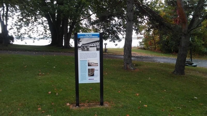
Location. 44° 2.597′ N, 73° 27.462′ W. Marker is in Port Henry, New York, in Essex County. Marker is on Park Place east of Main Street (New York State Route 9N/22), on the left when traveling east. Marker is at the Iron Center Museum. Touch for map. Marker is at or near this postal address: 34 Park Place, Port Henry NY 12974, United States of America. Touch for directions.
Other nearby markers. At least 8 other markers are within walking distance of this marker. Industrial Shoreline (a few steps from this marker); Realizing a Dream: the Rolling Stock Display (a few steps from this marker); A Busy Iron Port (a few steps from this marker); Lake Champlain & Moriah Railroad: The "Elsie and Em" (a few steps from this marker); Veterans Memorial (within shouting distance of this marker); Office Building of Witherbee and Sherman Iron Ore Company (within shouting distance of this marker); Witherbee Park and Town Hall (within shouting distance of this marker); LC&M Caboose (about 400 feet away, measured in a direct line). Touch for a list and map of all markers in Port Henry.
Related markers. Click here for a list of markers that are related to this marker.
Credits. This page was last revised on November 13, 2018. It was originally submitted on October 19, 2017, by William Fischer, Jr. of Scranton, Pennsylvania. This page has been viewed 197 times since then and 7 times this year. Photos: 1, 2. submitted on October 19, 2017, by William Fischer, Jr. of Scranton, Pennsylvania.

