Greer in Clearwater County, Idaho — The American West (Mountains)
Gold Rush Historic Byway
Adventure Into Idaho’s Beginnings
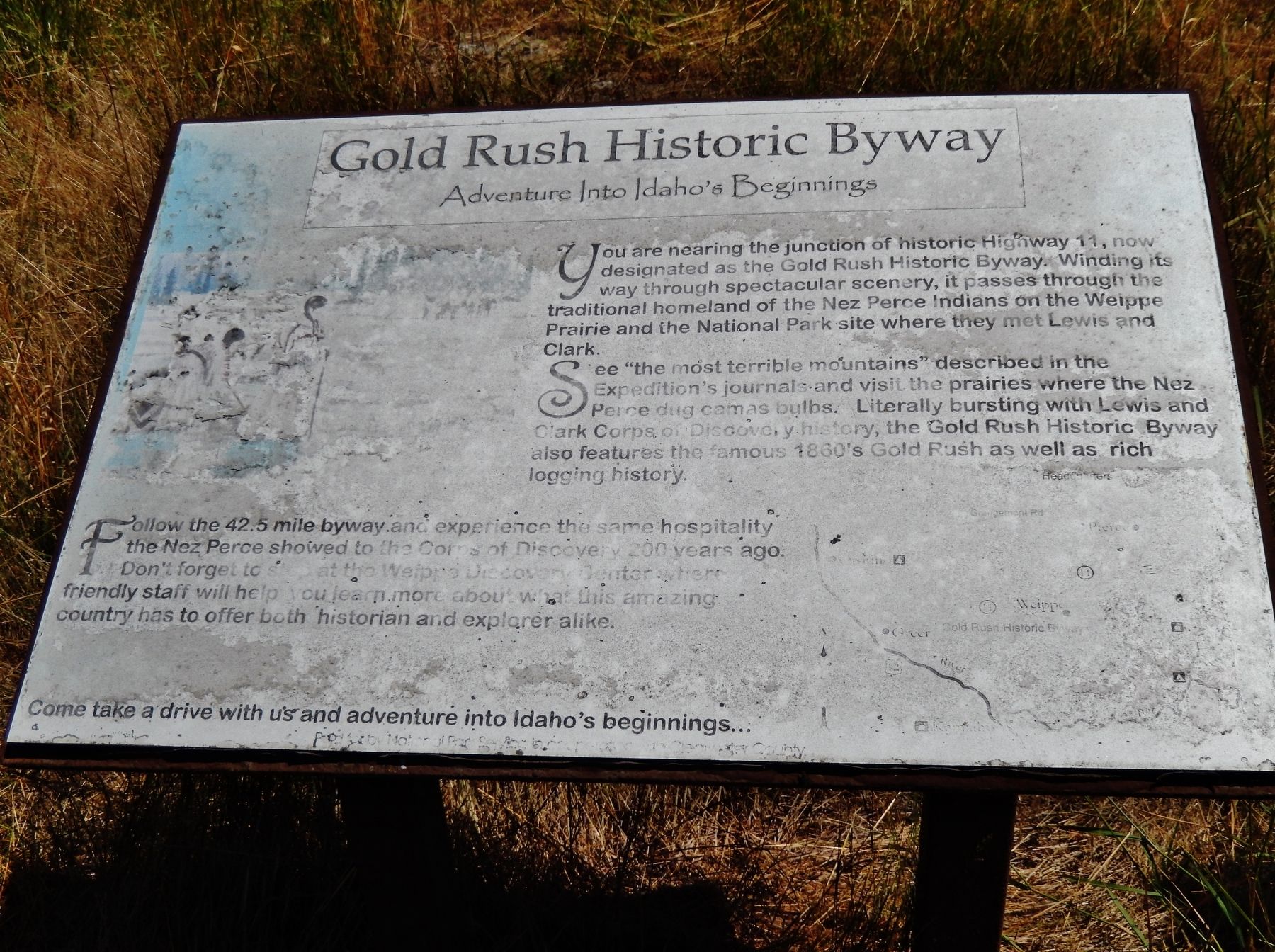
Photographed by Cosmos Mariner, July 14, 2016
1. Gold Rush Historic Byway Marker
See the “most terrible mountains” described in the Expedition’s journals and visit the prairies where the Nez Perce dug camas bulbs. Literally bursting with Lewis and Clark Corps of Discovery history, the Gold Rush Historic Byway also features the famous 1860’s Gold Rush as well as rich logging history.
Follow the 42.5 mile byway and experience the same hospitality the Nez Perce showed to the Corps of Discovery 200 years ago. Don’t forget to stop at the Weippe Discovery Center where friendly staff will help you learn more about what this amazing country has to offer both historian and explorer alike.
Come take a drive with us and adventure into Idaho’s beginnings.
Erected by National Park Service in cooperation with Clearwater County.
Topics and series. This historical marker is listed in these topic
this page online
Location. 46° 22.786′ N, 116° 10.662′ W. Marker is in Greer, Idaho, in Clearwater County. It is on U.S. 12 1½ miles south of State Highway 11, on the right when traveling west. Marker is located in a large pull-out on the east side of US Highway 12, overlooking the Clearwater River. Touch for map. Marker is in this post office area: Orofino ID 83544, United States of America. Touch for directions.

Regionally, this marker is in North Idaho — Idaho’s Panhandle. It is also in the American Mountain West, specifically in the Pacific Northwest, and in the Lewis & Clark Corridor. Globally, it is in North America, the Western Hemisphere, the Western World, and the Anglosphere.
Other nearby markers. At least 8 other markers are within 11 miles of this marker, measured as the crow flies: Gold Rush Ferry (here, next to this marker); Lewis and Clark (approx. 4.8 miles away); Fraser Park (approx. 6.2 miles away); Fraser (approx. 6.3 miles away); River Crossing Over Time (approx. 8 miles away); Routes Through the Region (approx. 8 miles away); a different marker also named Lewis and Clark (approx. 10.6 miles away); Canoe Building Site (approx. 11.1 miles away).
More about this marker. laminated wooden marker, rather badly weathered and faded
Credits. This page was last revised on November 9, 2017. It was originally submitted on November 8, 2017, by Cosmos Mariner of Cape Canaveral, Florida. This page has been viewed 626 times since then and 36 times this year. Photo 1. submitted on November 8, 2017, by Cosmos Mariner of Cape Canaveral, Florida. • Bill Pfingsten was the editor who published this page.
