Near Fairfax in Fairfax County, Virginia — The American South (Mid-Atlantic)
Battle of Chantilly
Ox Hill
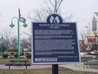
The ensuing battle raged on for a little less than three hours terminating in ferocious hand-to-hand combat in a violent late afternoon thunderstorm.
Tactically the battle ended in a stalemate leaving approximately 610 dead or wounded Union and 501 Confederate troops on the field. Union forces, however, suffered the greater loss when Major General Issac I. Stevens was shot and fatally wounded while leading the 79th New York against Hay's Louisiana and Thomas' 49th Georgia Brigades. Major General Philip Kearny, in an attempt to fill a suspected void in Stevens' line, moved out in front of the 21st Massachusetts Brigade and into the eastern edge of a cornfield where he encountered troops, presumably the 49th Georgia, who took issue with his presence within their line and killed Kearny as he attempted to escape.
The battle ended the hostilities of Second Manassas and set into motion General Robert E. Lee's excursion into Maryland and the bloody Battle of Antietam.
Contributed by Dennis W. King.
Erected by Developers Diversified Realty Macquarie DDR Trust Fairfax Town Center LLC.
Topics. This historical marker is listed in this topic list: War, US Civil. A significant historical month for this entry is September 1789.
Location. 38° 51.999′ N, 77° 22.043′ W. Marker is near Fairfax, Virginia, in Fairfax County. Marker is on Fairfax Towne Center west of West Ox Road (Virginia Route 608), in the median. The Fairfax Towne Center roadway continues east across the intersection with West Ox Road as Legato Road. Touch for map. Marker is at or near this postal address: 12180 Fairfax Towne Center, Fairfax VA 22033, United States of America. Touch for directions.
Other nearby markers. At least 5 other markers are within walking distance of this marker. Kearny and Stevens Monuments (approx. 0.2 miles away); Kearny's Stump and the Monument Lot (approx. 0.2 miles away); General Reno's Probe East of Ox Road (approx. 0.2 miles away); Major General Isaac Ingalls Stevens (approx. 0.2 miles away); Major General Philip Kearny (approx. 0.2 miles away). Touch for a list and map of all markers in Fairfax.
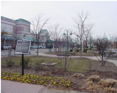
More about this marker. Fairfax Towne Center is the roadway entrance to the shopping center of the same name, which is in the southwest corner of the intersection of West Ox Road and Lee Jackson Memorial Highway (U.S. Route 50). The roadway widens and loops around a small park. The marker faces West Ox Road.
Also see . . .
1. The Thunderstorm and the Battle of Ox Hill. (Submitted on February 19, 2006.)
2. Tempest at Ox Hill: The Battle of Chantilly. By David A. Welker. Amazon.com page allows you to look inside this 2003 book. (Submitted on February 19, 2006.)
3. Battle of Chantilly, or Ox Hill. Civil War Preservation Trust resource page for the battle. Includes an animated map. (Submitted on September 5, 2008, by Craig Swain of Leesburg, Virginia.)
Additional keywords. Civil War
Credits. This page was last revised on August 22, 2021. It was originally submitted on February 17, 2006, by J. J. Prats of Powell, Ohio. This page has been viewed 4,293 times since then and 26 times this year. Photos: 1, 2. submitted on February 17, 2006, by J. J. Prats of Powell, Ohio.

