
Yorktown in York county, Virginia — The American South (Mid-Atlantic)
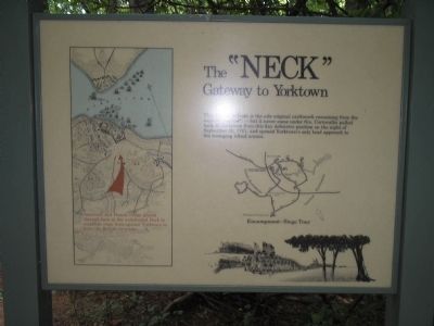
The “NECK”
Gateway to Yorktown
Photographed by Bill Coughlin, August 12, 2008
1. The "NECK" Marker
Erected by Colonial National Historical Park, National Park Service.
Topics. This historical marker is listed in these topic lists: Notable Events • Notable Places • War, US Revolutionary. A significant historical date for this entry is September 30, 1767.
Location. 37° 13.694′ N, 76° 30.767′ W. Marker is in Yorktown in York county, Virginia. It is on Historical Tour Drive, on the right when traveling north. Marker is located on the Yorktown Battlefield in Colonial National Historical Park, at stop L on the Allied Encampment Tour. Touch for map. Marker is in this post office area: Yorktown VA 23690, United States of America. Touch for directions.

Regionally, this marker is on Virginia’s Peninsula, in Coastal Virginia, and in the Hampton Roads Metropolitan Area. It is also in the American South, specifically in the Upper
this page online
Other nearby markers. At least 8 other markers are within walking distance of this marker: Yorktown (approx. 0.3 miles away); Mary Aggie and the Benefit of Clergy (approx. 0.3 miles away); Shiloh Baptist Church (approx. 0.4 miles away); Surrender at Yorktown (approx. 0.4 miles away); Outer Works (approx. 0.4 miles away); The Hornwork (approx. 0.4 miles away); British Inner Defense Line (approx. 0.4 miles away); Yorktown National Cemetery (approx. 0.4 miles away). Touch for a list and map of all markers in Yorktown.
More about this marker. The left of the map contains a map of the British fortifications at Yorktown, and their ships in the York River. The approach of the American and French troops is also indicated. A map on the right side of the
Photographed by Bill Coughlin, August 12, 2008
2. Marker on the Yorktown Battlefield
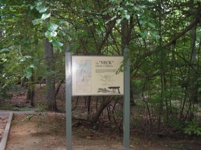
The remains of the British redoubt can be seen in the background of this photo.
Also see . . .
1. Yorktown Battlefield. National Park Service. (Submitted on September 2, 2008, by Bill Coughlin of Woodland Park, New Jersey.)
2. The Battle of Yorktown. The Patriot Resource website. (Submitted on September 2, 2008, by Bill Coughlin of Woodland Park, New Jersey.)
3. The Battle of Yorktown 1781. A British perspective of the Battle of Yorktown from BritishBattles.com. (Submitted on September 2, 2008, by Bill Coughlin of Woodland Park, New Jersey.)
Credits. This page was last revised on September 30, 2022. It was originally submitted on September 2, 2008, by Bill Coughlin of Woodland Park, New Jersey. This page has been viewed 1,205 times since then and 39 times this year. Photos: 1, 2. submitted on September 2, 2008, by Bill Coughlin of Woodland Park, New Jersey.
