Pensacola in Escambia County, Florida — The American South (South Atlantic)
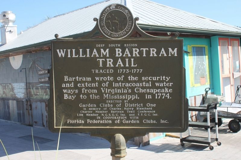
William Bartram Trail
Traced 1773-1777
| — | Deep South Region | — |
Photographed by Tim Fillmon, November 14, 2017
1. William Bartram Trail Marker
Erected by Garden Clubs of District One In memory of Charles Harry Blanchard Charter member Bartram Trail Conference Life member N.C.S.G.C. Inc. and F.F.G.C. Inc. in cooperation with Florida Federation of Garden Clubs, Inc.
Topics and series. This historical marker is listed in these topic lists: Colonial Era • Exploration • Waterways & Vessels. In addition, it is included in the William Bartram Trails series list. A significant historical year for this entry is 1774.
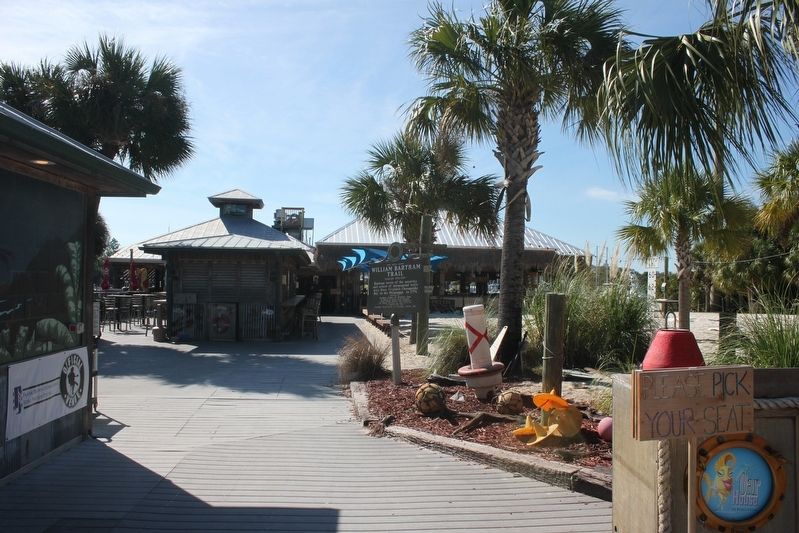
Location. 30° 24.027′ N, 87° 14.538′ W. Marker is in Pensacola, Florida, in Escambia County. It can be reached from South Pace Boulevard 0.1 miles south of Cypress Street when traveling south. Marker is next to the Oar House Restaurant. Touch for map. Marker is at or near this postal address: 1000 South Pace Boulevard, Pensacola FL 32502, United States of America. Touch for directions.

Regionally, this marker is on the Florida Panhandle. It is also in the American South, specifically in the Deep South, and on the
this page online
Other nearby markers. At least 8 other markers are within 2 miles of this marker, measured as the crow flies: Historic Greek Section (approx. 1.2 miles away); Former Goldfish Pond (approx. 1.2 miles away); Morris Slater (approx. 1.2 miles away); Monument Sculpting (approx. 1.2 miles away); Zinc Marker (approx. 1.2 miles away); Mollie McCoy (approx. 1.2 miles away); Historic Colored Section (approx. 1.2 miles away); Baby Section (approx. 1.2 miles away). Touch for a list and map of all markers in Pensacola.
More about this marker. This Bartram marker is known as the Bayou Chico location.
Also see . . . Bartram Trail Site. (Submitted on November 23, 2017, by Tim Fillmon of Webster, Florida.)
Photographed by Tim Fillmon, November 14, 2017
2. William Bartram Trail Marker and the Oar House Restaurant
Credits. This page was last revised on November 30, 2017. It was originally submitted on November 23, 2017, by Tim Fillmon of Webster, Florida. This page has been viewed 556 times since then and 29 times this year. Photos: 1, 2. submitted on November 23, 2017, by Tim Fillmon of Webster, Florida. • Bernard Fisher was the editor who published this page.
