Comite River
Blackwater Conservation Area
— Atchafalaya Water Heritage Trail —
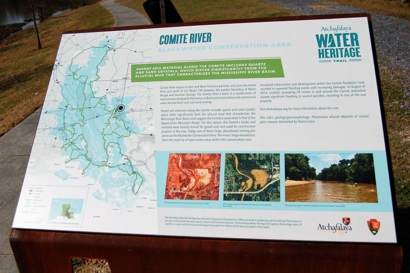
Parent soil material along the Comite includes quartz and sand crystals, which differ significantly from the alluvial mud that characterizes the Mississippi River Basin.
The Comite River begins in East and West Feliciana parishes and joins the Amite River just north of U.S. Route 190 between the eastern boundary of Baton Rouge and Denham Springs. The Comite River’s basin is a combination of natural areas along with the human-influenced conservation and commercial areas formed from rock and sand mining.
Parent soil materials along the Comite includes quartz and sand crystals, which differ significantly from the alluvial mud that characterizes the Mississippi River Basin and suggest the Comite’s watershed is that of the Appalachian Mountain Range. For this reason, the Comite’s banks and riverbed were heavily mined for gravel and rock used for construction projects in the area. Today, one of these large, abandoned mining pits serves as the Blackwater Conservation Area. The mine’s large excavations form the majority of open water areas within this conservation area.
Increased urbanization and development within the Comite floodplain have resulted in repeated flooding events with increasing damages. In August of 2016, rainfalls exceeding 20 inches in and around the Comite watershed caused significant flooding in
several parishes, resulting in loss of life and property.Visit Atchafalaya.org for more information about this site.
This site’s geology/geomorphology: Pleistocene alluvial deposits of coastal plain streams blanketed by Peoria Loess
Erected by State of Louisiana and National Park Service.
Topics and series. This historical marker is listed in these topic lists: Environment • Waterways & Vessels. In addition, it is included in the Atchafalaya Water Heritage Trail series list. A significant historical month for this entry is August 2016.
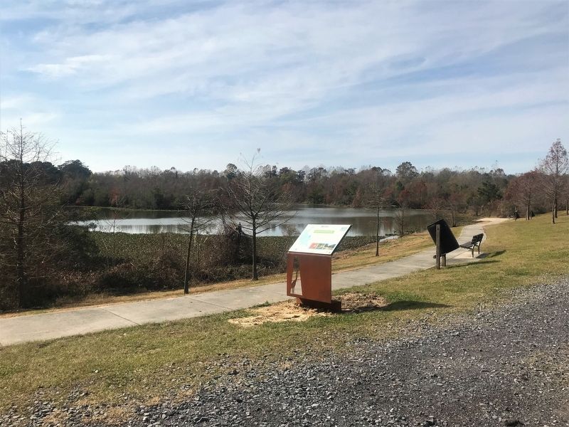
Location. 30° 32.073′ N, 91° 5.265′ W. Marker is in Central, Louisiana, in East Baton Rouge Parish. Marker can be reached from Blackwater Road (State Road 410) north of Hooper Road (Highway 408), on the right when traveling north. Touch for map. Marker is at or near this postal address: 9385 Blackwater Road, Baton Rouge LA 70837, United States of America. Touch for directions.
Other nearby markers. At least 8 other markers are within 7 miles of this marker, measured as the crow flies. Blackwater Conservation Area (within shouting distance of this marker); Original 1931 Baton Rouge Airport Beacon (approx. 3.4 miles away); Parish of St. Alphonsus Liguori (approx. 3.8 miles away); Southern University (approx. 5˝ miles away); Camphor Memorial United Methodist Church
Credits. This page was last revised on December 21, 2017. It was originally submitted on December 17, 2017, by Cajun Scrambler of Assumption, Louisiana. This page has been viewed 399 times since then and 33 times this year. Photos: 1, 2. submitted on December 17, 2017.

