Eastham in Barnstable County, Massachusetts — The American Northeast (New England)
Indian Rock
Photographed by Alan M. Perrie, September 14, 2015
1. Indian Rock Marker
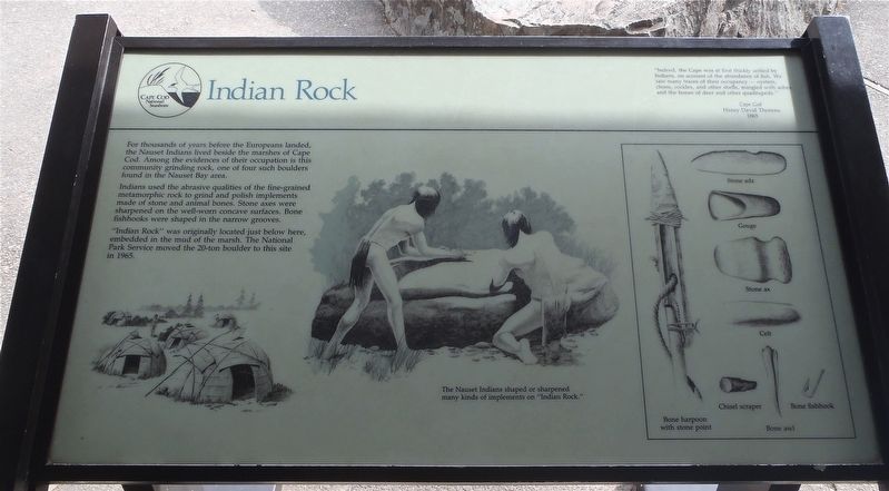
For thousands of years before the Europeans landed, the Nauset Indians lived beside the marshes of Cape Cod. Among the evidence of their occupation is this community grinding rock, one of four such boulders found in the Nauset Bay area.
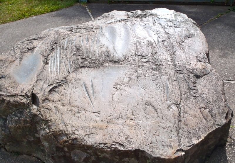
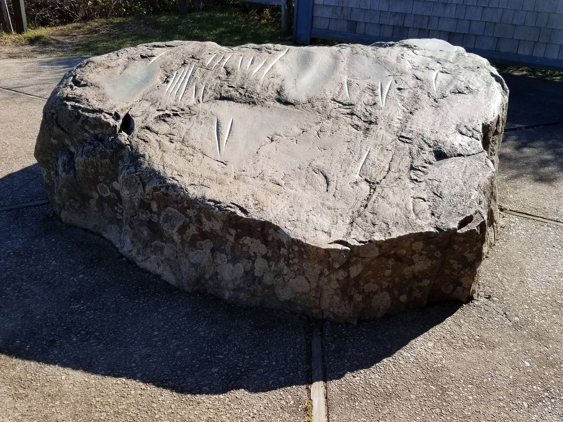
Indians used the abrasive qualities of the fine-grained metamorphic rock to grind and polish implements made of stone and animal bones. Stone axes were sharpened on the well-worn concave surfaces. Bone fishhooks were shaped in the narrow grooves.
“Indian Rock” was originally located just below here, embedded in the mud of the marsh. The National Park Service moved the 20-ton boulder to this site in 1965.
Erected by National Park Service, U.S. Department of the Interior.
Topics. This historical marker is listed in these topic lists: Anthropology & Archaeology • Indigenous Peoples and Communities • Natural Resources • Settlements & Settlers. A significant historical year for this entry is 1965.
Location. 41° 49.336′ N, 69° 57.798′ W. Marker is in Eastham, Massachusetts, in Barnstable County. It can be reached from Hemenway Road. The marker is located 0.1 mile down a
this page online

Regionally, this marker is on Massachusetts’ Cape Cod. It is also in the American Northeast, in New England, and on the Eastern Seaboard. Globally, it is in the North Atlantic Region, North America, the Western Hemisphere, the Western World, and the Anglosphere. Historically, it finds itself in what was once one of the original Thirteen Colonies.
Other nearby markers. At least 8 other markers are within walking distance of this marker: Port de Mallebarre (here, next to this marker); A Whale Bone Welcome (approx. 0.3 miles away); There’s No Place Like Home (approx. 0.3 miles away); Eastham Town Hall (approx. ¾ mile away); First Encounter (approx. ¾ mile away); Eastham Windmill (approx. 0.8 miles away); Cove Burying Ground (approx. 0.8 miles away); Bridge Road Cemetery (approx. 0.9 miles away). Touch for a list and map of all markers in Eastham.
Also see . . . Nauset Indians. (Submitted on December 17, 2017, by Alan M. Perrie of Unionville, Connecticut.)
Photographed by Alan M. Perrie, September 14, 2015
2. Indian Rock
Photographed by Alan M. Perrie, September 14, 2015
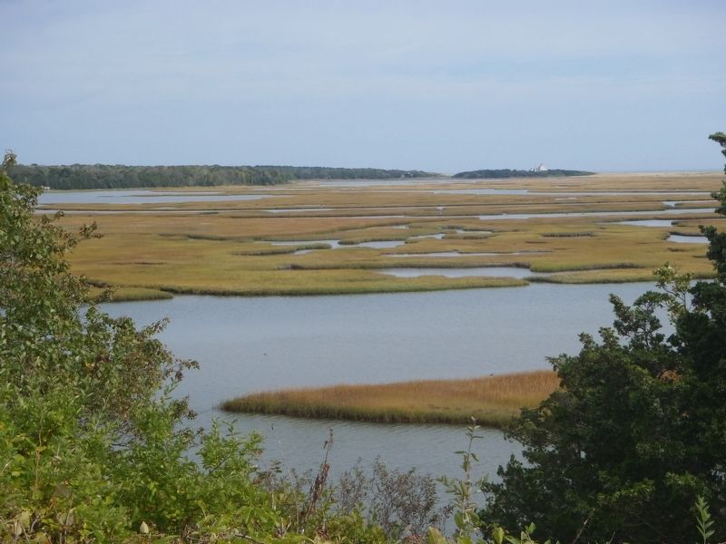
3. The marshes of Cape Cod can be seen from Indian Rock.
Photographed by Stephanie Seacord, October 24, 2019
4. Indian Rock
Credits. This page was last revised on August 9, 2025. It was originally submitted on December 17, 2017, by Alan M. Perrie of Unionville, Connecticut. This page has been viewed 3,057 times since then and 193 times this year. Photos: 1, 2, 3. submitted on December 17, 2017, by Alan M. Perrie of Unionville, Connecticut. 4. submitted on November 30, 2019, by Stephanie Seacord of Portsmouth, New Hampshire. • Bill Pfingsten was the editor who published this page.
