Arlington in Gilliam County, Oregon — The American West (Northwest)
Arlington Oregon Trail Kiosk
Photographed by Barry Swackhamer, July 1, 2017
1. Pathway to the "Garden of the World" panel
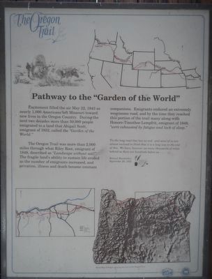
Pathway to the "Garden of the World" Excitement filled the air May 22, 1843 as nearly one thousand Americans left Missouri toward new lives in the Oregon Country. During the next two decades, more than 50,000 people emigrated to a land of abundance. a land that Abigail Scott, emigrant of 1852, called the "Garden of the World." The Oregon Trail was more than two thousand miles through what Riley Root, emigrant of 1848, called "Landscape without soil! River bottoms with scarcely enough grass to support emigrant teams." The fragile landscape's ability to sustain life eroded as numbers of emigrants increased and privation, illness and death became constant companions. Emigrants endured an extremely wearisome road, and by the time they reached this portion of the Trail, many along with Honore-Timothee Lempfrit, emigrant of 1848, "were exhausted by fatigue and lack of sleep."
Tis the long road that has no end. and some of us are almost inclined to think that it is a long way to the end of this. We have, however, as many thousands of miles behind as there are hundreds before us. ... -- Samuel Handsaker, September 20, 1853
this page online
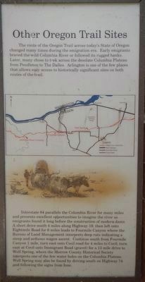
The route of the Oregon Trail across today's state of Oregon changed many times during the emigration era. Early emigrants braved the wild Columbia River or followed its rugged banks. Later many chose to trek across the desolate Columbia Plateau from Pendleton to The Dalles. Arlington is one of the few places that allows easy access to historically significant sites on both routes of the trail.
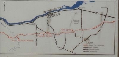
Interstate 84 parallels the Columbia River for many miles and presents excellent opportunities to imagine the river as emigrants found it long before the construction of modern dams. A short drive south 4 miles along Highway 19, then left onto Eightmile Road for 6 miles leads to Fourmile Canyon where the Bureau of Land Management interprets deep ruts indicating a steep and arduous wagon ascent. Continue south from Fourmile Canyon 1 mile, turn east onto Cecil road for 4 miles to Cecil; turn east at Cecil onto Immigrant Road (gravel) for a 13 mile drive to Well Spring, where the Morrow county Historical Society interprets one of the few water holes on the Columbia Plateau. Well Spring may also be found by
Photographed by Barry Swackhamer, July 1, 2017
2. Other Oregon Trail Sites panel
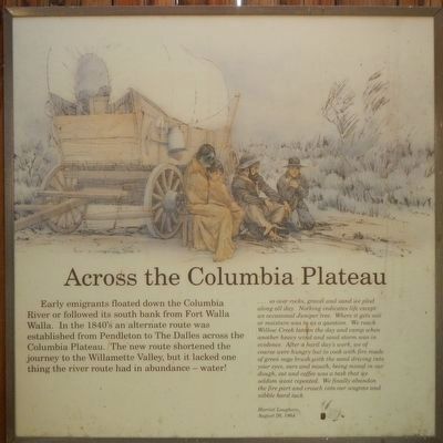
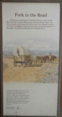
Early emigrants floated down the Columbia River or followed its south bank from |Fort Walla Walla. In the 1840's an alternate route was established from Pendleton to The Dalles across the Columbia Plateau. The new route shortened the journey to the Willamette Valley, but it lacked one thing the river route had in abundance -- water!
... so over rocks, gravel and sand we plod along all day. Nothing indicates life except an occasional Juniper tree. Where it gets soil or moisture was to us a question. We reach Willow Creek late in the day and camp when another heavy wind and sand storm was in evidence. After a hard day's work, we of course were hungry but to cook with fire made of green sage brush with the sand driving into your eyes, ears, and mouth, being mixed in our dough, eat and coffee was a task that we seldom want repeated. We finally abandon the fire part and crouch into our wagons and nibble hard tack. -- Harriet Loughary, August 20, 1864
Emigrants crossing the Columbia Plateau
Photographed by Barry Swackhamer, July 1, 2017
3. Other Oregon Trail Sites panel, detail
To day travel up Rock Creek, five miles to John Day River quite a large stream and beautiful valley, all being taken by ranchers. After noon go up steep hill three miles long, or rather up. There we reach the junction of the two roads leading to the Willamette Valley, one going over the Cascade Mountains through 'Barlow Pass' the other to The Dalles then by boat to Portland. -- Harriet Loughary, August 23, 1864
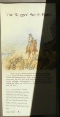
Many emigrants in the 1840's attempted to avoid risk, and the expense of hiring a canoe or bateau by following the south bank of the Columbia River. It was a poor road sandy and rocky along the river, with little wood for burning or grass for hungry livestock. Steep ascents to the Columbia Plateau along the precipitous ledges and bluffs took emigrants up to a mile away from the river.
Today we traveled leisurely, crossed a small stream, and passed over some very rugged road, the pack trail in some places going along in the steep and almost perpendicular side of the bluffs 100 feet above the Columbia, and the rock rising 100 feet almost hanging over the trail. In fact, it was rather disagreeable riding along in some places to look down. In event of your horse making a mis-step, himself and rider would be thrown down an awful precipice and buried in the gulf below. ... -- James W. Nesmith; October 15, 1843
Photographed by Barry Swackhamer, July 1, 2017
4. Across the Columbia Plateau panel
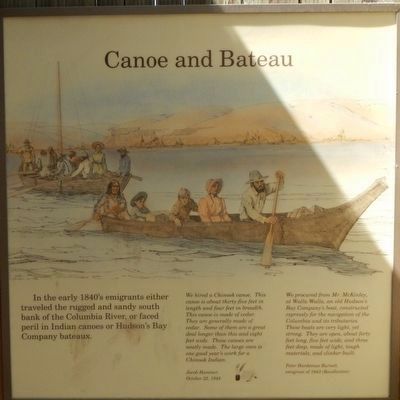
In the early 1840's emigrants either traveled the rugged and sandy south bank of the Columbia river, or faced peril in Indian canoes or Hudson's Bay Company bateaux.
We hired a Chinook canoe. This canoe is about thirty-five feet in length and four feet in breadth. This canoe is made of cedar. They are generally made of cedar. Some of them are a great deal longer than this and eight feet wide. Those canoes are neatly made. The large ones is one good year's work for a Chinook Indian. -- Jacob Hammer, October 22, 1844
"We procured from Mr; McKinley, at Walla Walla, an old Hudson's Bay Company's boat, constructed expressly for the navigation of the Columbia and its tributaries. These boats are very light, yet strong. They are open, about forty feet long, five feet wide, and three feet deep, made of light, tough materials, and clinker-built. -- Peter Hardeman Burnett, emigrant of 1843 (Recollection)
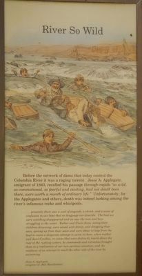
Before the network of dams that today control the Columbia River it was a raging torrent. Jesse A. Applegate, emigrant of 1843, recalled his passage through rapids "so wild, so commotional, so fearful and exciting, had not death been there, were worth a month of ordinary life."
Photographed by Barry Swackhamer, July 1, 2017
5. Fork in the Road panel
...presently there was a wail of anguish, a shriek, and a scene of confusion in our boat that no language can describe. The boat we were watching disappeared and we saw the men and boys struggling in the water. Father and Uncle Jesse, seeing their children drowning, were seized with frenzy, and dropping their oars, sprang up from their seats and were about to leap from the boat to make a desperate attempt to swim to them, when mother and Aunt Cynthia, in voices that were distinctly heard above the roar of the rushing waters, by commands and entreaties brought them to a realization of our own perilous situation, and the madness of an attempt to reach the other side of the river by swimming.-- Jesse A. Applegate; emigrant of 1843 (Recollection)
Erected by Oregon Trail Coordinating Council (OTCC).
Topics and series. This historical marker is listed in these topic lists: Roads & Vehicles • Settlements & Settlers • Waterways & Vessels. In addition, it is included in the Oregon Trail series list. A significant historical date for this entry is May 22, 1843.
Location. 45° 43.158′ N,
Photographed by Barry Swackhamer, July 1, 2017
6. The Rugged South Bank panel

Regionally, this marker is in Eastern Oregon. It is also in the American Mountain West and in the Lewis & Clark Corridor. Globally, it is in North America, on the Pacific Rim, in the Western Hemisphere, in the Western World, and in the Anglosphere.
Other nearby markers. At least 4 other markers are within 11 miles of this marker, measured as the crow flies: Erratic Boulder (approx. 1.2 miles away in Washington); This Marks the Crossing of the Old Oregon Trail (approx. 7 miles away); Rocks, Sand & Wind (approx. 10.3 miles away); Fourmile Canyon (approx. 10.3 miles away).
More about this marker. The Oregon Trail Kiosk is located at Earl Snell Memorial Park.
Photographed by Barry Swackhamer, July 1, 2017
7. Canoe and Bateau panel
Photographed by Barry Swackhamer, July 1, 2017
8. River So Wild panel
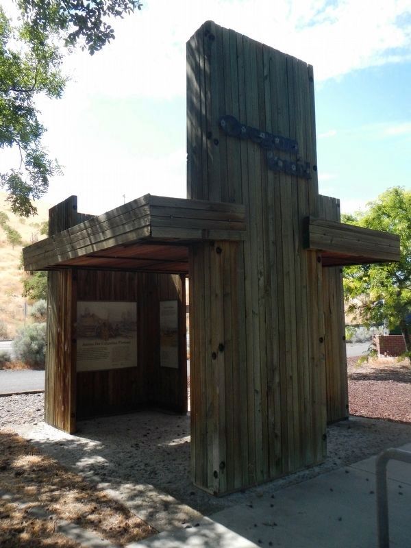
Photographed by Barry Swackhamer, July 1, 2017
9. Arlington Oregon Trail Kiosk
Credits. This page was last revised on December 13, 2024. It was originally submitted on December 27, 2017, by Barry Swackhamer of Brentwood, California. This page has been viewed 1,064 times since then and 48 times this year. Photos: 1, 2, 3, 4, 5, 6, 7, 8, 9. submitted on December 27, 2017, by Barry Swackhamer of Brentwood, California.
