Rossville in Miami County, Ohio — The American Midwest (Great Lakes)
Randolph Settlement
⎯⎯⎯
Jackson Cemetery (African)
Photographed by William Fischer, Jr., March 6, 2010
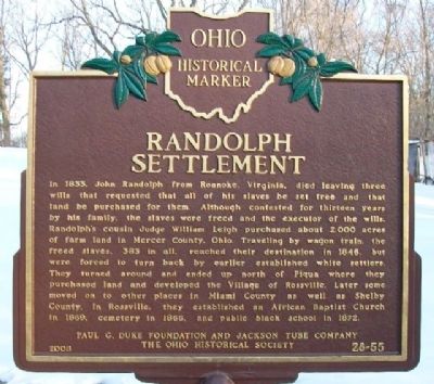
1. Randolph Settlement Marker (Side A)
Side A: Randolph Settlement
In 1833, John Randolph from Roanoke, Virginia, died leaving three wills that requested that all of his slaves be set free and that land be purchased for them. Although contested for thirteen years by his family, the slaves were freed and the executor of the wills, Randolph's cousin Judge William Leigh purchased about 2,000 acres of farm land in Mercer County, Ohio. Traveling by wagon train, the freed slaves, 383 in all, reached their destination in 1846, but were forced to turn back by earlier established white settlers. They turned around and ended up north of Piqua where they purchased land and developed the Village of Rossville. Later some moved on to other places in Miami County and well as Shelby County. In Rossville, they established an African Baptist Church in 1869, cemetery in 1866, and public black school in 1872.
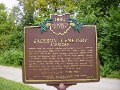
Side B: Jackson Cemetery (African)
Members from the following families are buried in Jackson Cemetery: Anderson, Armstrong, Bally, Basil, Blackburn, Bray, Brown, Butler, Cain, Clark, Clay, Coles, Crowder, Dalany, Fowlis, Giles, Gillard, Gillem, Governor, Hill, Huggard,
this page online
Erected 2008 by Paul G. Duke Foundation and Jackson Tube Company, and The Ohio Historical Society. (Marker Number 28-55.)
Topics and series. This historical marker is listed in these topic lists: Abolition & Underground RR • African Americans • Cemeteries & Burial Sites • Settlements & Settlers. In addition, it is included in the Ohio Historical Society / The Ohio History Connection series list. A significant historical year for this entry is 1833.
Location. 40° 9.434′ N, 84° 14.172′ W. Marker is in Rossville, Ohio, in Miami County. It is at the intersection of Zimmerlin Road and McFarland Road, on the right when traveling east on Zimmerlin Road. Westbound Zimmerlin Road "tees" into Dixie Drive, which then intersects County Road 25A about
Photographed by Tammy Cornett, April 30, 2011
2. Randolph Settlement Marker
Side B of Randolph Settlement Marker, showing names of families buried at the cemetery, including the Civil War veterans from Rossville.

Regionally, this marker is in the Dayton Metro, in the Miami Valley, and in the Till Plains. It is also in the American Midwest and in the Corn Belt. Globally, it is in North America, the Western Hemisphere, the Western World, and the Anglosphere. Historically, it finds itself in what was once the Haudenosaunee (Iroquois) Confederacy, the territory of the Mississippian Culture, and the Northwest Territory.
Other nearby markers. At least 8 other markers are within walking distance of this marker: Jackson Cemetery (within shouting distance of this marker); Rossville (about 500 feet away, measured in a direct line); Great Miami River (approx. 0.4 miles away); a different marker also named Great Miami River (approx. half a mile away); a different marker also named Great Miami River (approx. 0.6 miles away); a different marker also named Great Miami River (approx. 0.6 miles away); a different marker also named Great Miami River (approx. 0.6 miles away); a different marker also named
Photographed by William Fischer, Jr., March 6, 2010
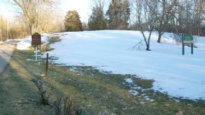
3. Randolph Settlement Marker
At Jackson Cemetery.
Also see . . .
1. The Randolph Freepeople (part 3): An Act of Becoming. Ohio History Connection website entry (Submitted on November 17, 2024, by Larry Gertner of New York, New York.)
2. African Jackson Cemetery. Wikipedia entry (Submitted on November 17, 2024, by Larry Gertner of New York, New York.)
Photographed by William Fischer, Jr., March 6, 2010
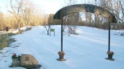
4. Randolph Settlement Marker
At Jackson Cemetery. Looking east.
Credits. This page was last revised on November 17, 2024. It was originally submitted on March 8, 2010, by William Fischer, Jr. of Reynoldsburg, Ohio. This page has been viewed 2,863 times since then and 124 times this year. Last updated on December 29, 2017, by Allen W. Bernard of Cincinnati, Oh 45202-1736. Photos: 1. submitted on March 8, 2010, by William Fischer, Jr. of Reynoldsburg, Ohio. 2. submitted on March 10, 2012, by Tammy Cornett of Piqua, Ohio. 3, 4. submitted on March 8, 2010, by William Fischer, Jr. of Reynoldsburg, Ohio. • Bill Pfingsten was the editor who published this page.
