Riverton in Barkhamsted in Litchfield County, Connecticut — The American Northeast (New England)
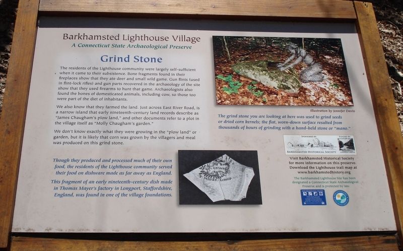
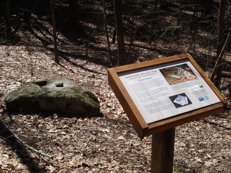
Barkhamsted Lighthouse Village Grind Stone
A Connecticut State Archaeological Preserve
We also know that they farmed the land. Just across East River Road, is a narrow island that early nineteenth-century land records describe as “James Chaugham’s plow land,” and other documents refer to a plot in the village itself as “Molly Chaugham’s garden.”
We don’t know exactly what they were growing in the “plow land” or garden, but it is likely that corn was grown by the villagers and meal was produced on this grind stone.
The grind stone you are looking at here was used to grind seeds or dried corn kernels; the flat, worn-down surface resulted from thousands of hours of grinding with a hand-held stone or “mano.”
Erected by Barkhamsted Historical Society.
Topics and series. This historical marker is listed in these topic lists: Anthropology & Archaeology • Native Americans • Settlements & Settlers. In addition, it is included in the Lighthouses series list.
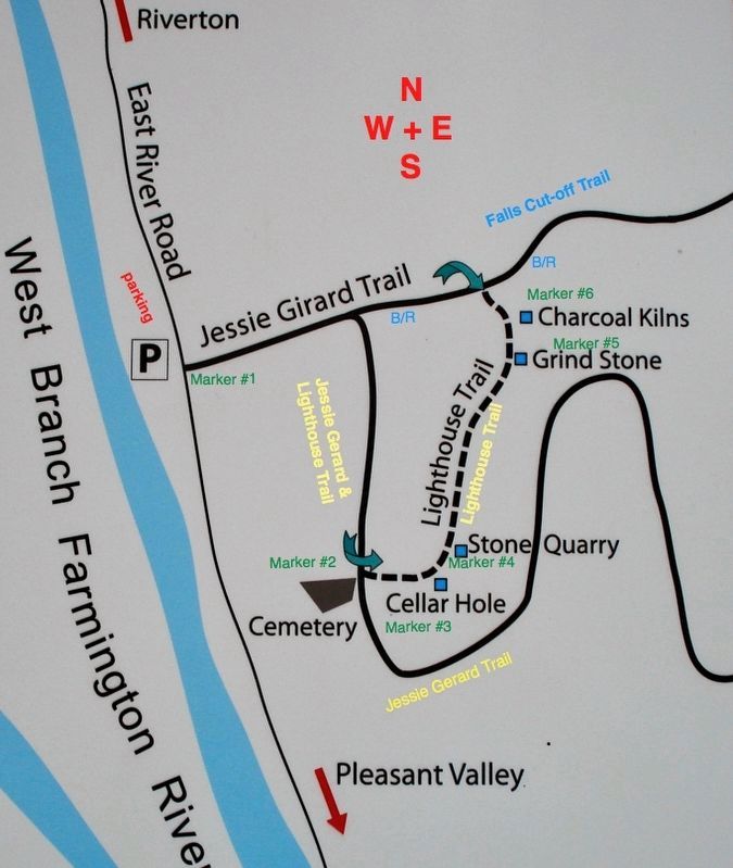
Location. 41° 56.551′ N, 73° 0.372′ W. Marker is in Barkhamsted, Connecticut, in Litchfield County. It is in Riverton. Marker can be reached from East River Road, 1.7 miles south of Connecticut Route 20. The marker is located on the Lighthouse Trail, 0.2 miles from the Trail-head. The trail starts at the Barkhamsted Lighthouse Village Marker found 1.7 miles south from state route 20 on East River Road. Touch for map. Marker is at or near this postal address: 410 E River Rd, Riverton CT 06065, United States of America. Touch for directions.
Other nearby markers. At least 8 other markers are within walking distance of this marker. Barkhamsted Lighthouse Village Stone Quarry (here, next to this marker); Barkhamsted Lighthouse Village Cellar Holes (here, next to this marker); Barkhamsted Lighthouse Village Cemetery (within shouting distance of this marker); Barkhamsted Lighthouse Village Charcoal Kilns (within shouting distance of this marker); Peoples State Forest (about 300 feet away, measured in a direct line); Barkhamsted Lighthouse Village (about 300 feet away); Camp White (approx. 0.3 miles away); Henry Robinson Buck (approx. 0.3 miles away). Touch for a list and map of all markers in Barkhamsted.
Also see . . .
1. Barkhamsted Lighthouse. CTMQ's Town Guide entry (Submitted on January 2, 2018, by Alan M. Perrie of Unionville, Connecticut.)
2. Barkhamsted Lighthouse. Connecticut History entry (Submitted on January 2, 2018, by Alan M. Perrie of Unionville, Connecticut.)
Credits. This page was last revised on February 10, 2023. It was originally submitted on January 2, 2018, by Alan M. Perrie of Unionville, Connecticut. This page has been viewed 244 times since then and 15 times this year. Photos: 1, 2, 3. submitted on January 2, 2018, by Alan M. Perrie of Unionville, Connecticut. • Bill Pfingsten was the editor who published this page.


