Near Mosier in Wasco County, Oregon — The American West (Northwest)
Memaloose Overlook
Islands of the Dead
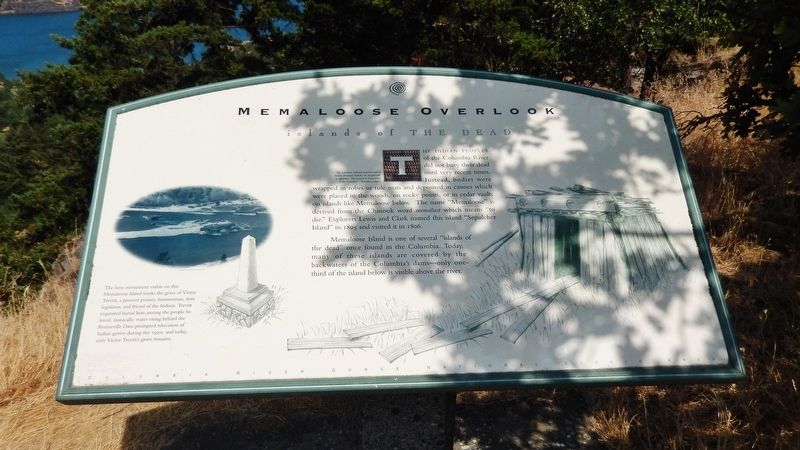
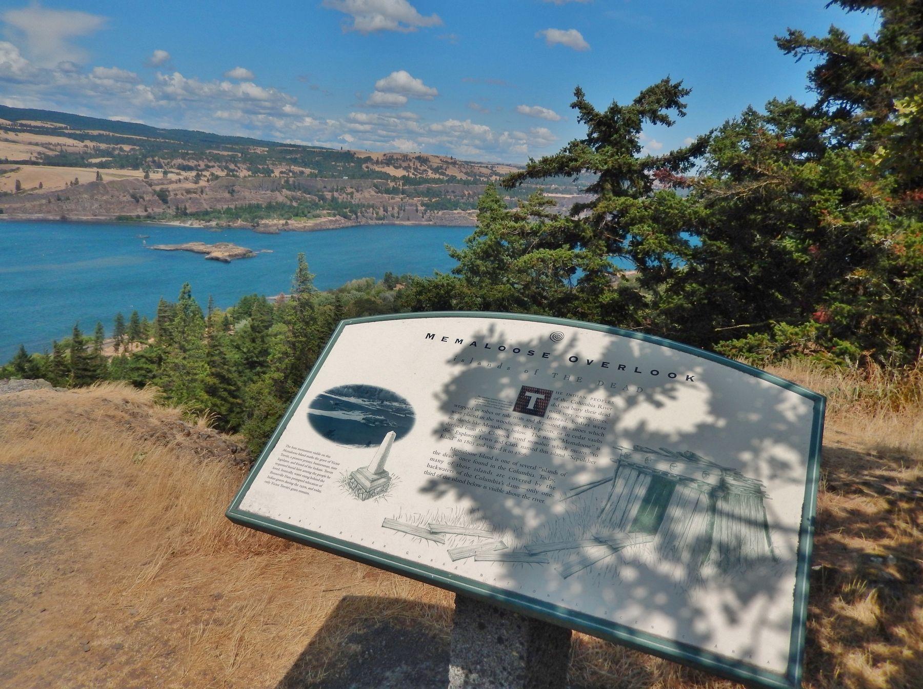
The Indian Peoples of the Columbia River did not bury their dead until very recent times. Instead, bodies were wrapped in robes or tule mats and deposited in canoes which were placed in the woods, on rocky points, or in cedar vaults on islands like Memaloose below. The name "Memaloose" is derived from the Chinook word memalust which means “to die." Explorers Lewis and Clark named this island "Sepulcher Island" in 1805 and visited it in 1806.
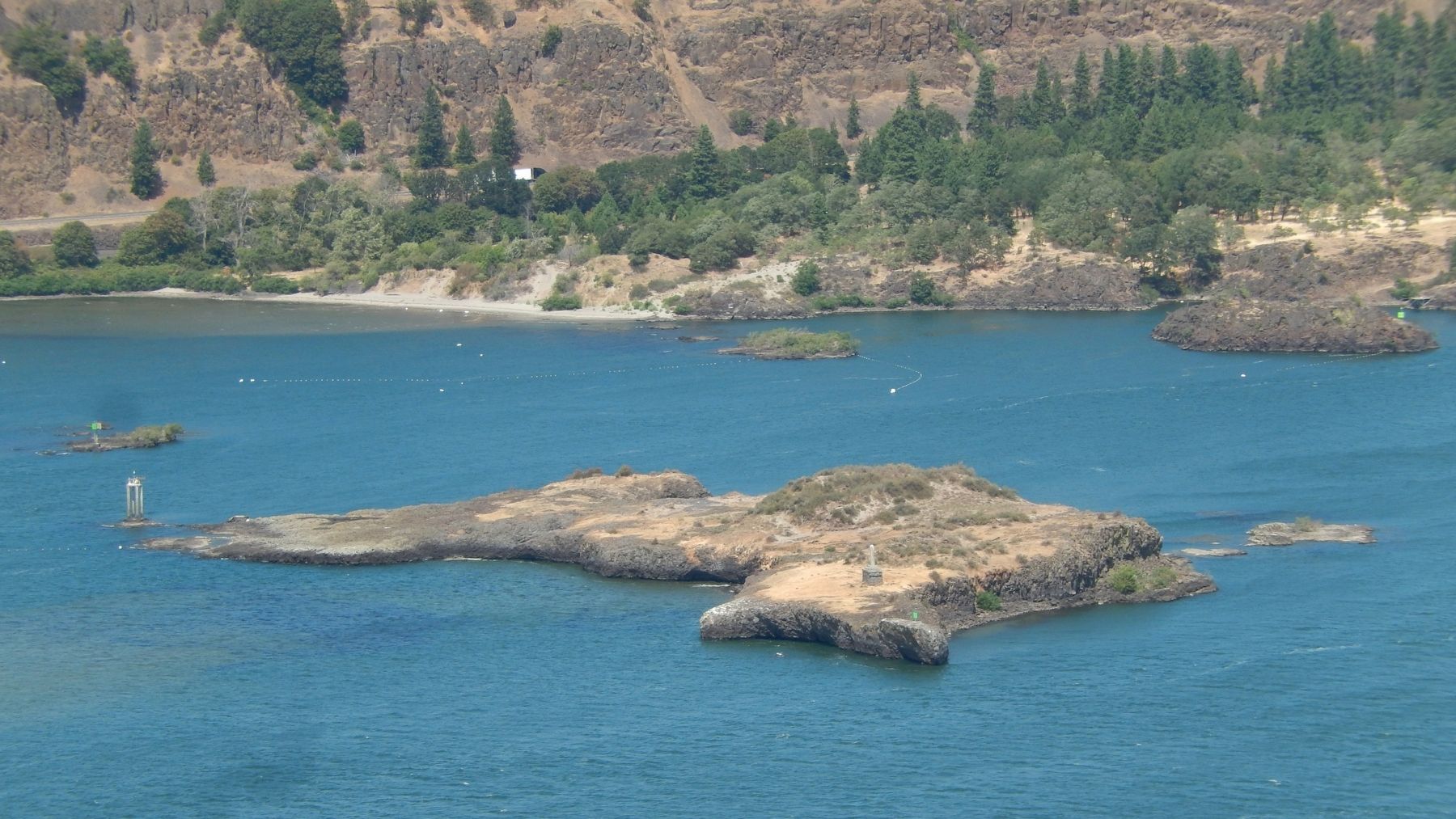
Memaloose Island is one of several "islands of the dead" once found in the Columbia. Today, many of these islands are covered by the backwaters of the Columbia's dams – only one-third of the island below is visible above the river.
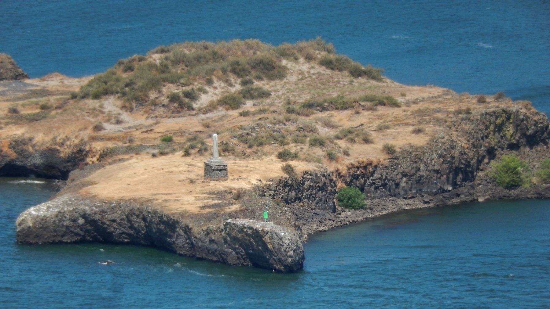
The lone monument visible on this Memaloose Island marks the grave of Victor Trevitt, a pioneer printer, businessman, state legislator, and friend of the Indians. Trevitt requested burial here among the people he loved. Ironically, water rising behind the Bonneville Dam prompted relocation of Indian graves during the 1930s, and today, only Victor Trevitt's grave remains.
Topics and series. This historical marker is listed in these topic lists: Cemeteries & Burial Sites • Exploration • Native Americans • Waterways & Vessels. In addition, it is included in the Lewis & Clark Expedition series list.
Location. 45° 41.649′ N, 121° 21.045′ W. Marker is near Mosier, Oregon, in Wasco County. Marker can be reached from Historic Columbia River Highway (U.S. 30) 3 miles east of Interstate 84, on the left when traveling east. Marker is located in a pull-out at the Memaloose Hills Trailhead, overlooking Memaloose Island and the Columbia River. Touch for map. Marker is in this post office area: Mosier OR 97040, United States of America. Touch for directions.
Other nearby markers. At least 8 other markers are within 7 miles of this marker, measured as the crow flies. Memaloose Rest Area Oregon Trail Kiosk (approx. 0.6 miles away); Memaloose—Island of the Dead (approx. 0.6 miles away); Transition Zones (approx. 1˝ miles away in Washington); A Fluid Geologic Past (approx. 1˝ miles away in Washington); Mosier (approx. 2.3 miles away); Rowena Crest - The Rowena Loops (approx. 2.6 miles away); Rowena Crest - Ice Age Floods (approx. 2.6 miles away); Pioneer Cemetery (approx. 6.7 miles away in Washington). Touch for a list and map of all markers in Mosier.
Related markers. Click here for a list of markers that are related to this marker.
Also see . . .
1. Memaloose Island.
On October 29, 1805, Lewis and Clark called Memaloose Island "Sepulcher Island". It was one of several islands commented on by Lewis and Clark as containing burial vaults for the Indian tribes that lived along the Columbia River. Several islands in the Columbia River are named "Memaloose", the accepted spelling adopted by the United States Board of Geographic Names (USBGN). The name is derived from "Memaloose Ilahee", Chinook jargon for "land of the dead". (Submitted on January 5, 2018, by Cosmos Mariner of Cape Canaveral, Florida.)
2. Trevitt’s burial on Memaloose Island.
Trevitt was buried on Lower Memaloose Island located in the Columbia River, just downriver from Lyle, Washington. He left a request in his will to be buried “with his friends the Indians” on Memaloose Island. Trevitt was the only white man to be buried there. He told his friends: “I have but one desire after I die, to be laid away on Memaloose Island with the Indians. They are more honest than whites and live up to the light they have. In the resurrection I will take my chances with the Indians.” source: History of Oregon Literature, by Alfred Powers (Submitted on January 5, 2018, by Cosmos Mariner of Cape Canaveral, Florida.)
3. Lower Memaloose Island.
One of multiple cemetery islands in the Columbia
River named Memaloose, after the Chinook Memaloose Ilahee, "Land of the Dead," or memalust, "to die." This is the best known and one of the largest islands at the current river level. Historically (and by extension, before outside contact) Chinookian speaking people of the Columbia River brought dead to these islands for final rest with the remains wrapped in robes, reed mats, or leather, or placed in above ground cedar plank cases or canoes.
Lewis and Clark recorded in October 1805 "... passed three large rocks in The river the middle rock is large long and has Several Square vaults on it. We call this rockey Island the Sepulchar." The next year on their return they briefly landed on the island and counted 13 structures full of bodies. (Submitted on January 5, 2018, by Cosmos Mariner of Cape Canaveral, Florida.)
Credits. This page was last revised on January 12, 2018. It was originally submitted on January 4, 2018, by Cosmos Mariner of Cape Canaveral, Florida. This page has been viewed 465 times since then and 60 times this year. Photos: 1. submitted on January 4, 2018, by Cosmos Mariner of Cape Canaveral, Florida. 2, 3, 4, 5, 6. submitted on January 5, 2018, by Cosmos Mariner of Cape Canaveral, Florida. • Bill Pfingsten was the editor who published this page.


