The Dalles in Wasco County, Oregon — The American West (Northwest)
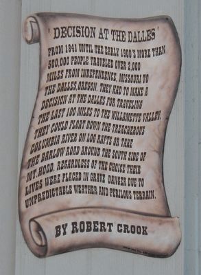
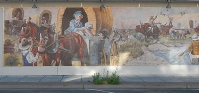
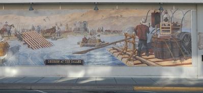
Decision at The Dalles
Erected by The Dalles Mural Society.
Topics. This historical marker is listed in these topic lists: Roads & Vehicles • Settlements & Settlers • Waterways & Vessels.
Location. 45° 36.038′ N, 121° 10.86′ W. Marker is in The Dalles, Oregon, in Wasco County. Marker is at the intersection of Federal Street and 2nd Street (East Little Trail), on the right when traveling south on Federal Street. Touch for map. Marker is in this post office area: The Dalles OR 97058, United States of America. Touch for directions.
Other nearby markers. At least 8 other markers are within walking distance of this marker. Nickelsen Bookstore (within shouting distance of this marker); Rock Fort Camp (within shouting distance of this marker); Wingate & Williams Building (within shouting distance of this marker); Maier Building (within shouting distance of this marker); French and Company Bank (about 300 feet away, measured in a direct line); The Pioneer Building (about 300 feet away); Seeing Red (about 400 feet away); The Corps of Discovery "Into the Narrows" (about 400 feet away). Touch for a list and map of all markers in The Dalles.
Credits. This page was last revised on January 11, 2018. It was originally submitted on January 10, 2018, by Barry Swackhamer of Brentwood, California. This page has been viewed 265 times since then and 19 times this year. Photos: 1, 2, 3. submitted on January 10, 2018, by Barry Swackhamer of Brentwood, California.


