Woodbury in Litchfield County, Connecticut — The American Northeast (New England)
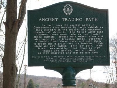
Ancient Trading Path
Project of the 2000-2003 Administration Mary Ann Groom Hepler, National President Caryl S. Stratton, State Regent
Erected by National Society Daughters of the American Colonists.
Topics and series. This historical marker is listed in these topic lists: Colonial Era • Native Americans. In addition, it is included in the Daughters of the American Colonists series list.
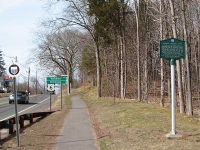
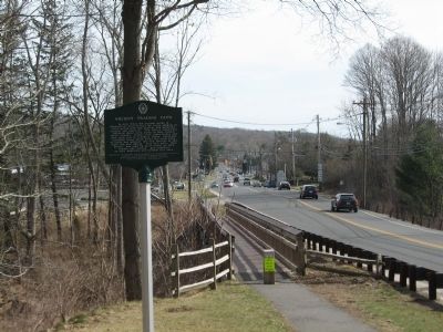
Location. 41° 31.773′ N, 73° 12.247′ W. Marker is in Woodbury, Connecticut, in Litchfield County. Marker is on Main Street (U.S. 6) ¼ mile north of Sherman Hill Road (Connecticut Route 64), on the right when traveling north. Touch for map. Marker is in this post office area: Woodbury CT 06798, United States of America. Touch for directions.
Other nearby markers. At least 8 other markers are within walking distance of this marker. In Memory Of George Washington (about 800 feet away, measured in a direct line); Glebe House (approx. half a mile away); District No. 2 Schoolhouse (approx. half a mile away); The Common (approx. 0.6 miles away); Woodbury (approx. 0.6 miles away); Soldiers' Memorial (approx. 0.6 miles away); Woodbury World War II Memorial (approx. 0.6 miles away); Woodbury Vietnam Era Monument (approx. 0.6 miles away). Touch for a list and map of all markers in Woodbury.
More about this marker. The marker is on a tall post.
Credits. This page was last revised on January 25, 2018. It was originally submitted on April 4, 2009, by Michael Herrick of Southbury, Connecticut. This page has been viewed 1,929 times since then and 14 times this year. Last updated on January 14, 2018, by Douglass Halvorsen of Klamath Falls, Oregon. Photos: 1, 2, 3. submitted on April 4, 2009, by Michael Herrick of Southbury, Connecticut. • Bill Pfingsten was the editor who published this page.


