North End East in Sioux Falls in Minnehaha County, South Dakota — The American Midwest (Upper Plains)
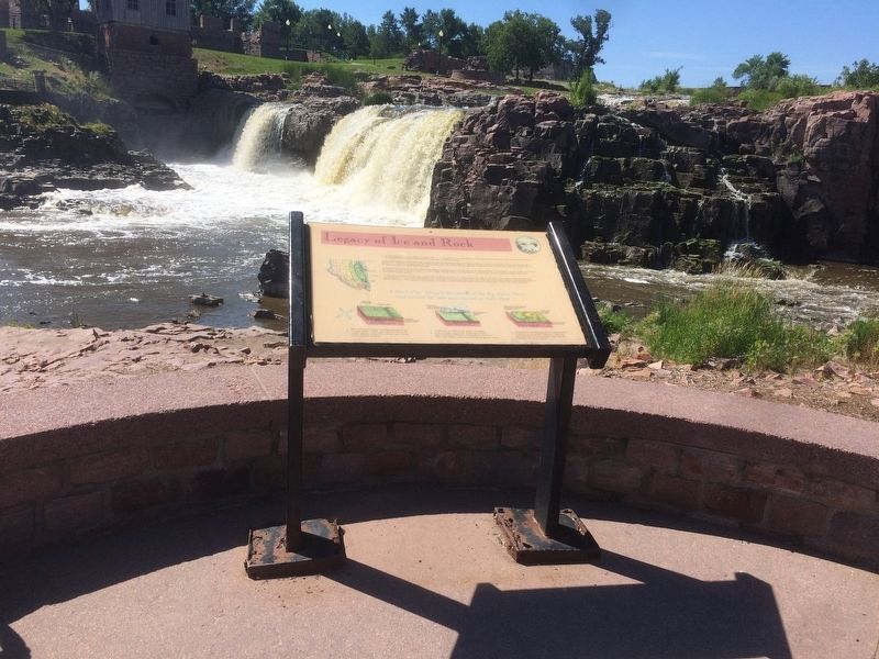
Legacy of Ice and Rock
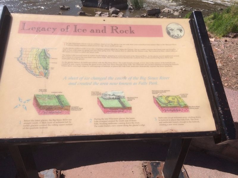
The late-Wisconsin Glacier was no ordinary sheet of ice! The glacier was one mile thick and it stretched from eastern Ohio to the Missouri River. It caused North America's most recent Ice Age, about 14,000 years ago.
As the glacier pushed south, it ran into highland plateau called the Coteau des Prairies. The ice couldn't overrun the Coteau and was forced to split in two, with some ice going east and some going west. The eastern flow is called the Des Moines Lobe. The western ice flow, which followed the James Lowland, is called the James Lobe.
The James Lobe covered most of eastern South Dakota, stopping its westward push at the Missouri River. As the glacier moved southward around the Coteau, it covered the area that's now Sioux Falls. This mountain of ice blocked the southerly flow of the ancestral Big Sioux River and meltwater from the glacier.
As the glacier melted, its meltwater joined with the Big Sioux River. The water found a trough, or low area in the surface of the bed rock and created its new course, forming the giant S-curve that now flows through Sioux Falls. The meltwater also eroded sediment covering the bedrock. Where there were high ridges or outcroppings of bedrock, in places like Falls Park, meltwater dramatically exposed the Sioux Quartzite.
A sheet of ice changed the course of the Big Sioux River and created the area now known as Falls Park.
1. Before the latest glacier, the Big Sioux River ran straight south. A thick layer of sediment left by earlier glaciers covered the rolling upper surface of the quartzite bedrock.
2. During the late-Wisconsin glacier, the James Lobe wrapped around the south side of Sioux Falls, blocking meltwater coming down the river. The water found a new course along the glacier's edge.
3. Meltwater swept sediment away, eroding down to bedrock in places like Falls Park. The river and meltwater found a trough in the bedrock, creating a new river course.
Erected 1997.
Topics. This historical marker is listed in these topic lists: Environment • Science & Medicine.
Location. 43° 33.416′ N, 96° 43.38′ W. Marker is in Sioux Falls, South Dakota, in Minnehaha County. It is in North End East. Marker is on East Falls Park Drive. Marker is located in Falls Park. Touch for map. Marker is in this post office area: Sioux Falls SD 57104, United States of America. Touch for directions.
Other nearby markers. At least 8 other markers are within walking distance of this marker. Hazel O'Connor (a few steps from this marker); Prison Quarry (within shouting distance of this marker); Philander Prescott (about 300 feet away, measured in a direct line); Falls Park Bridge (about 300 feet away); Inland Seas (about 300 feet away); Hive of the Queen City (about 400 feet away); Monarch of the Plains (about 400 feet away); The Sioux Quartzite (about 400 feet away). Touch for a list and map of all markers in Sioux Falls.
Credits. This page was last revised on February 16, 2023. It was originally submitted on January 16, 2018, by Ruth VanSteenwyk of Aberdeen, South Dakota. This page has been viewed 431 times since then and 22 times this year. Photos: 1, 2. submitted on January 16, 2018, by Ruth VanSteenwyk of Aberdeen, South Dakota. • Bill Pfingsten was the editor who published this page.

