El Dorado Hills in El Dorado County, California — The American West (Pacific Coastal)
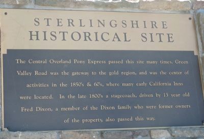
Sterlingshire
Historical Site
Topics. This historical marker is listed in these topic lists: Notable Events • Roads & Vehicles.
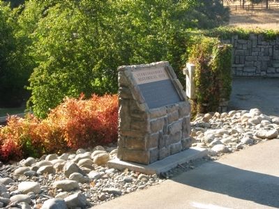
Location. 38° 42.61′ N, 121° 4.585′ W. Marker is in El Dorado Hills, California, in El Dorado County. Marker is on Green Valley Road, 0.1 miles east of Salmon Falls Road/El Dorado Hills Boulevard, on the right when traveling east. Marker is located at the entrance to the Sterlingshire Residential Area. Touch for map. Marker is in this post office area: El Dorado Hills CA 95762, United States of America. Touch for directions.
Other nearby markers. At least 8 other markers are within 4 miles of this marker, measured as the crow flies. Mormon Island, Negro Hill, Salmon Falls, and Condemned Bar (approx. 1.9 miles away); Mormon Island Relocation Cemetery (approx. 2 miles away); Prairie City Cemetery (approx. 2 miles away); a different marker also named Mormon Island (approx. 2.9 miles away); Folsom Dam Improvements (approx. 3 miles away); Pleasant Grove House (approx. 3.1 miles away); Johnny Cash Trail (approx. 3.8 miles away); Mormon Tavern (approx. 3.8 miles away). Touch for a list and map of all markers in El Dorado Hills.
Regarding Sterlingshire. Green Valley Road follows part of the Old Coloma Road. For more information please see the Pony Express markers and Old Coloma Road markers.
Credits. This page was last revised on June 16, 2016. It was originally submitted on September 9, 2008, by Syd Whittle of Mesa, Arizona. This page has been viewed 1,971 times since then and 31 times this year. Photos: 1, 2. submitted on September 9, 2008, by Syd Whittle of Mesa, Arizona. • Kevin W. was the editor who published this page.

