Oregon City in Clackamas County, Oregon — The American West (Northwest)
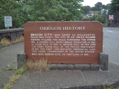
Oregon City Falls
Oregon History
Erected by Oregon Travel Experience. (Marker Number M12.)
Topics and series. This historical marker is listed in these topic lists: Industry & Commerce • Landmarks • Native Americans • Science & Medicine. In addition, it is included in the Oregon Beaver Boards series list. A significant historical year for this entry is 1842.
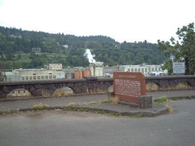
Location. 45° 21.118′ N, 122° 36.851′ W. Marker is in Oregon City, Oregon, in Clackamas County. Marker is on McLoughlin Boulevard (Oregon Route 99) near S. 2nd Street, on the right when traveling south. In the parking area overlooking Willamette Falls. Touch for map. Marker is in this post office area: Oregon City OR 97045, United States of America. Touch for directions.
Other nearby markers. At least 8 other markers are within walking distance of this marker. Oregon City (here, next to this marker); Peter Skene Ogden House (a few steps from this marker); Dr. John McLoughlin (within shouting distance of this marker); Larry G. Dahl (within shouting distance of this marker); Veterans Memorial Building (about 500 feet away, measured in a direct line); Explosion of Steamer Gazelle (about 800 feet away); Joseph L. Meek (approx. half a mile away); Canemah (approx. half a mile away). Touch for a list and map of all markers in Oregon City.
Also see . . .
1. A brief history of Oregon City. Historic Context Statement for the City of Oregon City (2000). (Submitted on July 1, 2008, by Kevin W. of Stafford, Virginia.)
2. Oregon City Falls - Oregon Travel Experience audio tour. (Submitted on April 2, 2012, by PaulwC3 of Northern, Virginia.)
3. Oregon Travel Experience - Oregon City Falls. (Submitted on January 12, 2018, by Douglass Halvorsen of Klamath Falls, Oregon.)
Credits. This page was last revised on February 7, 2018. It was originally submitted on July 1, 2008, by Kevin W. of Stafford, Virginia. This page has been viewed 2,273 times since then and 20 times this year. Last updated on January 30, 2018, by Douglass Halvorsen of Klamath Falls, Oregon. Photos: 1, 2, 3. submitted on July 1, 2008, by Kevin W. of Stafford, Virginia. • Andrew Ruppenstein was the editor who published this page.


