Mosier in Wasco County, Oregon — The American West (Northwest)
Memaloose—Island of the Dead
Oregon History
Photographed by Barry Swackhamer, July 2, 2017
1. Memaloose -- Island of the Dead Marker
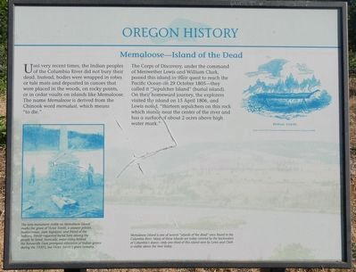
Captions: (bottom left) The lone monument on Memaloose Island marks the grave of Victor Trevitt, a pioneer printer, businessman, state legislator, and friend of the Indians. Trevitt requested burial here among the people he loved. Ironically, water rising behind the Bonneville Dam prompted relocation of Indian graves during the 1930's, but Victor Trevitt's grave remains.; (upper right) Burial canoe; (background) Memaloose Island is one of several "islands of the dead" once found in the Columbia River. Many of these islands are today covered by the backwaters of Columbia's dams -- only one-third of this island seen by Lewis and Clark is visible above the river today.
Until very recent times, the Indian people of the Columbia River did not bury their dead, Instead, bodies were wrapped in robes or tule mats and deposited in canoes that were placed in the woods, on rocky points, or in cedar vaults on islands like Memaloose. The name Memaloose is derived from the Chinook word memalust, which means "to die."
The Corps of Discovery, under the command of Meriwether Lewis and William Clark, passed this island in their quest to reach the Pacific Ocean on 29 October 1805—they called it "Sepulcher Island" (burial island). On their homeward journey, the explorers visited the island on 15 April 1806, and Lewis noted, "thirteen sepulchers on its rock which stands near the center of the river and has a surface of about 2 acres above high water mark."
Erected by Oregon Travel Experience.
Topics and series. This historical marker is listed in these topic lists: Anthropology & Archaeology • Exploration • Indigenous Peoples and Communities. In addition, it is included in the Lewis & Clark Expedition, and the Oregon Beaver Boards series lists. A significant historical date for this entry is April 15, 1806.
Location. 45° 41.76′ N,
this page online

Regionally, this marker is in Oregon’s Columbia River Gorge. It is also on the American Pacific Coast, in the Pacific Northwest, and in the Lewis & Clark Corridor. Globally, it is in North America, the Cascade Range, the Pacific Rim, the Western Hemisphere, the Western World, and the Anglosphere.
Other nearby markers. At least 8 other markers are within 6 miles of this marker, measured as the crow flies: Memaloose Rest Area Oregon Trail Kiosk (about 300 feet away, measured in a direct line); Memaloose Overlook (approx. 0.6 miles away); Transition Zones (approx. 0.9 miles away in Washington); A Fluid Geologic Past (approx. 0.9 miles away in Washington); Rowena Crest - The Rowena Loops (approx. 2.1 miles away); Rowena Crest - Ice Age Floods (approx. 2.1 miles away); Mosier (approx. 3 miles away); "friendly village" (approx. 5.1 miles away in Washington).
Photographed by Barry Swackhamer, July 2, 2017
2. Memaloose -- Island of the Dead Marker
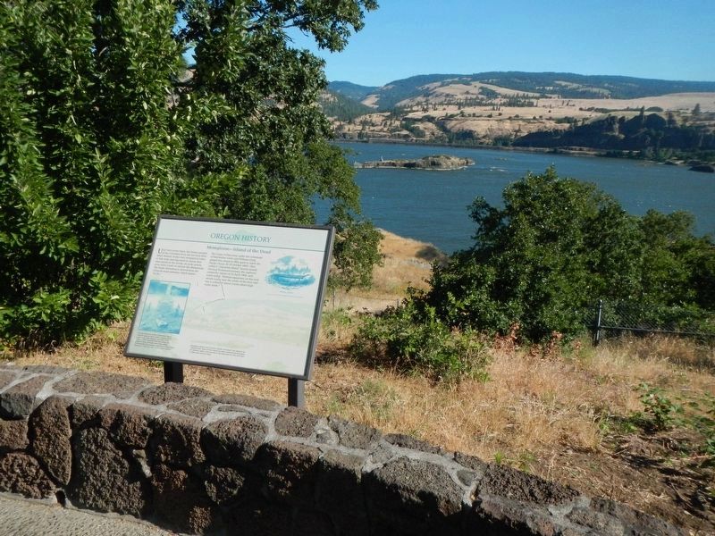
Memaloose Island in the distance
More about this marker. This marker is located at the westbound Memaloose Rest Area.
Related markers. Click here for a list of markers that are related to this marker.
Also see . . . Memaloose – Isle of the Dead. Wild About the NW website entry (Submitted on March 25, 2023, by Larry Gertner of New York, New York.)
Photographed by Barry Swackhamer, July 2, 2017
3. Memaloose -- Island of the Dead
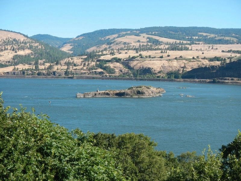
Victor Trevitt grave monument on the left end.
Credits. This page was last revised on December 14, 2024. It was originally submitted on January 2, 2018, by Barry Swackhamer of Brentwood, California. This page has been viewed 2,924 times since then and 161 times this year. Last updated on January 30, 2018, by Douglass Halvorsen of Klamath Falls, Oregon. Photos: 1, 2, 3. submitted on January 2, 2018, by Barry Swackhamer of Brentwood, California.
