University of Delaware in Lewes in Sussex County, Delaware — The American Northeast (Mid-Atlantic)
University of Delaware
Lewes Maritime History Trail
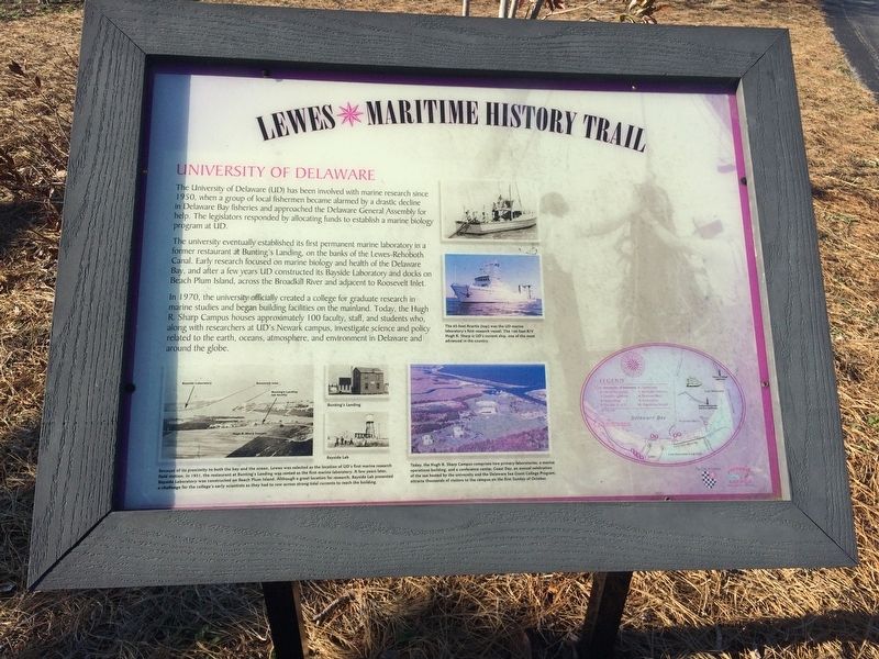
The University of Delaware (UD) has been involved with marine research since 1950, when a group of local fishermen became alarmed by drastic decline in Delaware Bay fisheries approached the Delaware General Assembly for help. The legislators responded by allocating funds to establish a marine biology program at UD.
The university eventually established its first permanent marine laboratory in a former restaurant at bunting's Landing, on the banks of the Lewes-Rehoboth Canal. Early research focused on the marine biology and health of Delaware Bay, and after a few years UD constructed its Bayside Laboratory and docks on Beach Plum Island, across the Broadkill River and adjacent to Roosevelt Inlet.
In 1970, the university officially created a college for graduate research in marine studies and began building facilities on the mainland. Today, the Hugh R. Sharp Campus houses approximately 100 faculty, staff, and students who, along with researchers at UD's Newark campus, investigate science and policy related to the earth, oceans, atmosphere and environment in Delaware and around the globe.
[Captions:]
45-foot Acartia (top) was the UD marine laboratory's first research vessel. The 146-foot R/V Hugh R. Sharp is UD's current ship, one of the most advanced in the country.
Because of its proximity to both the bay and the ocean, Lewes was selected as the location of UD's first marine research field station. In 1951, the restaurant at Bunting's Landing was rented as the first marine laboratory. A few years later, Bayside Laboratory was constructed on the Beach Plum Island. Although a great location for research, Bayside Lab presented a challenge for the college's early scientists as they had to row across strong tidal currents to reach the building.
Today, the Hugh R. Sharp Campus comprises two primary laboratories, a marine operations building, and a conference center. Coast Day, an annual celebration of the sea hosted by the university and the Delaware Sea Grant College Program, attracts thousands of visitors to the campus on the first Sunday of October.
Erected by City of Lewes. (Marker Number 1.)
Topics. This historical marker is listed in these topic lists: Animals • Education • Science & Medicine • Waterways & Vessels. A significant historical year for this entry is 1950.
Location. 38° 47.157′ N, 75° 9.633′ W. Marker is in Lewes, Delaware, in Sussex County. It is in University of Delaware. Marker can be reached from Pilottown Road east of Park Road, on the left when traveling west. On the grounds of University of Delaware-Lewes
Other nearby markers. At least 8 other markers are within 2 miles of this marker, measured as the crow flies. The De Vries Monument (about 600 feet away, measured in a direct line); deVries Monument (about 600 feet away); Tapping the Power of Wind Energy in Coastal Delaware (approx. 0.2 miles away); Home of Major Henry Fisher (approx. ¼ mile away); Maull House (approx. half a mile away); St. George African Methodist Episcopal (AME) Church and Cemetery (approx. 0.8 miles away); Station Master's House (approx. one mile away); Harbeson Railroad Station Privy (approx. 1.1 miles away). Touch for a list and map of all markers in Lewes.
Credits. This page was last revised on September 18, 2023. It was originally submitted on February 3, 2018, by Devry Becker Jones of Washington, District of Columbia. This page has been viewed 275 times since then and 35 times this year. Photos: 1, 2. submitted on February 3, 2018, by Devry Becker Jones of Washington, District of Columbia. • Bill Pfingsten was the editor who published this page.

