The National Mall in Southwest Washington in Washington, District of Columbia — The American Northeast (Mid-Atlantic)
Rick Bartow (1946-2016)
Wiyot
| — | Oregon | — |
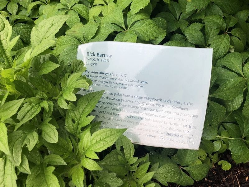
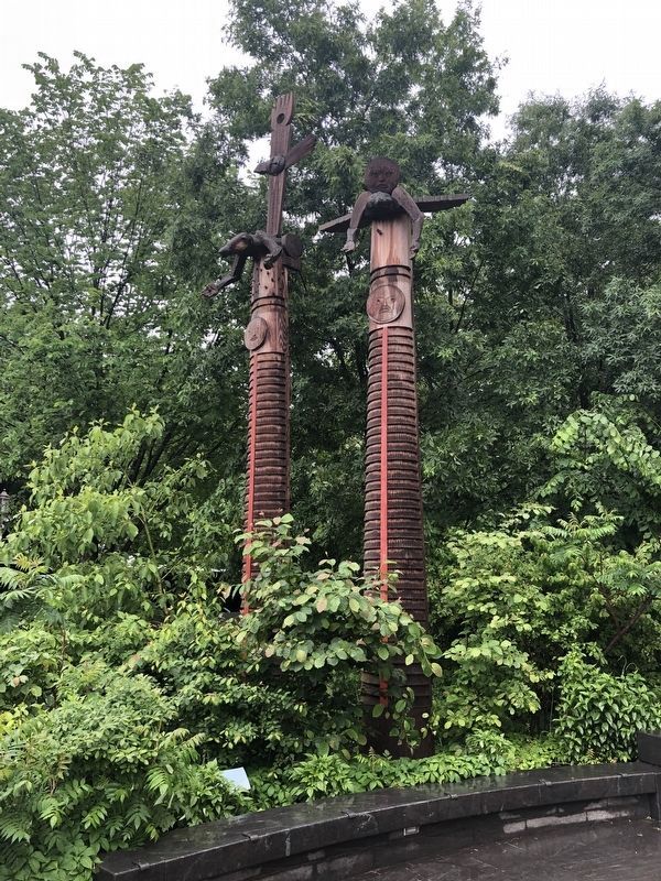
We Were Always Here, 2012
Old-growth Western red cedar, Port Orford cedar, old-growth Douglas fir, oak, maple, stain, sealer
Commissioned from the artist 2011 (26/8852)
In creating these two poles from a single old-growth cedar tree, artist Rick Bartow has drawn on the patterns and symbols from his Northern California Native heritage. These include Bear's conscientious and protective role as a healer and Raven's playful and sometimes comical acts that shaped the world and human society. The pole bases' horizontal pattern references the changing tides of Oregon mudfloats and symbolizes the flow of knowledge and inheritance--in Bartow's words, "the movement down to generations or up through the generations… like little waves."
Erected by Smithsonian Institution. (Marker Number 26/8852.)
Topics. This historical marker is listed in these topic lists: Anthropology & Archaeology • Arts, Letters, Music • Indigenous Peoples and Communities. A significant historical year for this entry is 2012.
Location. This marker has been replaced by another marker nearby. It was located near 38° 53.317′ N, 77° 1.023′ W. Marker
this page online

Regionally, this marker was in the Washington Metropolitan Area. It was also in the American Northeast, in the Upper South, in the Mid-Atlantic, in the Tidewater, and in the Chesapeake Bay Region. Globally, it was in North America, the Western Hemisphere, the Western World, and the Anglosphere.
Other nearby markers. At least 5 other markers are within walking distance of this location: Rick Bartow (a few steps from this marker); a different marker also named Cardinal Direction Marker: West (within shouting distance of this marker); Cardinal Direction Marker: North (within shouting distance of this marker); a different marker also named Traditional Croplands (within shouting distance of this marker);
Other markers no longer nearby. Can you hear the echo of the water bouncing off the rock? (was here, next to this marker but has been permanently removed); Wingapo (was here, next to this marker but has been permanently removed); Upland Hardwood Forest (was within shouting distance of this marker but has been replaced with another marker now near it); Sassafras • Wináhk (Wee-nock) (was within shouting distance of this marker but has been permanently removed); Cardinal Direction Marker: West (was within shouting distance of this marker but has been replaced with another marker now near it); Eastern Redcedar • Muráhk (mah-dok) (was within shouting distance of this marker but has been permanently removed); Cardinal Direction Markers (was within shouting distance of this marker but has been permanently removed); Meadow (was within shouting distance of this marker but has been replaced with another marker now near it); Traditional Croplands (was within shouting distance of this marker but has been replaced with another marker now near it); What is a Grandfather Rock? (was about 300 feet away, measured in a direct line but has been permanently removed); Cardinal Direction Marker: South (was about 300 feet away but has been replaced with another marker now near it).
Related marker. Click here for another marker that is related to this marker. This marker has been replaced with the linked marker.
Credits. This page was last revised on January 30, 2023. It was originally submitted on November 14, 2017, by Devry Becker Jones of Washington, District of Columbia. This page has been viewed 315 times since then and 14 times this year. Last updated on February 10, 2018, by Devry Becker Jones of Washington, District of Columbia. Photos: 1, 2. submitted on May 13, 2019, by Devry Becker Jones of Washington, District of Columbia. • Andrew Ruppenstein was the editor who published this page.
