South Windsor in Capitol Region, Connecticut — The American Northeast (New England)
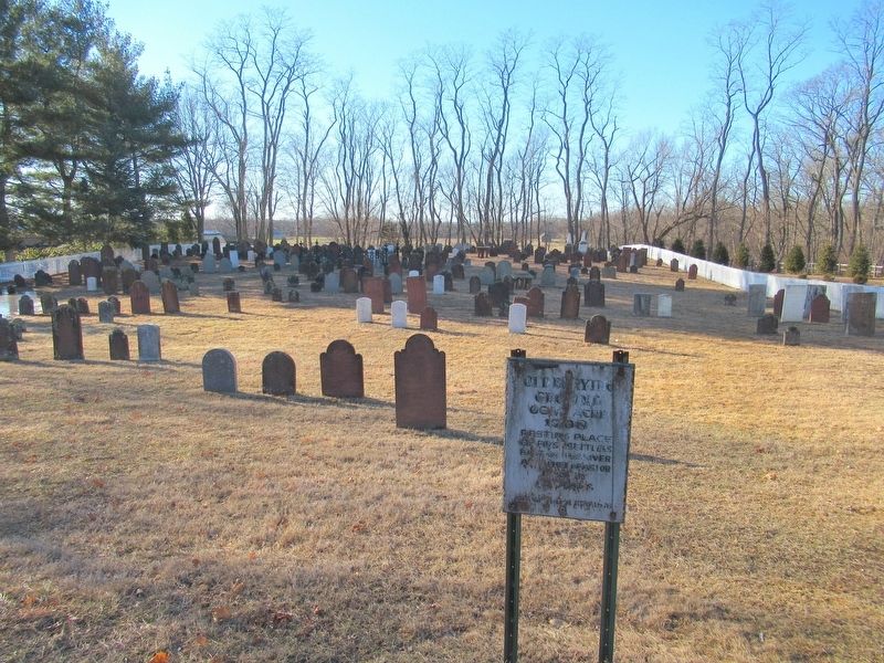
Old Burying Ground
Photographed by Michael Herrick, February 5, 2018
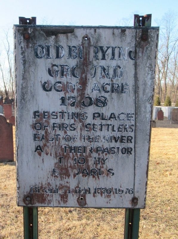
1. Old Burying Ground Marker
Ground
God’s Acre
1708
Resting Place
Of First Settlers
East of the River
And Their Pastor
Timothy
Edwards
Bicentennial 1776-1976
Topics. This historical marker is listed in these topic lists: Cemeteries & Burial Sites • Colonial Era.
Location. 41° 50.919′ N, 72° 36.601′ W. Marker is in South Windsor in Capitol Region, Connecticut. It is on Main Street 0.2 miles south of Oxbow Lane, on the right when traveling south. Touch for map. Marker is in this post office area: South Windsor CT 06074, United States of America. Touch for directions.

Regionally, this marker is in the Connecticut River Valley, in Greater Hartford, and in the Knowledge Corridor. It is also in the American Northeast and in New England. Globally, it is in North America, the Western Hemisphere, the Western World, and the Anglosphere. Historically, it finds itself in what was once Hartford County and also one of the original Thirteen Colonies.
Other nearby markers. At least 8 other markers are within 2 miles of this marker, measured as the crow flies: Jonathan Edwards
this page online
Photographed by Michael Herrick, February 5, 2018
2. Old Burying Ground Marker
Credits. This page was last revised on May 19, 2026. It was originally submitted on February 11, 2018, by Michael Herrick of Southbury, Connecticut. This page has been viewed 518 times since then and 31 times this year. Photos: 1, 2. submitted on February 11, 2018, by Michael Herrick of Southbury, Connecticut.
