
Oregon City in Clackamas County, Oregon — The American West (Northwest)
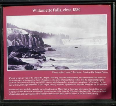
Willamette Falls, circa 1880
Photographed by Barry Swackhamer, September 25, 2017
1. Willamette Falls, circa 1880 Marker
For both cultures, the Falls created a natural trading area. Many Native Americans tribes came here to fish, harvest lamprey eels and trade with one another. For the new arrivals, since the Falls blocked ship travel, this was the head of navigation, and aspiring traders and shop owners located here to serve the rest of the Willamette Valley.
Erected by Historic Oregon City.
Topics. This historical marker is listed in these topic lists: Indigenous Peoples and Communities • Natural Features • Settlements & Settlers.
Location. 45° 21.882′ N, 122° 35.646′ W. Marker is in Oregon City, Oregon, in Clackamas
this page online

Regionally, this marker is in the Willamette Valley and in Greater Portland Area. It is also on the American Pacific Coast, in the Pacific Northwest, and in the Lewis & Clark Corridor. Globally, it is in North America, in the Cascade Range, on the Ring of Fire, in the Pacific Rim, in the Western Hemisphere, in the Western World, and in the Anglosphere.
Other nearby markers. At least 8 other markers are within walking distance of this marker: Historic Oregon City (here, next to this marker); Abernethy Green (within shouting distance of this marker); Abigail Scott Duniway (within shouting distance of this marker); George Abernethy's Historical Significance (within shouting distance of this marker); End of the Oregon Trail (within shouting distance of this marker); Fishing At Tumwater (within shouting distance of this marker); Lot Whitcomb (within shouting distance of this marker); Earthquakes and Mountain Fog (within shouting distance of this marker). Touch for a list and map of all markers in Oregon City.
More about this marker. The marker is located near the End of the Oregon Trail Interpretive Center parking lot.
Credits. This page was last revised on February 12, 2018. It was originally submitted on February 12, 2018, by Barry Swackhamer of Brentwood, California. This page has been viewed 388 times since then and 24 times this year. Photo 1. submitted on February 12, 2018, by Barry Swackhamer of Brentwood, California.
Editor’s want-list for this marker. Mid-distant view of this marker • Can you help?
